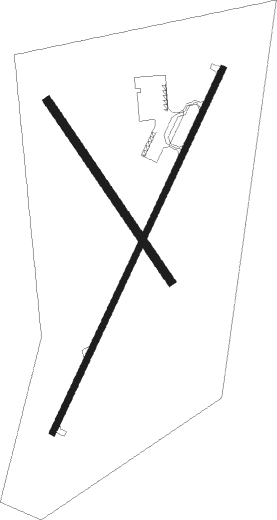
Flora - Flora Muni
Airport details
| Country | United States of America |
| State | Illinois |
| Region | K5 |
| Airspace | Kansas City Ctr |
| Municipality | Flora |
| Elevation | 473ft (144m) |
| Timezone | GMT -6 |
| Coordinates | 38.66499, -88.45311 |
| Magnetic var | |
| Type | land |
| Available since | X-Plane v10.40 |
| ICAO code | KFOA |
| IATA code | n/a |
| FAA code | FOA |
Communication
| Flora Muni AWOS 3 | 120.175 |
| Flora Muni CTAF/UNICOM | 122.700 |
Approach frequencies
| LOC | RW21 | 108.55 | 18.00mi |
Nearby beacons
| code | identifier | dist | bearing | frequency |
|---|---|---|---|---|
| OLY | OLNEY NDB | 13.5 | 79° | 272 |
| BIB | BIBLE GROVE VORTAC | 15.3 | 354° | 109 |
| FWC | WAYNE CO (FAIRFIELD) NDB | 17.2 | 171° | 257 |
| SAM | SAMSVILLE VOR/DME | 20.3 | 116° | 116.60 |
| VNN | VERNON DME | 24.6 | 229° | 113.80 |
| ENL | CENTRALIA VORTAC | 36.2 | 251° | 115 |
| LWV | DME | 40.2 | 83° | 108.80 |
| VLA | VANDALIA VOR/DME | 41.9 | 301° | 114.30 |
| PLX | PALESTINE (ROBINSON) NDB | 43.3 | 67° | 391 |
| GRE | GREENVILLE NDB | 44.2 | 280° | 233 |
| SYZ | SHELBYVILLE NDB | 48.1 | 332° | 365 |
| MTO | DME | 49.4 | 12° | 109.40 |
| PXV | POCKET CITY (EVANSVILLE) VORTAC | 54.9 | 137° | 113.30 |
| MW | JONNY (MARION) NDB | 55.2 | 212° | 382 |
| MD | CABBI (CARBONDALE-MURPHYSBORO) NDB | 60.6 | 225° | 388 |
| MWA | DME | 60.7 | 212° | 110.40 |
Instrument approach procedures
| runway | airway (heading) | route (dist, bearing) |
|---|---|---|
| RW03 | JETON (48°) | JETON JISID (6mi, 69°) 2200ft |
| RW03 | JISID (36°) | JISID 2200ft |
| RW03 | ZIMUN (350°) | ZIMUN JISID (11mi, 306°) 2200ft |
| RNAV | JISID 2200ft POWLS (6mi, 36°) 2200ft FEBKU (4mi, 36°) 1020ft KFOA (2mi, 35°) 513ft (5333mi, 114°) 783ft FIPEN (5327mi, 294°) 2200ft FIPEN (turn) | |
| RW21 | BIB (174°) | BIB FIPEN (9mi, 116°) 2200ft |
| RW21 | FIPEN (216°) | FIPEN 2200ft |
| RW21 | JOVAR (216°) | JOVAR FIPEN (11mi, 216°) 2200ft |
| RNAV | FIPEN 2200ft HANEL (7mi, 216°) 2200ft KFOA (6mi, 216°) 517ft (5333mi, 114°) 746ft JISID (5338mi, 293°) 2200ft JISID (turn) |
Disclaimer
The information on this website is not for real aviation. Use this data with the X-Plane flight simulator only! Data taken with kind consent from X-Plane 12 source code and data files. Content is subject to change without notice.

