Fort Pierce - Treasure Coast International
Airport details
| Country | United States of America |
| State | Florida |
| Region | K7 |
| Airspace | Miami Oceanic Ctr |
| Municipality | Saint Lucie County |
| Elevation | 21ft (6m) |
| Timezone | GMT -5 |
| Coordinates | 27.49747, -80.37264 |
| Magnetic var | |
| Type | land |
| Available since | X-Plane v10.40 |
| ICAO code | KFPR |
| IATA code | FPR |
| FAA code | FPR |
Communication
| Treasure Coast International ATIS | 134.825 |
| Treasure Coast International CTAF | 128.200 |
| Treasure Coast International FT PIERCE Ground Control | 119.550 |
| Treasure Coast International FT PIERCE Tower | 128.200 |
| Treasure Coast International PALM BEACH Approach | 132.800 |
| Treasure Coast International PALM BEACH Departure | 132.800 |
Approach frequencies
| ILS-cat-I | RW10R | 110.55 | 18.00mi |
| 3° GS | RW10R | 110.55 | 18.00mi |
Nearby Points of Interest:
Casa Caprona
-St. Lucie Village Historic District
-Immokolee
-Zora Neale Hurston House
-Old St. Anastasia Catholic School
-St. Lucie High School
-Old Fort Pierce City Hall
-Old Fort Pierce Post Office
-Arcade Building
-Boston House
-Jules Frere House
-Captain Hammond House
-Vero Beach Diesel Power Plant
-Osceola Park Historic Residential District
-Maher Building
-Theodore Hausmann Estate
-Old Indian River County Courthouse
-Judge Henry F. Gregory House
-Old Vero Beach Community Building
-Treasure Hammock Ranch Farmstead
-Tuckahoe
-Lyric Theatre
-Old Martin County Courthouse
-Pelican Island National Wildlife Refuge
-Krueger House
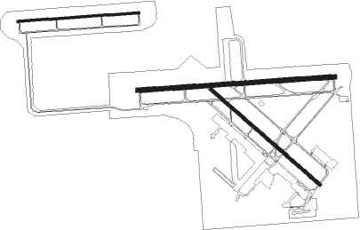
Runway info
Runway 10L / 28R  | ||
| length | 1216m (3990ft) | |
| bearing | 90° / 270° | |
| width | 23m (75ft) | |
| surface | asphalt | |
| blast zone | 46m (151ft) / 47m (154ft) | |
| Runway 10R / 28L | ||
| length | 1980m (6496ft) | |
| bearing | 90° / 270° | |
| width | 46m (150ft) | |
| surface | asphalt | |
| blast zone | 58m (190ft) / 57m (187ft) | |
| Runway 14 / 32 | ||
| length | 1451m (4760ft) | |
| bearing | 132° / 312° | |
| width | 30m (100ft) | |
| surface | asphalt | |
Nearby beacons
| code | identifier | dist | bearing | frequency |
|---|---|---|---|---|
| FPR | FORT PIERCE NDB | 0.6 | 183° | 275 |
| TRV | TREASURE (VERO BEACH) VORTAC | 12.5 | 327° | 117.30 |
| UTX | UNITED NDB | 35.4 | 176° | 405 |
| MLB | MELBOURNE VOR/DME | 39 | 337° | 115.85 |
| PHK | PAHOKEE VOR/DME | 46.1 | 204° | 115.40 |
| COF | PATRICK (COCOA) TACAN | 46.2 | 342° | 115 |
| PBI | PALM BEACH VORTAC | 51.4 | 161° | 115.70 |
Instrument approach procedures
| runway | airway (heading) | route (dist, bearing) |
|---|---|---|
| RW10R | SHEDS (48°) | SHEDS HASOK (6mi, 345°) 2000ft ZAHZA (6mi, 12°) 2000ft |
| RW10R | TRV (147°) | TRV MIMBE (8mi, 235°) 2000ft ZAHZA (6mi, 175°) 2000ft |
| RNAV | ZAHZA 2000ft TIKIY (6mi, 90°) 1800ft SIVYO (3mi, 90°) 700ft KFPR (2mi, 90°) 72ft (4893mi, 109°) 480ft ANGEE (4881mi, 289°) 2000ft ANGEE (turn) | |
| RW14 | DIDDY (70°) | DIDDY RUCYO (21mi, 39°) 2000ft POBCI (7mi, 68°) 2000ft |
| RW14 | VALKA (155°) | VALKA KOYEP (11mi, 151°) 2000ft POBCI (7mi, 208°) 2000ft |
| RNAV | POBCI 2000ft JOMDU (7mi, 132°) 1800ft PULME (3mi, 132°) 700ft KFPR (2mi, 132°) 69ft (4893mi, 109°) 480ft ANGEE (4881mi, 289°) 2000ft ANGEE (turn) | |
| RW28L | JUDUD (310°) | JUDUD BRONG (7mi, 17°) 2000ft |
| RW28L | TRV (147°) | TRV VOYUT (21mi, 109°) 2000ft BRONG (6mi, 197°) 2000ft |
| RNAV | BRONG 2000ft YADDU (6mi, 284°) 1600ft TEGUC (2mi, 284°) 860ft SESOC (2mi, 283°) 233ft (4892mi, 109°) 440ft AWOTA (4904mi, 289°) 2000ft AWOTA (turn) | |
| RW32 | ANGEE (278°) | ANGEE WADAS (8mi, 204°) 2000ft WADAS (turn) 2000ft |
| RW32 | SURFN (293°) | SURFN FOMGU (16mi, 296°) 2000ft WADAS (7mi, 248°) 2000ft |
| RW32 | TBIRD (16°) | TBIRD NOYEM (12mi, 64°) 2000ft WADAS (7mi, 40°) 2000ft |
| RNAV | WADAS 2000ft COSVA (6mi, 312°) 2000ft JILKO (4mi, 312°) 600ft KFPR (3mi, 312°) 68ft (4893mi, 109°) 520ft AWOTA (4904mi, 289°) 2000ft AWOTA (turn) |
Disclaimer
The information on this website is not for real aviation. Use this data with the X-Plane flight simulator only! Data taken with kind consent from X-Plane 12 source code and data files. Content is subject to change without notice.