French Lick - French Lick Muni
Airport details
| Country | United States of America |
| State | Indiana |
| Region | K5 |
| Airspace | Indianapolis Ctr |
| Municipality | Orange County |
| Elevation | 791ft (241m) |
| Timezone | GMT -5 |
| Coordinates | 38.50622, -86.63695 |
| Magnetic var | |
| Type | land |
| Available since | X-Plane v10.40 |
| ICAO code | KFRH |
| IATA code | FRH |
| FAA code | FRH |
Communication
| French Lick Muni AWOS 3 | 118.075 |
| French Lick Muni CTAF/UNICOM | 122.800 |
| French Lick Muni LOUISVILLE Approach/Departure | 132.075 |
Nearby Points of Interest:
Dixie Garage
-First Baptist Church
-Newberry Friends Meeting House
-Lindley House
-Paoli Historic District
-Orange County Courthouse
-Thomas Newby Braxtan House
-Pioneer Mothers Memorial Forest
-Evangelische Lutherische Emanuels Kirche
-Martin County Courthouse
-Orleans Historic District
-John Opel House
-Lynd School
-Gramelspacher–Gutzweiler House
-Louis H. Sturm Hardware Store
-Dubois County Courthouse
-Mitchell Downtown Historic District
-Mitchell Opera House
-William Proctor House
-Potts Creek Rockshelter
-Jacob Rickenbaugh House
-Huntingburg Commercial Historic District
-Huntingburg Town Hall and Fire Engine House
-Dr. Alois Wollenmann House
-Zahn Historic District
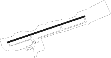
Runway info
| Runway 8 / 26 | ||
| length | 1674m (5492ft) | |
| bearing | 79° / 259° | |
| width | 31m (100ft) | |
| surface | asphalt | |
Nearby beacons
| code | identifier | dist | bearing | frequency |
|---|---|---|---|---|
| OOM | HOOSIER (BLOOMINGTON) VORTAC | 38.3 | 2° | 110.20 |
| MYS | MYSTIC VOR | 41.1 | 147° | 108.20 |
| JV | CATCH (JEFFERSONVILLE) NDB | 42.3 | 92° | 331 |
| EVV | VICCI (EVANSVILLE) NDB | 44.2 | 245° | 219 |
| FTK | FORT KNOX VOR/DME | 47.7 | 132° | 109.60 |
| LWV | DME | 48 | 285° | 108.80 |
| BQM | (LOUISVILLE) DME | 48.6 | 106° | 112.20 |
| OWB | OWENSBORO VOR/DME | 52.1 | 215° | 108.60 |
| BA | CLIFS (COLUMBUS) NDB | 62.1 | 45° | 410 |
| HU | YINNO (TERRE HAUTE) NDB | 63.7 | 319° | 245 |
| TTH | TERRE HAUTE VORTAC | 65.5 | 328° | 115.30 |
| EWO | NEW HOPE VOR/DME | 69.4 | 132° | 110.80 |
Instrument approach procedures
| runway | airway (heading) | route (dist, bearing) |
|---|---|---|
| RW08 | CLOWN (91°) | CLOWN JIKPI (15mi, 108°) 4000ft |
| RW08 | JIKPI (79°) | JIKPI 6000ft JIKPI (turn) 4000ft |
| RW08 | PXV (63°) | PXV JIKPI (45mi, 56°) 4000ft |
| RNAV | JIKPI 4000ft FORBS (14mi, 79°) 2400ft KFRH (5mi, 79°) 826ft (5247mi, 114°) 1057ft WITAM (5228mi, 294°) 4000ft WITAM (turn) | |
| RW26 | MAIZE (273°) | MAIZE WITAM (12mi, 297°) 4000ft |
| RW26 | STREP (247°) | STREP WITAM (15mi, 230°) 4000ft |
| RW26 | WITAM (259°) | WITAM 6000ft WITAM (turn) 4000ft |
| RNAV | WITAM 4000ft AVBAY (7mi, 259°) 2500ft LYREE (7mi, 259°) 2400ft ZEGOR (3mi, 259°) 1480ft KFRH (3mi, 259°) 822ft (5247mi, 114°) 1042ft JIKPI (5266mi, 294°) 4000ft JIKPI (turn) |
Disclaimer
The information on this website is not for real aviation. Use this data with the X-Plane flight simulator only! Data taken with kind consent from X-Plane 12 source code and data files. Content is subject to change without notice.