Sioux Falls - Joe Foss Fld
Airport details
| Country | United States of America |
| State | South Dakota |
| Region | K3 |
| Airspace | Minneapolis Ctr |
| Municipality | Sioux Falls |
| Elevation | 1429ft (436m) |
| Timezone | GMT -6 |
| Coordinates | 43.58617, -96.73670 |
| Magnetic var | |
| Type | land |
| Available since | X-Plane v10.40 |
| ICAO code | KFSD |
| IATA code | FSD |
| FAA code | FSD |
Communication
| Joe Foss Fld ATIS | 126.600 |
| Joe Foss Fld CTAF | 118.300 |
| Joe Foss Fld UNICOM | 122.950 |
| Joe Foss Fld SIOUX FALLS Ground Control | 121.900 |
| Joe Foss Fld SIOUX FALLS Tower | 118.300 |
| Joe Foss Fld MINNEAPOLIS ARTCC Approach | 126.900 |
| Joe Foss Fld SIOUX FALLS Approach | 125.800 |
| Joe Foss Fld MINNEAPOLIS ARTCC Departure | 126.900 |
| Joe Foss Fld SIOUX FALLS Departure | 125.800 |
Approach frequencies
| ILS-cat-I | RW03 | 109.9 | 18.00mi |
| ILS-cat-I | RW21 | 111.1 | 18.00mi |
| 3° GS | RW03 | 109.9 | 18.00mi |
| 3° GS | RW21 | 111.1 | 18.00mi |
Nearby Points of Interest:
Eighth Street Bridge
-Sioux Falls National Bank Building
-Central Fire Station
-Rock Island Depot
-Federal Building and United States Courthouse
-Grand Lodge and Library of the Ancient Free and Accepted Masons
-South Dakota School for the Deaf
-Jorden Hall
-Renner Lutheran Church
-Shafer Round Barn
-Carnegie Free Public Library
-St. Peter's Lutheran Church
-William G. Milne House
-Canton Lutheran Church
-South Dakota Department of Transportation Bridge No. 63-132-040
-Parker Masonic Hall
-Bridge No. 63-137-090-Parker
-John Rowe House
-Holy Trinity Church-Episcopal
-Blue Mounds State Park WPA/Rustic Style Historic Resources
-Burlington, Cedar Rapids, and Northern Railroad-Rock Rapids Station, Railroad Track and Bridge
-Lyon County Courthouse
-Melan Bridge
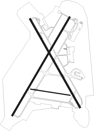
Runway info
Runway 3 / 21  | ||
| length | 2743m (8999ft) | |
| bearing | 44° / 224° | |
| width | 46m (150ft) | |
| surface | concrete | |
| blast zone | 46m (151ft) / 49m (161ft) | |
| Runway 15 / 33 | ||
| length | 2439m (8002ft) | |
| bearing | 147° / 327° | |
| width | 46m (150ft) | |
| surface | concrete | |
| blast zone | 64m (210ft) / 43m (141ft) | |
| Runway 9 / 27 | ||
| length | 959m (3146ft) | |
| bearing | 100° / 280° | |
| width | 23m (75ft) | |
| surface | concrete | |
Nearby beacons
| code | identifier | dist | bearing | frequency |
|---|---|---|---|---|
| FSD | SIOUX FALLS VORTAC | 4.2 | 325° | 115 |
| FS | ROKKY (SIOUX FALLS) NDB | 6.8 | 225° | 245 |
| BK | CHRLZ (BROOKINGS) NDB | 47 | 345° | 335 |
| YKN | YANKTON VOR/DME | 49.1 | 224° | 111.40 |
| YK | CAGUR (YANKTON) NDB | 50.9 | 217° | 347 |
| MML | MARSHALL VOR/DME | 65 | 47° | 111 |
| GB | GARNO (MARSHALL) NDB | 65.5 | 42° | 253 |
Instrument approach procedures
| runway | airway (heading) | route (dist, bearing) |
|---|---|---|
| RW03 | DOLTS (68°) | DOLTS KASME (12mi, 90°) 4000ft |
| RW03 | JILRO (349°) | JILRO KASME (16mi, 305°) 4000ft |
| RNAV | KASME 4000ft RANOE (7mi, 44°) 3400ft VULKN (4mi, 44°) 2160ft KFSD (3mi, 46°) 1478ft (5698mi, 114°) 1674ft MOPUE (5690mi, 294°) 4000ft MOPUE (turn) | |
| RW09 | FSD (145°) | FSD FABUK (9mi, 262°) 4000ft FABUK (turn) 4000ft |
| RNAV | FABUK 4000ft GIKNE (6mi, 100°) 3200ft KFSD (5mi, 95°) 1463ft (5698mi, 114°) 2500ft MOPUE (5690mi, 294°) 4000ft MOPUE (turn) | |
| RW15 | FRYRE (104°) | FRYRE CEPOL (12mi, 73°) 3800ft |
| RW15 | SECTO (229°) | SECTO CEPOL (16mi, 265°) 3800ft CEPOL (turn) 3800ft |
| RNAV | CEPOL 3800ft CIDAM (7mi, 147°) 2900ft WEDOR (2mi, 147°) 2160ft KFSD (3mi, 143°) 1477ft (5698mi, 114°) 1830ft FEZNT (5694mi, 294°) 3800ft FEZNT (turn) | |
| RW21 | MOPUE (223°) | MOPUE 4000ft |
| RNAV | MOPUE 4000ft RAPNE (7mi, 224°) 3100ft RULYO (2mi, 224°) 2300ft KFSD (3mi, 221°) 1479ft (5698mi, 114°) 1630ft KASME (5707mi, 294°) 4000ft KASME (turn) | |
| RW27 | CATID (288°) | CATID FENKI (14mi, 304°) 4500ft WAGNO (6mi, 271°) 3700ft |
| RW27 | FSD (145°) | FSD FENKI (17mi, 103°) 4500ft FENKI (turn) 4500ft WAGNO (6mi, 271°) 3700ft |
| RNAV | WAGNO 3700ft ZEBLI (3mi, 271°) 2800ft FAMIK (2mi, 275°) 2120ft KFSD (2mi, 287°) 1462ft (5698mi, 114°) 2500ft MOPUE (5690mi, 294°) 4000ft MOPUE (turn) | |
| RW33 | FEZNT (328°) | FEZNT 3800ft |
| RNAV | FEZNT 3800ft YUCNU (6mi, 327°) 3100ft ZOTSU (3mi, 327°) 2280ft KFSD (3mi, 331°) 1467ft (5698mi, 114°) 1729ft CEPOL (5702mi, 294°) 3800ft CEPOL (turn) |
Disclaimer
The information on this website is not for real aviation. Use this data with the X-Plane flight simulator only! Data taken with kind consent from X-Plane 12 source code and data files. Content is subject to change without notice.