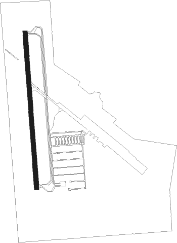
Fort Sill - Henry Post Army Airfield
Airport details
| Country | United States of America |
| State | Oklahoma |
| Region | K4 |
| Airspace | Ft Worth Ctr |
| Municipality | Lawton |
| Elevation | 1187ft (362m) |
| Timezone | GMT -6 |
| Coordinates | 34.64301, -98.39935 |
| Magnetic var | |
| Type | land |
| Available since | X-Plane v10.40 |
| ICAO code | KFSI |
| IATA code | FSI |
| FAA code | FSI |
Communication
| Henry Post Army Airfield ATIS | 135.425 |
| Henry Post Army Airfield POST Ground Control | 121.700 |
| Henry Post Army Airfield POST Tower | 124.950 |
| Henry Post Army Airfield FORT SILL Approach | 118.600 |
| Henry Post Army Airfield FORT SILL Departure | 120.550 |
Nearby Points of Interest:
Mahoney-Clark House
-Carnegie Library
-Mattie Beal House
-Quanah Parker Star House
-New Hope Baptist Church (Chickasha, Oklahoma)
Runway info
| Runway 18 / 36 | ||
| length | 1526m (5007ft) | |
| bearing | 180° / 0° | |
| width | 46m (150ft) | |
| surface | concrete | |
Nearby beacons
| code | identifier | dist | bearing | frequency |
|---|---|---|---|---|
| LAW | LAWTON VOR/DME | 8.8 | 185° | 109.40 |
| DUC | DME | 28.4 | 118° | 111 |
| HBR | HOBART VORTAC | 35.4 | 289° | 111.80 |
| SHP | SHEPPARD (WICHITA FALLS) TACAN | 39.8 | 188° | 110.80 |
| SPS | WICHITA FALLS VORTAC | 40.5 | 196° | 112.70 |
| LTS | ALTUS VORTAC | 43 | 271° | 109.80 |
| SKB | SCOTLAND (WICHITA FALLS) NDB | 51.8 | 186° | 344 |
| BFV | BURNS FLAT (CLINTON) VORTAC | 53.3 | 306° | 110 |
| RG | GALLY (OKLAHOMA CITY) NDB | 55.9 | 51° | 350 |
| IRW | WILL ROGERS (OKLAHOMA CIT VORTAC | 57.9 | 48° | 114.10 |
| BZ | FOSSI (CLINTON) NDB | 62.5 | 315° | 393 |
| PWA | WILEY POST (OKLAHOMA CITY VOR/DME | 64.9 | 40° | 113.40 |
Instrument approach procedures
| runway | airway (heading) | route (dist, bearing) |
|---|---|---|
| RW18 | HBR (109°) | HBR CIROX (27mi, 89°) 4000ft NICIR (6mi, 107°) 4000ft |
| RW18 | NEADS (235°) | NEADS SAPOE (16mi, 257°) 4000ft NICIR (6mi, 253°) 4000ft |
| RW18 | NICIR (179°) | NICIR 4000ft |
| RNAV | NICIR 4000ft OGLOE (6mi, 180°) 2800ft WUGED (2mi, 180°) 2020ft KFSI (3mi, 177°) 1229ft (5820mi, 109°) 1588ft FESAD (5821mi, 289°) 3500ft FESAD (turn) | |
| RW36 | FESAD (1°) | FESAD 3500ft |
| RW36 | TEYUV (329°) | TEYUV FESAD (6mi, 270°) 3500ft FESAD (turn) 3500ft |
| RW36 | WALTO (351°) | WALTO FESAD (7mi, 335°) 3500ft |
| RNAV | FESAD 3500ft ITOVE (6mi, 0°) 2800ft KFSI (5mi, 2°) 1211ft (5820mi, 109°) 1490ft NICIR (5819mi, 289°) 4000ft NICIR (turn) |
Disclaimer
The information on this website is not for real aviation. Use this data with the X-Plane flight simulator only! Data taken with kind consent from X-Plane 12 source code and data files. Content is subject to change without notice.
