Fort Madison - Fort Madison Muni
Airport details
| Country | United States of America |
| State | Iowa |
| Region | K3 |
| Airspace | Chicago Ctr |
| Municipality | Fort Madison |
| Elevation | 721ft (220m) |
| Timezone | GMT -6 |
| Coordinates | 40.65911, -91.32775 |
| Magnetic var | |
| Type | land |
| Available since | X-Plane v10.40 |
| ICAO code | KFSW |
| IATA code | FMS |
| FAA code | FSW |
Communication
| Fort Madison Muni AWOS 3 | 120.925 |
| Fort Madison Muni CTAF/UNICOM | 122.800 |
Nearby Points of Interest:
Holy Family Catholic Church
-Old Fort Madison High School
-Moyce-Steffens House
-Park-to-Park Residential Historic District
-Chief Justice Joseph M. Beck House
-Lee County Courthouse
-Albright House
-Fort Madison Downtown Commercial Historic District
-Cattermole Memorial Library
-Atchison, Topeka and Santa Fe Passenger and Freight Complex Historic District
-Fort Madison
-St. Joseph's Church Complex
-Daniel McConn Barn
-Walter A. Sheaffer House
-Craig and Virginia Sheaffer House
-Fort Madison Toll Bridge
-Cambre House and Farm
-Faeth Farmstead and Orchard District
-Nauvoo Historic District
-William J. Reimbold House
-Dennis Melcher Pottery and House
-Geode State Park
-Cascade Bridge
-James M. Forney House
-Starker–Leopold Historic District
Runway info
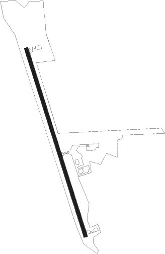
| Runway 17 / 35 | ||
| length | 1221m (4006ft) | |
| bearing | 163° / 343° | |
| width | 23m (75ft) | |
| surface | concrete | |
Nearby beacons
| code | identifier | dist | bearing | frequency |
|---|---|---|---|---|
| BR | BURNS (BURLINGTON) NDB | 9.3 | 91° | 390 |
| EOK | KEOKUK NDB | 12.6 | 209° | 366 |
| BRL | BURLINGTON VOR/DME | 18.7 | 81° | 111.40 |
| JZY | MACOMB NDB | 36 | 100° | 251 |
| DDD | CITY DME | 43.2 | 14° | 116.50 |
| GBG | DME | 43.9 | 73° | 109.80 |
| UI | QUINCY NDB | 46.5 | 175° | 293 |
| UIN | QUINCY VORTAC | 48.7 | 177° | 113.60 |
| OTM | OTTUMWA VOR/DME | 50.4 | 290° | 111.60 |
| MZV | MOLINE VOR/DME | 50.5 | 46° | 114.40 |
| IOW | IOWA CITY VOR/DME | 53.2 | 342° | 116.20 |
Instrument approach procedures
| runway | airway (heading) | route (dist, bearing) |
|---|---|---|
| RW17 | BRL (261°) | BRL NOFWO (17mi, 300°) 2600ft HOTTS (8mi, 260°) 2600ft |
| RW17 | HOTTS (163°) | HOTTS 6000ft HOTTS (turn) 2600ft |
| RW17 | MOTVE (126°) | MOTVE HOTTS (8mi, 80°) 2600ft |
| RNAV | HOTTS 2600ft AWIFI (7mi, 163°) 2400ft SNUGS (3mi, 163°) 1580ft KFSW (3mi, 163°) 763ft (5466mi, 114°) 972ft DRIBS (5463mi, 294°) 2600ft DRIBS (turn) | |
| RW35 | BRL (261°) | BRL ZONOL (16mi, 216°) 2600ft DRIBS (8mi, 260°) 2600ft |
| RW35 | DRIBS (343°) | DRIBS 2600ft |
| RW35 | LOAMY (63°) | LOAMY LUGIF (16mi, 89°) 2600ft DRIBS (8mi, 80°) 2600ft |
| RNAV | DRIBS 2600ft AWIRU (7mi, 343°) 2400ft FILLS (3mi, 343°) 1400ft KFSW (2mi, 343°) 765ft (5466mi, 114°) 972ft HOTTS (5468mi, 294°) 2600ft HOTTS (turn) |
Disclaimer
The information on this website is not for real aviation. Use this data with the X-Plane flight simulator only! Data taken with kind consent from X-Plane 12 source code and data files. Content is subject to change without notice.