Fort Knox - Godman Aaf
Airport details
| Country | United States of America |
| State | Kentucky |
| Region | K5 |
| Airspace | Indianapolis Ctr |
| Municipality | Hardin County |
| Elevation | 753ft (230m) |
| Timezone | GMT -5 |
| Coordinates | 37.90722, -85.97154 |
| Magnetic var | |
| Type | land |
| Available since | X-Plane v10.40 |
| ICAO code | KFTK |
| IATA code | FTK |
| FAA code | FTK |
Communication
| Godman AAF AWOS-3 | 121.025 |
| Godman AAF CTAF | 126.800 |
| Godman AAF Ground Control | 121.900 |
| Godman AAF Tower | 126.800 |
| Godman AAF LOUISVILLE Approach/Departure | 123.675 |
Approach frequencies
| ILS-cat-I | RW18 | 108.95 | 18.00mi |
| 3° GS | RW18 | 108.95 | 18.00mi |
Nearby Points of Interest:
United States Bullion Depository
-Fort Duffield
-Kintner-Withers House
-Brandenburg Methodist Episcopal Church
-Meade County Jail
-Brandenburg Commercial District
-Riverside, The Farnsley-Moremen Landing
-Helm Place
-Bank of the Commonwealth
-Elizabethtown Armory
-J. Roy Bond House
-Benjamin Helm House
-Embry Chapel Church
-Larue-Layman House
-Morrison Lodge
-First Baptist Church
-Brown Pusey House Community Center
-Waverly Hills Sanatorium
-First Presbyterian Church
-Gabriel Farnsley House
-South Louisville Reformed Church
-Swan's Landing Archeological Site
-Epworth Methodist Evangelical Church
-Corydon Historic District
-Immanuel Chapel Protestant Episcopal Church
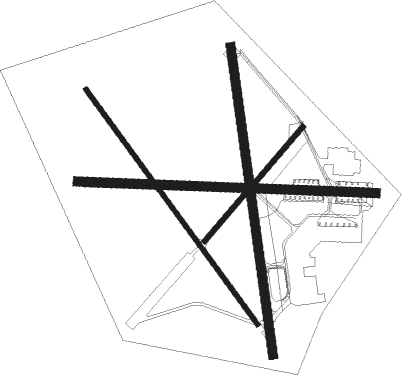
Runway info
Runway 9 / 27  | ||
| length | 1521m (4990ft) | |
| bearing | 95° / 275° | |
| width | 46m (150ft) | |
| surface | asphalt | |
| Runway 15 / 33 | ||
| length | 1480m (4856ft) | |
| bearing | 142° / 322° | |
| width | 23m (75ft) | |
| surface | asphalt | |
| blast zone | 61m (200ft) / 49m (161ft) | |
| Runway 18 / 36 | ||
| length | 1582m (5190ft) | |
| bearing | 176° / 356° | |
| width | 46m (150ft) | |
| surface | asphalt | |
| blast zone | 62m (203ft) / 60m (197ft) | |
| Runway 5 / 23 | ||
| length | 767m (2516ft) | |
| bearing | 52° / 232° | |
| width | 27m (90ft) | |
| surface | asphalt | |
| blast zone | 15m (49ft) / 15m (49ft) | |
Nearby beacons
| code | identifier | dist | bearing | frequency |
|---|---|---|---|---|
| FTK | FORT KNOX VOR/DME | 0 | 270° | 109.60 |
| MYS | MYSTIC VOR | 12.9 | 267° | 108.20 |
| LK | LAANG (LOUISVILLE) NDB | 21.4 | 55° | 414 |
| EWO | NEW HOPE VOR/DME | 21.6 | 133° | 110.80 |
| IIU | LOUISVILLE VORTAC | 22 | 64° | 114.80 |
| BQM | (LOUISVILLE) DME | 24.2 | 44° | 112.20 |
| JV | CATCH (JEFFERSONVILLE) NDB | 35.7 | 22° | 331 |
| GVR | (MADISON) DME | 56.2 | 30° | 114.65 |
| BWG | GREEN DME | 62.9 | 206° | 117.90 |
Departure and arrival routes
| Transition altitude | 18000ft |
| Transition level | 18000ft |
| STAR starting points | distance | inbound heading | |
|---|---|---|---|
| ALL | |||
| CHERI4 | 32.1 | 121° | |
Instrument approach procedures
| runway | airway (heading) | route (dist, bearing) |
|---|---|---|
| RW15 | NADDI (142°) | NADDI 2500ft |
| RNAV | NADDI 2500ft OJESA (6mi, 143°) 2300ft KFTK (5mi, 141°) 800ft (5214mi, 114°) 1155ft MYS (5227mi, 294°) 3000ft MYS (turn) | |
| RW18 | IIU (244°) | IIU SOVGE (14mi, 271°) 3000ft KUTGE (5mi, 267°) 2500ft |
| RW18 | KUTGE (176°) | KUTGE 2500ft |
| RW18 | MAIZE (176°) | MAIZE KUTGE (22mi, 175°) 2500ft |
| RW18 | MYS (87°) | MYS PUBRE (14mi, 37°) 2500ft KUTGE (5mi, 88°) 2500ft |
| RNAV | KUTGE 2500ft IJENY (6mi, 176°) 2500ft KFTK (6mi, 177°) 810ft (5214mi, 114°) 1155ft NADDI (5221mi, 294°) 2600ft NADDI (turn) | |
| RW36 | EWO (313°) | EWO HONAL (17mi, 283°) 2500ft |
| RW36 | MYS (87°) | MYS HONAL (15mi, 129°) 2500ft HONAL (turn) 2500ft |
| RW36 | OSINE (43°) | OSINE HONAL (18mi, 59°) 2500ft |
| RNAV | HONAL 2500ft FOGPE (6mi, 14°) 2500ft JILNO (3mi, 15°) 1580ft KFTK (3mi, 10°) 784ft (5214mi, 114°) 1155ft HONAL (5216mi, 294°) 2500ft HONAL (turn) |
Holding patterns
| STAR name | hold at | type | turn | heading* | altitude | leg | speed limit |
|---|---|---|---|---|---|---|---|
| CHERI4 | CHERI | VHF | left | 279 (99)° | 1.0min timed | ICAO rules | |
| *) magnetic outbound (inbound) holding course | |||||||
Disclaimer
The information on this website is not for real aviation. Use this data with the X-Plane flight simulator only! Data taken with kind consent from X-Plane 12 source code and data files. Content is subject to change without notice.