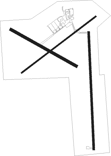
Fulton - Elton Hensley Meml
Airport details
| Country | United States of America |
| State | Missouri |
| Region | K3 |
| Airspace | Kansas City Ctr |
| Municipality | Callaway County |
| Elevation | 886ft (270m) |
| Timezone | GMT -6 |
| Coordinates | 38.83811, -92.00259 |
| Magnetic var | |
| Type | land |
| Available since | X-Plane v10.40 |
| ICAO code | KFTT |
| IATA code | n/a |
| FAA code | FTT |
Communication
| Elton Hensley Meml CTAF/UNICOM | 122.700 |
| Elton Hensley Meml MIZZU Approach/Departure | 124.375 |
Nearby Points of Interest:
Dr. George M. Willing House
-John Augustus Hockaday House
-Robnett-Payne House
-M. Fred Bell Rental Cottage
-M. Fred Bell Speculative Cottage
-Brandon-Bell-Collier House
-Pitcher Store
-Maplewood
-Huber's Ferry Farmstead Historic District
-Bond's Chapel Methodist Episcopal Church
-David Gordon House and Collins Log Cabin
-Greenwood
-East Campus Neighborhood
-Senior Hall
-David Guitar House
-Frederick Apartments
-Stephens College South Campus Historic District
-Coca-Cola Bottling Company Building
-Kress Building
-Central Dairy Building
-Wright Brothers Mule Barn
-Downtown Columbia
-Virginia Building
-Sanford F. Conley House
-Ballenger Building

Nearby beacons
| code | identifier | dist | bearing | frequency |
|---|---|---|---|---|
| COU | COLUMBIA VOR/DME | 10.2 | 263° | 110.20 |
| HLV | HALLSVILLE VORTAC | 17.5 | 335° | 114.20 |
| JE | ALGOA (JEFFERSON CITY) NDB | 17.7 | 193° | 397 |
| VIH | VICHY (ROLLA/VICHY) VOR/DME | 43.3 | 157° | 117.70 |
| MCM | DME | 53.8 | 330° | 112.90 |
| SHY | SUNSHINE (KAISER) VOR/DME | 55.5 | 217° | 108.40 |
Instrument approach procedures
| runway | airway (heading) | route (dist, bearing) |
|---|---|---|
| RW06 | HLV (155°) | HLV JAGUV (19mi, 204°) 2800ft VICEE (5mi, 140°) 2800ft |
| RW06 | HODGS (337°) | HODGS WENIS (13mi, 287°) 2800ft VICEE (5mi, 320°) 2800ft |
| RW06 | VICEE (64°) | VICEE 2800ft |
| RNAV | VICEE 2800ft EDPAH (6mi, 63°) 2500ft OBEBE (3mi, 63°) 1620ft KFTT (2mi, 66°) 919ft KRUPE (11mi, 63°) 2800ft KRUPE (turn) | |
| RW18 | HLV (155°) | HLV YAKUY (8mi, 123°) 3000ft |
| RW18 | MEMAC (251°) | MEMAC YAKUY (23mi, 271°) 3000ft |
| RW18 | YAKUY (183°) | YAKUY 6000ft YAKUY (turn) 3000ft |
| RNAV | YAKUY 3000ft ZENIS (6mi, 182°) 2500ft ZIRAM (2mi, 182°) 1720ft KFTT (3mi, 186°) 919ft (5499mi, 113°) 1155ft UYURO (5499mi, 293°) 3000ft UYURO (turn) | |
| RW24 | FTZ (278°) | FTZ WEDOG (38mi, 283°) 2800ft KRUPE (5mi, 321°) 2800ft |
| RW24 | HLV (155°) | HLV YAKUN (14mi, 110°) 2800ft KRUPE (5mi, 140°) 2800ft |
| RW24 | KRUPE (243°) | KRUPE 2800ft |
| RNAV | KRUPE 2800ft ZANGO (6mi, 243°) 2500ft CODOR (3mi, 243°) 1620ft KFTT (2mi, 241°) 921ft LURRE (4mi, 245°) HODGS (15mi, 139°) 2800ft HODGS (turn) | |
| RW36 | BNTON (33°) | BNTON UYURO (8mi, 72°) 3000ft |
| RW36 | HODGS (337°) | HODGS UYURO (6mi, 297°) 3000ft |
| RW36 | UYURO (2°) | UYURO 6000ft UYURO (turn) 3000ft |
| RNAV | UYURO 3000ft WIROM (6mi, 2°) 2500ft KFTT (5mi, 1°) 916ft (5499mi, 113°) 1286ft YAKUY (5498mi, 293°) 3000ft YAKUY (turn) |
Disclaimer
The information on this website is not for real aviation. Use this data with the X-Plane flight simulator only! Data taken with kind consent from X-Plane 12 source code and data files. Content is subject to change without notice.