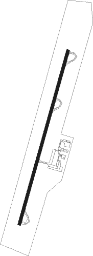
Farmville - Farmville Regl
Airport details
| Country | United States of America |
| State | Virginia |
| Region | K6 |
| Airspace | Washington Ctr |
| Municipality | Cumberland County |
| Elevation | 416ft (127m) |
| Timezone | GMT -5 |
| Coordinates | 37.35753, -78.43781 |
| Magnetic var | |
| Type | land |
| Available since | X-Plane v10.40 |
| ICAO code | KFVX |
| IATA code | n/a |
| FAA code | FVX |
Communication
| Farmville Regl AWOS 3 | 132.725 |
| Farmville Regl CTAF/UNICOM | 122.800 |
Nearby Points of Interest:
Needham
-Farmville Historic District
-Cushing Hall
-Venable Hall
-Debtors' Prison
-Worsham High School
-Chellowe
-Old Prince Edward County Clerk's Office
-Locust Grove
-Robert Russa Moton Boyhood Home
-Holliday Lake 4-H Educational Center
-Charles Irving Thornton
-Sayler's Creek Battlefield
-Oak Hill
-Cumberland Court House Historic District
-Cumberland County Courthouse
-Trenton
-Woodside (Buckingham, Virginia)
-Ingleside (Amelia Courthouse, Virginia)
-Twin Lakes State Park
-Burke's Tavern
-Falkland (Redd Shop, Virginia)
-Farmer House (Deatonville, Virginia)
-Perry Hill (Saint Joy, Virginia)
-Inverness (Burkeville, Virginia)
Nearby beacons
| code | identifier | dist | bearing | frequency |
|---|---|---|---|---|
| BKT | BLACKSTONE NDB | 23.3 | 120° | 326 |
| FAK | FLAT ROCK VORTAC | 30.8 | 74° | 113.30 |
| LYH | LYNCHBURG VOR/DME | 38.6 | 263° | 109.20 |
| LY | BOJAR (LYNCHBURG) NDB | 38.8 | 263° | 385 |
| LVL | LAWRENCEVILLE VORTAC | 41.3 | 135° | 112.90 |
| GVE | GORDONSVILLE VORTAC | 41.6 | 23° | 115.60 |
| MOL | MONTEBELLO VOR/DME | 45.5 | 309° | 115.30 |
| SBV | SOUTH BOSTON VORTAC | 49.4 | 220° | 110.40 |
| SH | STAUT(STAUNTON-WAYNESBORO-HARR NDB | 56.3 | 328° | 375 |
| DAN | DANVILLE VOR | 64 | 229° | 113.10 |
| EZF | SHANNON (FREDERICKSBURG) NDB | 71.9 | 47° | 237 |
Instrument approach procedures
| runway | airway (heading) | route (dist, bearing) |
|---|---|---|
| RW03 | INSAC (56°) | INSAC WAMPO (8mi, 106°) 3000ft |
| RW03 | LELLI (352°) | LELLI WAMPO (12mi, 317°) 3000ft |
| RW03 | WAMPO (25°) | WAMPO 3000ft |
| RNAV | WAMPO 3000ft NUVME (7mi, 25°) 2500ft JILAR (3mi, 25°) 1360ft KFVX (3mi, 25°) 466ft (4855mi, 115°) 720ft BODRY (4852mi, 296°) 3000ft BODRY (turn) | |
| RW21 | BODRY (205°) | BODRY 3000ft |
| RW21 | COLAB (182°) | COLAB BODRY (4mi, 106°) 3000ft |
| RW21 | FAK (254°) | FAK APIGY (12mi, 274°) 3000ft BODRY (12mi, 274°) 3000ft |
| RNAV | BODRY 3000ft DEPOY (7mi, 205°) 2500ft SIBTE (3mi, 205°) 1480ft KFVX (4mi, 205°) 468ft (4855mi, 115°) 696ft WAMPO (4858mi, 295°) 3000ft WAMPO (turn) |
Disclaimer
The information on this website is not for real aviation. Use this data with the X-Plane flight simulator only! Data taken with kind consent from X-Plane 12 source code and data files. Content is subject to change without notice.
