Reeds Spring - Branson West Muni
Airport details
| Country | United States of America |
| State | Missouri |
| Region | K3 |
| Airspace | Kansas City Ctr |
| Municipality | Branson West |
| Elevation | 1348ft (411m) |
| Timezone | GMT -6 |
| Coordinates | 36.69850, -93.40225 |
| Magnetic var | |
| Type | land |
| Available since | X-Plane v11.40 |
| ICAO code | KFWB |
| IATA code | n/a |
| FAA code | KFWB |
Communication
| Branson West Muni AWOS | 119.725 |
| Branson West Muni CTAF | 123.000 |
| Branson West Muni Springfield App | 126.350 |
| Branson West Muni Springfield Dep | 126.350 |
Nearby Points of Interest:
Stone County Courthouse
-Cricket and Crest Tunnels
-W.D. Crawford House
-Ozark Courthouse Square Historic District
-Berryville Gymnasium
-Berryville Agriculture Building
-Berryville Post Office
-Carroll County Courthouse, Eastern District
-Lewis Shaw Coleman House
-Beaver Bridge (Arkansas)
-Concord School House
-Blue Springs Heritage Center
-Haggard Ford Swinging Bridge
-Sanitarium Lake Bridges Historic District
-U.S. 62 White River Bridge
-Elijah Teague Anderson House
-Yell Masonic Lodge Hall
-Quigley's Castle
-Springfield National Cemetery
-Dog Branch School
-J.E. King Manufacturing Company
-Robert B. and Vitae A. Kite Apartment Building
-Day House
-Edward M. and Della C. Wilhoit House
-Camp Manor Apartments
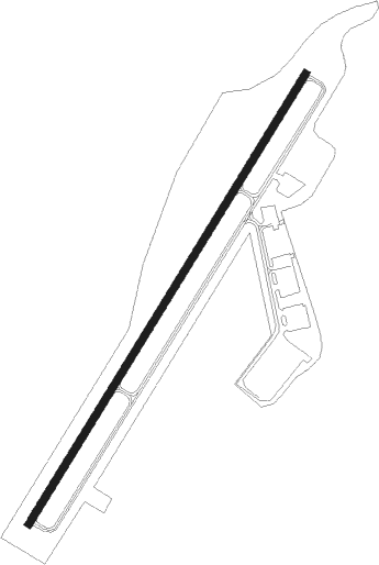
Runway info
| Runway 3 / 21 | ||
| length | 1526m (5007ft) | |
| bearing | 42° / 222° | |
| width | 23m (75ft) | |
| surface | concrete | |
Nearby beacons
| code | identifier | dist | bearing | frequency |
|---|---|---|---|---|
| HRO | HARRISON VOR/DME | 24.5 | 154° | 112.50 |
| DGD | DOGWOOD VORTAC | 31.9 | 58° | 109.40 |
| SGF | SPRINGFIELD VORTAC | 39.6 | 6° | 116.90 |
| RZC | RAZORBACK (FAYETTEVILLE) VORTAC | 44 | 238° | 116.40 |
| FLP | DME | 51.4 | 113° | 116.05 |
Instrument approach procedures
| runway | airway (heading) | route (dist, bearing) |
|---|---|---|
| RW03 | EDJON (42°) | EDJON 3400ft |
| RW03 | HARKS (58°) | HARKS EDJON (7mi, 82°) 3400ft |
| RW03 | PPAMM (10°) | PPAMM EDJON (9mi, 322°) 3400ft |
| RNAV | EDJON 3400ft CONIE (6mi, 42°) 3000ft WOREP (4mi, 42°) 1840ft KFWB (2mi, 42°) 1331ft (5569mi, 111°) 1491ft ENDRS (5562mi, 292°) 3000ft ENDRS (turn) | |
| RW21 | ENDRS (222°) | ENDRS 3000ft |
| RNAV | ENDRS 3000ft BRNTT (5mi, 222°) 3000ft HIVGA (3mi, 222°) 2080ft KFWB (3mi, 222°) 1388ft (5569mi, 111°) 1598ft EDJON (5576mi, 291°) 3400ft EDJON (turn) |
Disclaimer
The information on this website is not for real aviation. Use this data with the X-Plane flight simulator only! Data taken with kind consent from X-Plane 12 source code and data files. Content is subject to change without notice.