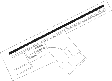
Monongahela - Rostraver
Airport details
| Country | United States of America |
| State | Pennsylvania |
| Region | K6 |
| Airspace | Cleveland Ctr |
| Municipality | Rostraver Township |
| Elevation | 1228ft (374m) |
| Timezone | GMT -5 |
| Coordinates | 40.20972, -79.83144 |
| Magnetic var | |
| Type | land |
| Available since | X-Plane v10.40 |
| ICAO code | KFWQ |
| IATA code | n/a |
| FAA code | FWQ |
Communication
| Rostraver AWOS 3 | 118.475 |
| Rostraver CTAF/UNICOM | 122.800 |
| Rostraver PITTSBURGH Approach/Departure | 119.350 |
Nearby Points of Interest:
Donora-Webster Bridge
-Van Kirk Farm
-Hutchinson Farm (Elizabeth, Pennsylvania)
-Cement City Historic District
-Plumer House
-Dick Building
-Household No. 1 Site
-Youghiogheny River Trail
-David Longwell House
-Bethel African American Episcopal Church of Monongahela City
-Edward G. Acheson House
-Col. Edward Cook House
-Charleroi Historic District
-United States Post Office
-First National Bank of Charleroi
-Locus 7 Site
-Dusmal House
-Whitsett Historic District
-John H. Nelson House
-Alliance Furnace
-Carnegie Free Library
-Karolcik Building
-Youghiogheny Bank of Pennsylvania
-Sewickley Manor
-Andrew and Jennie McFarlane House
Nearby beacons
| code | identifier | dist | bearing | frequency |
|---|---|---|---|---|
| AGC | ALLEGHENY (PITTSBURGH) VOR/DME | 10.4 | 288° | 110 |
| VV | CAMOR (CONNELLSVILLE) NDB | 20 | 165° | 299 |
| MMJ | (PITTSBURGH) DME | 23.5 | 308° | 112 |
| IHD | INDIAN HEAD VORTAC | 25.9 | 116° | 108.20 |
| HLG | WHEELING VOR/DME | 33.9 | 274° | 112.20 |
| MGW | MORGANTOWN VOR/DME | 39.2 | 183° | 111.60 |
| EWC | ELLWOOD CITY VOR/DME | 40.8 | 328° | 115.80 |
| SYS | STOYSTOWN (SOMERSET) NDB | 42.6 | 98° | 209 |
| JST | JOHNSTOWN VOR/DME | 46.1 | 84° | 113 |
| AIR | BELLAIRE VOR/DME | 46.7 | 259° | 117.10 |
| GRV | DME | 49.8 | 126° | 112.30 |
| UCP | CASTLE (NEW CASTLE) NDB | 55.6 | 324° | 272 |
| CIP | DME | 58.7 | 22° | 112.90 |
| CKB | CLARKSBURG VOR/DME | 60.8 | 205° | 112.60 |
| YN | FETCH (YOUNGSTOWN/WARREN) NDB | 68.9 | 322° | 338 |
| ESL | KESSEL VOR/DME | 70.7 | 139° | 110.80 |
Instrument approach procedures
| runway | airway (heading) | route (dist, bearing) |
|---|---|---|
| RW08 | AKSAR (84°) | AKSAR EROCU (10mi, 96°) 3000ft |
| RNAV | EROCU 3000ft EYOPO (6mi, 72°) 3000ft KFWQ (6mi, 72°) 1279ft (4940mi, 117°) 1628ft FURIX (4928mi, 297°) 3700ft FURIX (turn) | |
| RW26 | HOMEE (235°) | HOMEE FURIX (15mi, 216°) 3700ft |
| RW26 | MILWO (258°) | MILWO FURIX (8mi, 268°) 3700ft |
| RNAV | FURIX 3700ft OSSAR (8mi, 252°) 3000ft KFWQ (6mi, 252°) 1273ft DECSA (5mi, 252°) AGC (8mi, 311°) 3000ft AGC (turn) |
Disclaimer
The information on this website is not for real aviation. Use this data with the X-Plane flight simulator only! Data taken with kind consent from X-Plane 12 source code and data files. Content is subject to change without notice.
