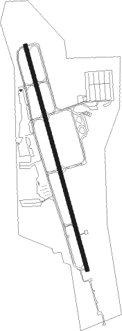
Fayetteville - Drake Field
Airport details
| Country | United States of America |
| State | Arkansas |
| Region | K4 |
| Airspace | Memphis Ctr |
| Municipality | Fayetteville |
| Elevation | 1250ft (381m) |
| Timezone | GMT -6 |
| Coordinates | 36.00508, -94.17006 |
| Magnetic var | |
| Type | land |
| Available since | X-Plane v10.40 |
| ICAO code | KFYV |
| IATA code | FYV |
| FAA code | FYV |
Communication
| Drake Field ATIS | 119.575 |
| Drake Field CTAF | 128.000 |
| Drake Field UNICOM | 122.950 |
| Drake Field Ground Control | 121.800 |
| Drake Field Tower | 128.000 |
| Drake Field RAZORBACK Approach/Departure | 121.000 |
Approach frequencies
| LOC | RW16 | 111.9 | 18.00mi |
| LDA | RW34 | 111.9 | 18.00mi |
| 3.5° GS | RW34 | 111.9 | 18.00mi |
Nearby Points of Interest:
Old U.S. Route 71
-Johnson Barn
-Stone House
-Black Oak Cemetery
-Washington County Jail
-Fayetteville Fire Department Fire Station 1
-Fayetteville Historic Square
-Lynn Shelton American Legion Post No. 27
-Walker Family Plot
-John S. Vest House
-Tharp House
-Ridge House
-David and Mary Margaret Durst House
-Hantz House
-Dickson Street
-Wilson-Pittman-Campbell-Gregory House
-Ozark Hall
-Goff Farm Stone Bridge
-University of Arkansas Chemistry Building
-Gregg House
-Frisco Depot
-Mack Morton Barn
-Headquarters House (Fayetteville, Arkansas)
-Villa Rosa
-Campus of the University of Arkansas
Nearby beacons
| code | identifier | dist | bearing | frequency |
|---|---|---|---|---|
| RZC | RAZORBACK (FAYETTEVILLE) VORTAC | 14.6 | 11° | 116.40 |
| SLG | SILOAM SPRINGS NDB | 19 | 300° | 284 |
| FSM | FORT SMITH VORTAC | 37.3 | 189° | 110.40 |
| HRO | HARRISON VOR/DME | 50 | 72° | 112.50 |
| EOS | NEOSHO VOR/DME | 51.9 | 342° | 117.30 |
Departure and arrival routes
| Transition altitude | 18000ft |
| Transition level | 18000ft |
| SID end points | distance | outbound heading | |
|---|---|---|---|
| RW16 | |||
| RZC3 | 20mi | 80° | |
| RW34 | |||
| RZC3 | 20mi | 80° | |
Instrument approach procedures
| runway | airway (heading) | route (dist, bearing) |
|---|---|---|
| RW16 | ELMIE (166°) | ELMIE 3000ft |
| RW16 | GENET (131°) | GENET ELMIE (12mi, 106°) 3000ft |
| RW16 | RZC (191°) | RZC ELMIE (6mi, 231°) 3000ft |
| RNAV | ELMIE 3000ft OSETE (5mi, 166°) 2900ft ZABKO (3mi, 166°) 2080ft KFYV (3mi, 166°) 1301ft (5608mi, 111°) 1652ft OPVIE (5607mi, 291°) VIMXU (6mi, 184°) 4000ft VIMXU (turn) | |
| RW34 | CASKS (305°) | CASKS YABUV (9mi, 268°) 4000ft VIMXU (6mi, 292°) 4000ft |
| RW34 | CHESO (10°) | CHESO VIMXU (14mi, 23°) 4000ft |
| RW34 | VIMXU (355°) | VIMXU 4000ft |
| RNAV | VIMXU 4000ft OPVIE (6mi, 4°) 3100ft JENOL (2mi, 347°) 2540ft KFYV (5mi, 346°) 1283ft (5608mi, 111°) 1652ft ELMIE (5609mi, 291°) 3000ft ELMIE (turn) |
Disclaimer
The information on this website is not for real aviation. Use this data with the X-Plane flight simulator only! Data taken with kind consent from X-Plane 12 source code and data files. Content is subject to change without notice.