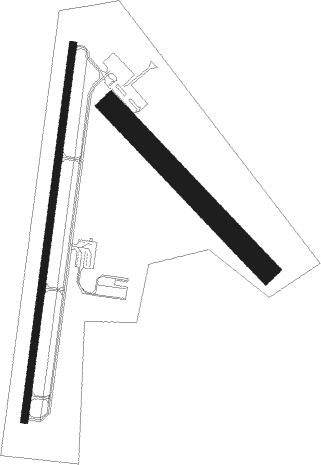
Fitzgerald - Fitzgerald Muni
Airport details
| Country | United States of America |
| State | Georgia |
| Region | K7 |
| Airspace | Jacksonville Ctr |
| Municipality | Fitzgerald |
| Elevation | 365ft (111m) |
| Timezone | GMT -5 |
| Coordinates | 31.68390, -83.27090 |
| Magnetic var | |
| Type | land |
| Available since | X-Plane v10.40 |
| ICAO code | KFZG |
| IATA code | FZG |
| FAA code | FZG |
Communication
| FITZGERALD MUNI AWOS 3 | 118.625 |
| FITZGERALD MUNI CTAF/UNICOM | 123.000 |
Approach frequencies
| LOC | RW02 | 111.1 | 18.00mi |
Nearby Points of Interest:
Ben Hill County Courthouse
-Holtzendorf Apartments
-Ben Hill County Jail
-Ocilla Public School
-Irwin County Courthouse
-Tifton Residential Historic District
-Tift County Courthouse
-Tifton Commercial Historic District
-Alapaha Colored School
-Wilcox County Courthouse
-Turner County Jail
-Turner County Courthouse
-McCranie's Turpentine Still
-Lonnie A. Pope House
-Union Banking Company Building
-Downtown Douglas Historic District
-Eleventh District A & M School-South Georgia College Historic District
-Gaskin Avenue Historic District
-Sumner High School and auditorium
-Possum Poke
-Poulan Library
-Old Berrien County Jail
-Berrien County Courthouse
-William G. Harrison House
-Telfair Center for the Arts

Nearby beacons
| code | identifier | dist | bearing | frequency |
|---|---|---|---|---|
| SUR | FITZGERALD NDB | 4.3 | 196° | 362 |
| IFM | TIFT MYERS (TIFTON) VOR | 18.9 | 220° | 112.50 |
| OWC | COFFEE COUNTY (DOUGLAS) NDB | 24.4 | 129° | 390 |
| EZM | EASTMAN NDB | 27.5 | 15° | 366 |
| MQW | MC RAE NDB | 31.7 | 43° | 280 |
| VNA | VIENNA VORTAC | 33.8 | 337° | 116.50 |
| AZE | HAZLEHURST NDB | 33.9 | 73° | 414 |
| OHY | CONEY (CORDELE) NDB | 35.5 | 298° | 400 |
| AMG | ALMA VORTAC | 40 | 101° | 115.10 |
| VAD | MOODY (VALDOSTA) TACAN | 43.6 | 174° | 113.30 |
| AYS | WAYCROSS VORTAC | 44.2 | 120° | 110.20 |
| BHC | BAXLEY NDB | 45 | 88° | 376 |
| MGR | DME | 45.3 | 222° | 108.80 |
| HOE | HOMERVILLE NDB | 45.5 | 142° | 209 |
| AY | WIKET (WAYCROSS) NDB | 49.6 | 112° | 219 |
| DB | CREKE (DUBLIN) NDB | 49.8 | 18° | 251 |
| LKG | LINDBERGH (AMERICUS) NDB | 51.8 | 300° | 242 |
| GTP | PATON (THOMASVILLE) NDB | 52.1 | 217° | 245 |
| ACJ | SOUTHER (AMERICUS) NDB | 53.3 | 295° | 242 |
| OTK | VALDOSTA VOR/DME | 54.2 | 181° | 114.80 |
| IZS | MONTEZUMA NDB | 55.5 | 313° | 426 |
| DBN | DUBLIN VORTAC | 57.3 | 27° | 113.10 |
| UQN | ONYUN (VIDALIA) NDB | 59.2 | 61° | 372 |
| WRB | ROBINS (WARNER ROBINS) TACAN | 59.7 | 342° | 135.30 |
| CYR | CAIDY (CAIRO) NDB | 66 | 228° | 338 |
| EEX | EMANUEL COUNTY (SWAINSBORO) NDB | 72.1 | 40° | 309 |
Instrument approach procedures
| runway | airway (heading) | route (dist, bearing) |
|---|---|---|
| RW02 | WODAM (14°) | WODAM 1900ft |
| RNAV | WODAM 1900ft POTYO (7mi, 14°) 1700ft REKLE (2mi, 14°) 1000ft KFZG (2mi, 16°) 395ft (5061mi, 111°) 611ft AFUFI (5061mi, 291°) DUMMY (11mi, 7°) 2300ft DUMMY (turn) |
Disclaimer
The information on this website is not for real aviation. Use this data with the X-Plane flight simulator only! Data taken with kind consent from X-Plane 12 source code and data files. Content is subject to change without notice.