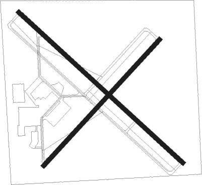
Fulton - Oswego Co
Airport details
| Country | United States of America |
| State | New York |
| Region | K6 |
| Airspace | Boston Ctr |
| Municipality | Town of Volney |
| Elevation | 475ft (145m) |
| Timezone | GMT -5 |
| Coordinates | 43.35078, -76.38805 |
| Magnetic var | |
| Type | land |
| Available since | X-Plane v10.40 |
| ICAO code | KFZY |
| IATA code | n/a |
| FAA code | FZY |
Communication
| OSWEGO CO ASOS | 119.275 |
| OSWEGO CO CTAF/UNICOM | 123.000 |
| OSWEGO CO SYRACUSE Approach/Departure | 134.275 |
Approach frequencies
| ILS-cat-I | RW33 | 110.9 | 18.00mi |
| 3.5° GS | RW33 | 110.9 | 18.00mi |
Nearby Points of Interest:
St. John's Episcopal Church
-Oswego Armory
-Oswego City Library
-Oswego County Courthouse
-Sweet Memorial Building
-Oswego City Hall
-Buckhout-Jones Building
-Market House
-Northrup-Gilbert House
-Tanner Block
-Woodruff Block
-Nash
-Oswego Yacht Club
-Sheldon Hall
-Leonard Ames Farmhouse
-Thayer Farmstead
-Mexico High School
-Mexico Village Historic District
-Peter Chandler House
-Schroeppel House
-Oswego-Oneida Streets Historic District
-Whig Hill
-Baldwinsville Village Hall
-Mrs. I. L. Crego House
-Carley's Mills Schoolhouse

Nearby beacons
| code | identifier | dist | bearing | frequency |
|---|---|---|---|---|
| FZ | FALLN (FULTON) NDB | 5.2 | 127° | 220 |
| SYR | SYRACUSE VORTAC | 13.9 | 136° | 117 |
| ART | WATERTOWN VORTAC | 38.7 | 28° | 109.80 |
| GGT | GEORGETOWN TACAN | 41.7 | 135° | 117.80 |
| ITH | DME | 51.4 | 185° | 111.80 |
| PYA | PENN YAN NDB | 51.6 | 223° | 260 |
| IT | VRNAH (ITHACA) NDB | 55.3 | 179° | 266 |
| YGK | KINGSTON NDB | 57.5 | 347° | 263 |
Instrument approach procedures
| runway | airway (heading) | route (dist, bearing) |
|---|---|---|
| RW15 | JOBSI (128°) | JOBSI 6000ft JOBSI (turn) 3000ft |
| RNAV | JOBSI 3000ft WUPKO (7mi, 128°) 2100ft XIJAF (2mi, 128°) 1380ft KFZY (3mi, 128°) 506ft (4813mi, 120°) 783ft OSSGO (4804mi, 300°) 3000ft OSSGO (turn) | |
| RW24 | IFIZE (236°) | IFIZE 3600ft |
| RW24 | OSYOB (211°) | OSYOB IFIZE (5mi, 128°) 3600ft |
| RW24 | WUJFE (256°) | WUJFE IFIZE (5mi, 308°) 3600ft |
| RNAV | IFIZE 3600ft WIELD (6mi, 236°) 2100ft KFZY (5mi, 236°) 509ft (4813mi, 120°) 875ft NINIE (4815mi, 300°) LYSAN (7mi, 217°) 3000ft LYSAN (turn) | |
| RW33 | OSSGO (308°) | OSSGO 6000ft OSSGO (turn) 3000ft |
| RNAV | OSSGO 3000ft HURTI (7mi, 308°) 2400ft YUQIG (3mi, 308°) 1440ft KFZY (3mi, 308°) 507ft (4813mi, 120°) 771ft JOBSI (4823mi, 300°) 3000ft JOBSI (turn) |
Disclaimer
The information on this website is not for real aviation. Use this data with the X-Plane flight simulator only! Data taken with kind consent from X-Plane 12 source code and data files. Content is subject to change without notice.