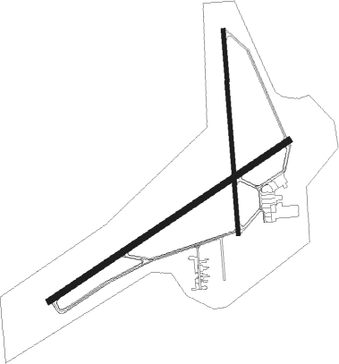
Gadsden - Northeast Alabama Rgnl
Airport details
| Country | United States of America |
| State | Alabama |
| Region | K7 |
| Airspace | Atlanta Ctr |
| Municipality | Gadsden |
| Elevation | 567ft (173m) |
| Timezone | GMT -6 |
| Coordinates | 33.97265, -86.08908 |
| Magnetic var | |
| Type | land |
| Available since | X-Plane v10.40 |
| ICAO code | KGAD |
| IATA code | GAD |
| FAA code | GAD |
Communication
| NORTHEAST ALABAMA RGNL AWOS 3 | 127.825 |
| NORTHEAST ALABAMA RGNL CTAF/UNICOM | 122.800 |
| NORTHEAST ALABAMA RGNL BIRMINGHAM Approach/Departure | 132.150 |
Approach frequencies
| ILS-cat-I | RW24 | 108.35 | 18.00mi |
| 3° GS | RW24 | 108.35 | 18.00mi |
Nearby Points of Interest:
United States Post Office
-Attalla Downtown Historic District
-Alabama City Wall Street Historic District
-Howard Gardner Nichols Memorial Library
-Eleventh Street School
-Turrentine Historic District
-Charles Gunn House
-Colonel O.R. Hood House
-Gadsden Times-News Building
-Gadsden Downtown Historic District
-John Looney House
-Janney Furnace Park
-Dr. James J. Bothwell House
-Judge Elisha Robinson House
-Fort Strother
-Thomas A. Snellgrove Homestead
-Edward Fenns Whitman House
-First Presbyterian Church
-Albertville Depot
-Alexander Woods House
-Ten Oaks
-Aderholdt's Mill
-Richard P. Huger House

Nearby beacons
| code | identifier | dist | bearing | frequency |
|---|---|---|---|---|
| GAD | GADSDEN VOR/DME | 0.3 | 56° | 112.30 |
| TDG | DME | 23.9 | 173° | 108.80 |
| AN | BOGGA (ANNISTON) NDB | 27.4 | 160° | 211 |
| VUZ | VULCAN (BIRMINGHAM) VORTAC | 44.3 | 250° | 114.40 |
| BH | MCDEN (BIRMINGHAM) NDB | 46.8 | 239° | 224 |
| RMG | ROME VORTAC | 49.5 | 79° | 115.40 |
| GPQ | CARROLLTON NDB | 53.7 | 113° | 278 |
| RQZ | ROCKET (HUNTSVILLE) VORTAC | 56.4 | 327° | 112.20 |
| DCU | DME | 58.5 | 308° | 112.80 |
| LGC | LA GRANGE VORTAC | 70.9 | 136° | 115.60 |
Instrument approach procedures
| runway | airway (heading) | route (dist, bearing) |
|---|---|---|
| RW06 | GAD (236°) | GAD JODAT (13mi, 244°) 3500ft JODAT (turn) 3500ft |
| RW06 | VUZ (70°) | VUZ JODAT (31mi, 72°) 3500ft |
| RNAV | JODAT 3500ft AWELU (4mi, 65°) 3000ft CEGON (2mi, 65°) 2500ft KILEC (4mi, 65°) 1240ft KGAD (3mi, 64°) 609ft (5210mi, 112°) 1300ft SNEAR (5222mi, 292°) 3500ft SNEAR (turn) | |
| RW18 | GAD (236°) | GAD GAYEC (13mi, 360°) 3500ft GAYEC (turn) 3500ft |
| RW18 | GESTS (184°) | GESTS GAYEC (6mi, 189°) 3500ft |
| RNAV | GAYEC 3500ft OCOKO (4mi, 180°) 2700ft EKUTE (2mi, 180°) 2500ft KGAD (7mi, 182°) 582ft (5210mi, 112°) 836ft HORPO (5210mi, 291°) WENDO (9mi, 266°) 3600ft WENDO (turn) | |
| RW24 | EBAZE (227°) | EBAZE HUBJU (12mi, 204°) 3600ft |
| RW24 | GAD (236°) | GAD HUBJU (13mi, 66°) 3600ft HUBJU (turn) 3600ft |
| RW24 | MAYES (270°) | MAYES HUBJU (7mi, 344°) 3600ft HUBJU (turn) 3600ft |
| RNAV | HUBJU 3600ft FIKOX (4mi, 245°) 3000ft BLKEY (3mi, 245°) 2500ft WANEB (3mi, 245°) 1620ft KGAD (4mi, 246°) 592ft (5210mi, 112°) 770ft CEGON (5216mi, 291°) STAMP (3mi, 223°) 3600ft STAMP (turn) | |
| RW36 | GAD (236°) | GAD LEVIC (13mi, 190°) 3500ft LEVIC (turn) 3500ft |
| RW36 | NOPVE (14°) | NOPVE LEVIC (11mi, 19°) 3500ft |
| RNAV | LEVIC 3500ft PETBE (4mi, 18°) 2800ft HORPO (2mi, 18°) 2500ft KGAD (6mi, 359°) 593ft (5210mi, 112°) 969ft EKUTE (5210mi, 292°) SNEAR (12mi, 275°) 3500ft SNEAR (turn) |
Disclaimer
The information on this website is not for real aviation. Use this data with the X-Plane flight simulator only! Data taken with kind consent from X-Plane 12 source code and data files. Content is subject to change without notice.