Galliano - South Lafourche
Airport details
| Country | United States of America |
| State | Louisiana |
| Region | K4 |
| Airspace | Houston Oceanic Ctr |
| Municipality | Lafourche Parish |
| Elevation | 0ft (0m) |
| Timezone | GMT -6 |
| Coordinates | 29.44111, -90.26111 |
| Magnetic var | |
| Type | land |
| Available since | X-Plane v10.40 |
| ICAO code | KGAO |
| IATA code | n/a |
| FAA code | GAO |
Communication
| South Lafourche AWOS 3 | 118.175 |
| South Lafourche UNICOM CTAF | 123.000 |
| South Lafourche NEW ORLEANS Approach/Departure | 123.850 |
Approach frequencies
| ILS-cat-I | RW36 | 109.1 | 18.00mi |
| 3° GS | RW36 | 109.1 | 18.00mi |
Nearby Points of Interest:
Harlem Plantation House
-Woodland Plantation
-Promised Land
-Mary Plantation House
-L.J. Bernard Hardware Store
-St. Peter A.M.E. Church
-Aldrich–Genella House
-Gretna Historic District
-Old Jefferson Parish Courthouse
-George Washington Cable House
-LaBranche Plantation Dependency
-Orange Grove Plantation House
-Edward Douglass White House
-Huey P. Long Mansion
-Magnolia Projects
-St. Charles Streetcar Line
-Kerner House
-Polmer Store
-Ormond Plantation House
-Zephirin Toups Sr. House
-Robert E. Lee Monument
-Bohn Motor Company Automobile Dealership
-Ardoyne Plantation House
-John Minor Wisdom United States Court of Appeals Building
-Gallier Hall
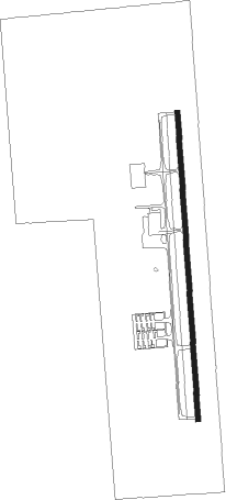
Runway info
| Runway 18 / 36 | ||
| length | 1983m (6506ft) | |
| bearing | 181° / 1° | |
| width | 30m (100ft) | |
| surface | asphalt | |
Nearby beacons
| code | identifier | dist | bearing | frequency |
|---|---|---|---|---|
| LEV | LEEVILLE (GRAND ISLE) VORTAC | 17.9 | 149° | 113.50 |
| HRV | HARVEY (NEW ORLEANS) VORTAC | 28 | 32° | 114.10 |
| TBD | TIBBY (THIBODAUX) VOR/DME | 32.5 | 291° | 112 |
| MS | KINTE (NEW ORLEANS) NDB | 35.8 | 347° | 338 |
| RQR | RESERVE VOR/DME | 42.4 | 333° | 110.80 |
Instrument approach procedures
| runway | airway (heading) | route (dist, bearing) |
|---|---|---|
| RW18 | HIKEN (181°) | HIKEN 6000ft HIKEN (turn) 2000ft |
| RW18 | HRV (212°) | HRV ZAPSI (15mi, 213°) 2000ft HIKEN (6mi, 271°) 2000ft |
| RW18 | TBD (111°) | TBD OYABI (24mi, 93°) 2000ft HIKEN (6mi, 90°) 2000ft |
| RNAV | HIKEN 2000ft JADUL (6mi, 181°) 1700ft AIVER (4mi, 181°) 560ft KGAO (2mi, 181°) 51ft (5419mi, 108°) 520ft HIKEN (5419mi, 288°) 2000ft HIKEN (turn) | |
| RW36 | COPUP (1°) | COPUP 2000ft |
| RW36 | HRV (212°) | HRV ZETON (37mi, 193°) 2000ft COPUP (6mi, 271°) 2000ft |
| RW36 | TBD (111°) | TBD WROTH (34mi, 133°) 2000ft COPUP (6mi, 90°) 2000ft |
| RNAV | COPUP 2000ft JOXAG (6mi, 1°) 1700ft JELON (3mi, 1°) 620ft KGAO (2mi, 1°) 49ft (5419mi, 108°) 198ft HIKEN (5419mi, 288°) 2000ft HIKEN (turn) |
Disclaimer
The information on this website is not for real aviation. Use this data with the X-Plane flight simulator only! Data taken with kind consent from X-Plane 12 source code and data files. Content is subject to change without notice.