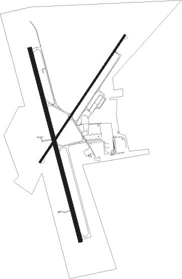
Gillette - Gillette Campbell Co
Airport details
| Country | United States of America |
| State | Wyoming |
| Region | K1 |
| Airspace | Denver Ctr |
| Municipality | Campbell County |
| Elevation | 4365ft (1330m) |
| Timezone | GMT -7 |
| Coordinates | 44.34892, -105.53936 |
| Magnetic var | |
| Type | land |
| Available since | X-Plane v10.40 |
| ICAO code | KGCC |
| IATA code | GCC |
| FAA code | GCC |
Communication
| Gillette Campbell Co ASOS | 124.175 |
| Gillette Campbell Co CTAF | 118.500 |
| Gillette Campbell Co UNICOM | 122.950 |
| Gillette Campbell Co Ground Control | 121.700 |
| Gillette Campbell Co Tower | 118.500 |
Approach frequencies
| ILS-cat-I | RW34 | 110.1 | 18.00mi |
| 3° GS | RW34 | 110.1 | 18.00mi |
Nearby beacons
| code | identifier | dist | bearing | frequency |
|---|---|---|---|---|
| GCC | GILLETTE VOR/DME | 0.1 | 255° | 114.60 |
| GC | DERYK (GILLETTE) NDB | 4.7 | 168° | 380 |
| CZI | CRAZY WOMAN VOR/DME | 43.9 | 249° | 117.30 |
Instrument approach procedures
| runway | airway (heading) | route (dist, bearing) |
|---|---|---|
| RW16 | GCC (75°) | GCC CACLA (12mi, 346°) 7000ft CACLA (turn) 7000ft |
| RW16 | HITOS (168°) | HITOS CACLA (7mi, 174°) 7000ft |
| RW16 | MIDGE (108°) | MIDGE CACLA (12mi, 70°) 7000ft CACLA (turn) 7000ft |
| RNAV | CACLA 7000ft ACITU (6mi, 166°) 6000ft KGCC (6mi, 164°) 4382ft (6068mi, 113°) 4660ft IDIPE (6069mi, 293°) JUGIP (9mi, 170°) 7000ft JUGIP (turn) | |
| RW34 | DEBBI (69°) | DEBBI JENNE (10mi, 118°) 7000ft FEKIX (8mi, 86°) 7000ft |
| RW34 | GCC (75°) | GCC FEKIX (13mi, 165°) 7000ft FEKIX (turn) 7000ft |
| RW34 | TOOKE (350°) | TOOKE FEKIX (7mi, 356°) 7000ft |
| RW34 | WUVUT (291°) | WUVUT FEKIX (12mi, 243°) 7000ft FEKIX (turn) 7000ft |
| RNAV | FEKIX 7000ft OBURE (8mi, 346°) 5800ft HIVOL (2mi, 346°) 5240ft KGCC (3mi, 348°) 4417ft (6068mi, 113°) 4619ft ACITU (6069mi, 293°) MIDGE (12mi, 272°) 7000ft MIDGE (turn) |
Disclaimer
The information on this website is not for real aviation. Use this data with the X-Plane flight simulator only! Data taken with kind consent from X-Plane 12 source code and data files. Content is subject to change without notice.

