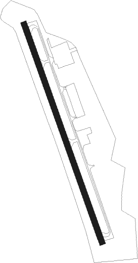
Gardner - Gardner Muni
Airport details
| Country | United States of America |
| State | Massachusetts |
| Region | K6 |
| Airspace | Boston Ctr |
| Municipality | Templeton |
| Elevation | 955ft (291m) |
| Timezone | GMT -5 |
| Coordinates | 42.54989, -72.01603 |
| Magnetic var | |
| Type | land |
| Available since | X-Plane v10.40 |
| ICAO code | KGDM |
| IATA code | GDM |
| FAA code | GDM |
Communication
| Gardner Muni CTAF/Unicom | 122.800 |
| Gardner Muni Boston Center App | 123.750 |
| Gardner Muni Boston Center Dep | 123.750 |
Nearby Points of Interest:
Miss Toy Town Diner
-West Gardner Square Historic District
-Garbose Building
-Gardner News Building
-Lake Street Fire Station
-First Minister's House
-Jabez Partridge Homestead
-F.W. Smith Silver Company
-Elm Street Fire Station
-Gardner Uptown Historic District
-Levi Heywood Memorial Library Building
-Rev. Samuel Gay House
-Baldwinville Village Historic District
-Hubbardston Public Library
-Hubbardston Town Common Historic District
-Searles Hill Cemetery
-Phillipston Center Historic District
-Templeton Developmental Center
-Ahijah Wood House
-Nathan Wood House
-Ezra Wood-Levi Warner Place
-District No. 5 School
-Four Corners-Goodnow Farm Historic District
-Old Centre Historic District
-No. 4 Schoolhouse
Nearby beacons
| code | identifier | dist | bearing | frequency |
|---|---|---|---|---|
| GDM | GARDNER VOR/DME | 1.8 | 265° | 110.60 |
| EEN | DME | 19 | 312° | 109.40 |
| MJ | FITZY (MANCHESTER) NDB | 28.6 | 57° | 209 |
| CEF | WESTOVER(SPRINGFIELD/CHIC TACAN | 30.9 | 235° | 114 |
| MHT | MANCHESTER VOR/DME | 34.3 | 64° | 114.40 |
| PUT | PUTNAM VOR/DME | 36.5 | 164° | 117.40 |
| BAF | BARNES (WESTFIELD/SPRINGF VORTAC | 38.8 | 241° | 113 |
| CO | EPSOM (CONCORD) NDB | 42.2 | 45° | 216 |
| LWM | DME | 42.2 | 78° | 112.50 |
| CTR | CHESTER VOR/DME | 44.1 | 255° | 115.10 |
| CON | CONCORD VOR/DME | 44.6 | 33° | 112.90 |
| OW | STOGE (NORWOOD) NDB | 47.1 | 116° | 397 |
| CNH | CLAREMONT NDB | 51.6 | 337° | 233 |
| PVD | PROVIDENCE VOR/DME | 56 | 145° | 115.60 |
| HFD | HARTFORD VOR/DME | 59.4 | 210° | 114.90 |
| ORW | NORWICH VOR/DME | 59.6 | 179° | 110 |
| LC | BLNAP (LACONIA) NDB | 62.8 | 26° | 328 |
| RUT | DME | 71.5 | 316° | 111 |
Instrument approach procedures
| runway | airway (heading) | route (dist, bearing) |
|---|---|---|
| RWNVB | TETAE (189°) | TETAE VISLY (5mi, 259°) 4800ft |
| RWNVB | VISLY (160°) | VISLY 4800ft |
| RWNVB | WALAL (134°) | WALAL VISLY (5mi, 79°) 4800ft |
| RNAV | VISLY 4800ft SAPTE (6mi, 160°) 3000ft KGDM (6mi, 160°) 1004ft (4616mi, 121°) 1355ft VISLY (4621mi, 301°) 4800ft VISLY (turn) |
Disclaimer
The information on this website is not for real aviation. Use this data with the X-Plane flight simulator only! Data taken with kind consent from X-Plane 12 source code and data files. Content is subject to change without notice.