Georgetown - Brown Co
Airport details
| Country | United States of America |
| State | Ohio |
| Region | K5 |
| Airspace | Indianapolis Ctr |
| Municipality | Brown County |
| Elevation | 958ft (292m) |
| Timezone | GMT -5 |
| Coordinates | 38.88194, -83.88274 |
| Magnetic var | |
| Type | land |
| Available since | X-Plane v10.40 |
| ICAO code | KGEO |
| IATA code | n/a |
| FAA code | GEO |
Communication
| Brown Co CTAF | 122.900 |
Nearby Points of Interest:
Brown County Courthouse
-Thompson Farm
-Pisgah Christian Church
-James Weldon House
-Brothers-O'Neil House
-Wells-Keith House
-William Winter Stone House
-Bracken Baptist Church
-Bullskin Creek Site
-Aberdeen Mound
-Pogue House
-Point Au View
-Henry Perviance Peers House
-Armstrong Row
-Lee House (Maysville, Kentucky)
-Old Library Building
-Washington Opera House
-Newdigate-Reed House
-John Brett Richeson House
-Phillips' Folly
-West Fourth Street Historic District
-Russell Theatre
-Cox-Hord House
-Washington Historic District
-Ferris Site
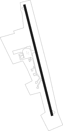
Runway info
| Runway 18 / 36 | ||
| length | 1077m (3533ft) | |
| bearing | 168° / 348° | |
| width | 20m (66ft) | |
| surface | asphalt | |
Nearby beacons
| code | identifier | dist | bearing | frequency |
|---|---|---|---|---|
| PWF | SPORTYS (BATAVIA) NDB | 19.4 | 300° | 245 |
| FLM | FALMOUTH VOR/DME | 24.4 | 241° | 117 |
| HW | CUBLA (WILMINGTON) NDB | 28.3 | 1° | 299 |
| MXQ | MIDWEST (WILMINGTON) VOR/DME | 33.1 | 8° | 112.90 |
| IL | AIRBO (WILMINGTON) NDB | 37.3 | 13° | 407 |
| CVG | CINCINNATI VORTAC | 39.1 | 279° | 117.30 |
| YRK | YORK VORTAC | 44.6 | 105° | 112.80 |
| HKF | HOOK FIELD (MIDDLETOWN) NDB | 45.4 | 318° | 239 |
| MW | ONIDA (MIDDLETOWN) NDB | 46.5 | 328° | 223 |
| EOP | WAVERLY NDB | 47.5 | 73° | 385 |
| CSS | COURT HOUSE (WASHINGTON) NDB | 48.8 | 34° | 414 |
| IOB | MOUNT STERLING NDB | 49.5 | 187° | 210 |
| GN | BRIDL (LEXINGTON) NDB | 54.1 | 219° | 340 |
| FFO | PATTERSON (DAYTON) TACAN | 56.8 | 350° | 115.20 |
| XUB | YELLOW BUD (CIRCLEVILLE) VOR | 57.2 | 55° | 112.50 |
| SGH | DME | 57.3 | 2° | 113.20 |
| XSF | SPRINGFIELD TACAN | 57.4 | 3° | 133.80 |
| HYK | LEXINGTON VOR/DME | 61.5 | 213° | 112.60 |
| AT | BRUNY (DAYTON) NDB | 61.6 | 335° | 315 |
| ECB | DME | 63 | 127° | 110.40 |
| BU | BOUTN (COLUMBUS) NDB | 64.5 | 36° | 230 |
| LE | BLAYD (LEXINGTON) NDB | 65 | 221° | 242 |
| DD | COBBS (COLUMBUS) NDB | 65.4 | 45° | 253 |
| RID | RICHMOND VOR/DME | 68.7 | 312° | 110.60 |
| LCK | RICKENBACKER (COLUMBUS) TACAN | 71.1 | 46° | 134.20 |
Instrument approach procedures
| runway | airway (heading) | route (dist, bearing) |
|---|---|---|
| RW36 | BIKAY (348°) | BIKAY 3000ft |
| RW36 | FELAK (18°) | FELAK 3000ft BIKAY (5mi, 82°) 3000ft |
| RW36 | WAGOM (320°) | WAGOM 3000ft BIKAY (5mi, 262°) 3000ft |
| RNAV | BIKAY 3000ft LIFDI (6mi, 348°) 2600ft KGEO (5mi, 348°) 993ft (5119mi, 115°) 1420ft BIKAY (5117mi, 295°) 3000ft BIKAY (turn) |
Disclaimer
The information on this website is not for real aviation. Use this data with the X-Plane flight simulator only! Data taken with kind consent from X-Plane 12 source code and data files. Content is subject to change without notice.