Greybull - South Big Horn County
Airport details
| Country | United States of America |
| State | Wyoming |
| Region | K1 |
| Airspace | Salt Lake City Ctr |
| Municipality | Big Horn County |
| Elevation | 3933ft (1199m) |
| Timezone | GMT -7 |
| Coordinates | 44.51794, -108.08300 |
| Magnetic var | |
| Type | land |
| Available since | X-Plane v10.40 |
| ICAO code | KGEY |
| IATA code | GEY |
| FAA code | GEY |
Communication
| South Big Horn County ASOS | 135.325 |
| South Big Horn County CTAF/UNICOM | 122.800 |
Nearby Points of Interest:
Lower Shell School House
-EJE Bridge over Shell Creek
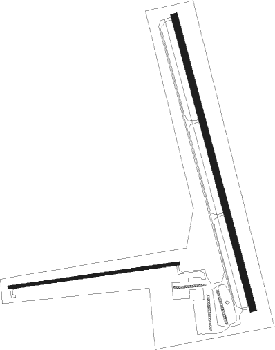
Runway info
Runway 16 / 34  | ||
| length | 2137m (7011ft) | |
| bearing | 165° / 345° | |
| width | 46m (151ft) | |
| surface | asphalt | |
| Runway 8 / 26 | ||
| length | 1207m (3960ft) | |
| bearing | 87° / 267° | |
| width | 23m (75ft) | |
| surface | asphalt | |
Nearby beacons
| code | identifier | dist | bearing | frequency |
|---|---|---|---|---|
| GEY | GREYBULL NDB | 0.3 | 179° | 275 |
| HCY | COWLEY NDB | 28.3 | 318° | 257 |
| RLY | WORLAND VOR/DME | 33.7 | 167° | 114.80 |
| POY | POWELL NDB | 36.6 | 296° | 344 |
| COD | CODY VOR/DME | 38.2 | 277° | 111.80 |
Departure and arrival routes
| Transition altitude | 18000ft |
| Transition level | 18000ft |
| SID end points | distance | outbound heading | |
|---|---|---|---|
| RW08 | |||
| PECKK2 | 15mi | 266° | |
| RW16 | |||
| PECKK2 | 15mi | 266° | |
| RW26 | |||
| PECKK2 | 15mi | 266° | |
| RW34 | |||
| PECKK2 | 15mi | 266° | |
Instrument approach procedures
| runway | airway (heading) | route (dist, bearing) |
|---|---|---|
| RW08 | COD (97°) | COD DIVLE (18mi, 104°) 8800ft PECKK (6mi, 104°) 7200ft |
| RW08 | CRANY (52°) | CRANY PECKK (14mi, 352°) 7200ft |
| RW08 | PECKK (86°) | PECKK 7200ft |
| RNAV | PECKK 7200ft LEGKI (7mi, 86°) 6300ft ZUNOB (4mi, 87°) 5000ft LUTIC (turn) 4680ft KGEY (3mi, 84°) 3982ft (6173mi, 112°) 4400ft CRANY (6190mi, 292°) 9000ft CRANY (turn) | |
| RW34 | CRANY (52°) | CRANY JIGAX (12mi, 83°) 8000ft PAYIL (5mi, 82°) 6400ft PAYIL (turn) 6400ft |
| RW34 | RLY (347°) | RLY WULAX (16mi, 348°) 6800ft PAYIL (5mi, 346°) 6400ft |
| RNAV | PAYIL 6400ft HUGAX (6mi, 346°) 5900ft KGEY (7mi, 343°) 3966ft (6173mi, 112°) 4400ft CRANY (6190mi, 292°) 9000ft CRANY (turn) |
Disclaimer
The information on this website is not for real aviation. Use this data with the X-Plane flight simulator only! Data taken with kind consent from X-Plane 12 source code and data files. Content is subject to change without notice.