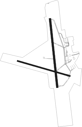
Glens Falls - Floyd Bennett Mem
Airport details
| Country | United States of America |
| State | New York |
| Region | K6 |
| Airspace | Boston Ctr |
| Municipality | Town of Queensbury |
| Elevation | 328ft (100m) |
| Timezone | GMT -5 |
| Coordinates | 43.34122, -73.61031 |
| Magnetic var | |
| Type | land |
| Available since | X-Plane v10.40 |
| ICAO code | KGFL |
| IATA code | GFL |
| FAA code | GFL |
Communication
| Floyd Bennett Mem ASOS | 119.250 |
| Floyd Bennett Mem CTAF/UNICOM | 123.000 |
Approach frequencies
| ILS-cat-I | RW01 | 110.7 | 18.00mi |
| 3° GS | RW01 | 110.7 | 18.00mi |
Nearby Points of Interest:
Glens Falls Home for Aged Women
-James L. Dix House
-Stephen T. Birdsall House
-F. W. Wait House
-Society of Friends Hall
-Dr. Charles A. Foster House
-Glens Falls Feeder Canal
-18th Separate Company Armory
-Hiram Krum House
-Russell M. Little House
-Thomas Burnham House
-William McEchron House
-Addison B. Colvin House
-Enoch Rosekrans House
-Peyser and Morrison Shirt Company Building
-W. T. Cowles House
-Joubert and White Building
-St. Mary's – St. Alphonsus Regional Catholic School
-George H. Parks House
-Zopher Delong House
-Jones Ordway House
-First Presbyterian Church
-Hoopes House
-John E. Parry House
-A. S. Rugge House

Nearby beacons
| code | identifier | dist | bearing | frequency |
|---|---|---|---|---|
| GF | GANSE (GLENS FALLS) NDB | 5.1 | 177° | 209 |
| CAM | CAMBRIDGE VOR/DME | 23.8 | 142° | 115 |
| RUT | DME | 30.8 | 74° | 111 |
| HEU | HUNTER (SCHENECTADY) NDB | 32.5 | 214° | 356 |
| AL | HAWKY (ALBANY) NDB | 32.6 | 201° | 219 |
| DYO | SMUTO (RUTLAND) NDB | 35.9 | 61° | 221 |
| ALB | ALBANY VORTAC | 36.6 | 198° | 115.30 |
| JJH | JOHNSTOWN NDB | 37.6 | 245° | 523 |
Instrument approach procedures
| runway | airway (heading) | route (dist, bearing) |
|---|---|---|
| RW01 | EKAKE (357°) | EKAKE 3500ft |
| RNAV | EKAKE 3500ft CAGUG (6mi, 358°) 2200ft KGFL (6mi, 357°) 375ft (4694mi, 120°) 900ft EKAKE (4691mi, 300°) 3500ft EKAKE (turn) | |
| RW12 | MALLO (79°) | MALLO HELOS (20mi, 57°) 4500ft HILAB (9mi, 80°) 4300ft |
| RNAV | HILAB 4300ft WISPI (8mi, 101°) 3300ft SIBIE (3mi, 105°) 2200ft KGFL (5mi, 104°) 373ft (4694mi, 120°) 728ft WAREN (4707mi, 300°) 4000ft WAREN (turn) | |
| RW19 | FIKAT (159°) | FIKAT 4600ft ZOMSI (6mi, 158°) 2900ft |
| RW19 | GOCER (137°) | GOCER 5500ft FIKAT (5mi, 78°) 4600ft ZOMSI (6mi, 158°) 2900ft |
| RW19 | HIRUS (185°) | HIRUS 6000ft FIKAT (5mi, 258°) 4600ft ZOMSI (6mi, 158°) 2900ft |
| RNAV | ZOMSI 2900ft CIMOT (2mi, 158°) 2700ft DECAC (3mi, 158°) 1720ft JENAB (3mi, 158°) 548ft ISKUQ (2mi, 158°) EKAKE (11mi, 182°) 3000ft EKAKE (turn) | |
| RW30 | DORIS (304°) | DORIS KOSPE (17mi, 335°) 6000ft CATIR (7mi, 280°) 4200ft |
| RNAV | CATIR 4200ft ERUPE (6mi, 285°) 2300ft CENOX (5mi, 285°) 624ft (4693mi, 120°) 728ft WAREN (4707mi, 300°) 4000ft WAREN (turn) |
Disclaimer
The information on this website is not for real aviation. Use this data with the X-Plane flight simulator only! Data taken with kind consent from X-Plane 12 source code and data files. Content is subject to change without notice.