Greenfield - Greenfield Muni
Airport details
| Country | United States of America |
| State | Iowa |
| Region | K3 |
| Airspace | Minneapolis Ctr |
| Municipality | Adair County |
| Elevation | 1359ft (414m) |
| Timezone | GMT -6 |
| Coordinates | 41.32722, -94.44517 |
| Magnetic var | |
| Type | land |
| Available since | X-Plane v10.40 |
| ICAO code | KGFZ |
| IATA code | n/a |
| FAA code | GFZ |
Communication
| Greenfield Muni CTAF | 122.900 |
| Greenfield Muni MINNEAPOLIS CNTR | 125.650 |
Nearby Points of Interest:
hotel greenfield
-Warren Opera House Block and Hetherington Block
-Adair County Courthouse
-Catalpa
-Chicago, Rock Island and Pacific Railroad: Stuart Passenger Station
-Masonic Temple Building
-Dexter Community House
-Earlham Public School
-North River Stone Schoolhouse
-W.J. and Nettie J. Cornell House
-Henry C. Wallace House
-Guiberson House
-Miller Richard and Mary Fisher Tidrick House
-Madison County Courthouse
-C.D. Bevington House and Stone Barn
-C.D. and Eliza Heath Bevington Privy
-White, Munger and Company Store
-Emily Hornback House
-William R. and Martha Foster Shriver House
-Adams County Jail
-Corning Commercial Historic District
-John D. Bush House
-Job A. and Rebecca E. McWaid House
-Dallas County Courthouse
-Hotel Whitney
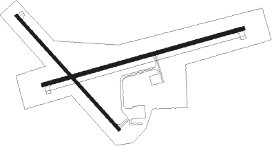
Runway info
Runway 7 / 25  | ||
| length | 1036m (3399ft) | |
| bearing | 82° / 262° | |
| width | 18m (60ft) | |
| surface | concrete | |
| Runway 14 / 32 | ||
| length | 762m (2500ft) | |
| bearing | 134° / 314° | |
| width | 15m (50ft) | |
| surface | concrete | |
Nearby beacons
| code | identifier | dist | bearing | frequency |
|---|---|---|---|---|
| DSM | DES MOINES VORTAC | 36.5 | 82° | 117.50 |
| EFW | JEFFERSON NDB | 41.4 | 8° | 391 |
| LMN | LAMONI VOR/DME | 48.9 | 147° | 116.70 |
Instrument approach procedures
| runway | airway (heading) | route (dist, bearing) |
|---|---|---|
| RW07 | BRIDJ (260°) | BRIDJ IVUJO (21mi, 261°) 3000ft IVUJO (turn) 3000ft |
| RW07 | CETUB (33°) | CETUB WUGRA (21mi, 15°) 3000ft IVUJO (6mi, 345°) 3000ft |
| RW07 | LYMAN (84°) | LYMAN IVUJO (6mi, 90°) 3000ft |
| RNAV | IVUJO 3000ft JIDAP (6mi, 82°) 3000ft RURCE (2mi, 82°) 2340ft KGFZ (3mi, 82°) 1399ft (5606mi, 114°) 1665ft ZOLNI (5594mi, 294°) 3000ft ZOLNI (turn) | |
| RW25 | LINDE (210°) | LINDE HOSGU (12mi, 169°) 3000ft ZOLNI (6mi, 166°) 3000ft |
| RW25 | WIVEY (278°) | WIVEY JITED (20mi, 275°) 3000ft ZOLNI (6mi, 346°) 3000ft |
| RW25 | ZOLNI (262°) | ZOLNI 3000ft |
| RNAV | ZOLNI 3000ft FIBGU (6mi, 262°) 3000ft CEXUV (2mi, 262°) 2340ft KGFZ (3mi, 262°) 1404ft (5606mi, 114°) 1666ft IVUJO (5617mi, 294°) 3000ft IVUJO (turn) |
Disclaimer
The information on this website is not for real aviation. Use this data with the X-Plane flight simulator only! Data taken with kind consent from X-Plane 12 source code and data files. Content is subject to change without notice.