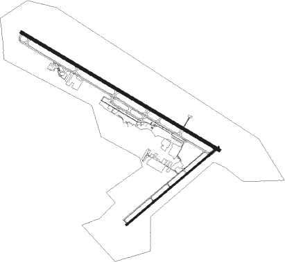
Grand Junction - Grand Junction Regl
Airport details
| Country | United States of America |
| State | Colorado |
| Region | K2 |
| Airspace | Denver Ctr |
| Municipality | Grand Junction |
| Elevation | 4860ft (1481m) |
| Timezone | GMT -7 |
| Coordinates | 39.12204, -108.52410 |
| Magnetic var | |
| Type | land |
| Available since | X-Plane v10.40 |
| ICAO code | KGJT |
| IATA code | GJT |
| FAA code | GJT |
Communication
| Grand Junction Regl ATIS | 118.550 |
| Grand Junction Regl CTAF | 118.100 |
| Grand Junction Regl UNICOM | 122.950 |
| Grand Junction Regl Grand Junction Ground | 121.700 |
| Grand Junction Regl Grand Junction Tower | 118.100 |
| Grand Junction Regl Denver Arrivial | 119.700 |
| Grand Junction Regl Denver Departure | 119.700 |
Approach frequencies
| LDA | RW29 | 109.7 | 18.00mi |
| ILS-cat-I | RW11 | 110.3 | 18.00mi |
| 3° GS | RW11 | 110.3 | 18.00mi |
Nearby Points of Interest:
Cross Orchards Historic Site
-North Seventh Street Historic Residential District
-Handy Chapel
-Clifton Community Center and Church
-Denver and Rio Grande Western Railroad Depot
-Devils Kitchen Picnic Shelter
-Serpents Trail
-Bookcliff Shelter
-Fruita Museum
-Saddlehorn Comfort Station
-Saddlehorn Caretaker's House and Garage
-Saddlehorn Visitor Center
-Colorado National Monument Visitor Center Complex
-Rim Rock Drive
-Saddlehorn Utility Area Historic District
-IOOF Hall
-Delta County Bank Building
-First Methodist Episcopal Church of Delta
-First Presbyterian Church of Eckert
Nearby beacons
| code | identifier | dist | bearing | frequency |
|---|---|---|---|---|
| JNC | GRAND JUNCTION VOR/DME | 13 | 257° | 112.40 |
| RIL | RIFLE VOR/DME | 44.6 | 63° | 110.60 |
| MTJ | MONTROSE VOR/DME | 47.1 | 135° | 117.10 |
| EKR | MEEKER VOR/DME | 63.1 | 32° | 115.20 |
Departure and arrival routes
| Transition altitude | 18000ft |
| Transition level | 18000ft |
| SID end points | distance | outbound heading | |
|---|---|---|---|
| RW11 | |||
| JNC7 | 18mi | 58° | |
| MONMT2, NOKXI1 | 13mi | 257° | |
| RW29 | |||
| JNC7 | 18mi | 58° | |
| MONMT2 | 13mi | 257° | |
| RHONE2 | 27mi | 321° | |
Instrument approach procedures
| runway | airway (heading) | route (dist, bearing) |
|---|---|---|
| RW11-Y | JNC (77°) | JNC AVUXE (7mi, 1°) 9800ft CARKU (5mi, 42°) 8200ft |
| RW11-Y | MACKS (119°) | MACKS LOMMA (8mi, 119°) 9000ft CARKU (5mi, 119°) 8200ft |
| RW11-Y | PACES (260°) | PACES HASKI (20mi, 290°) 10300ft CARKU (5mi, 222°) 8200ft |
| RNAV | CARKU 8200ft ENIDE (6mi, 119°) 6300ft WOPGU (3mi, 119°) 5400ft KGJT (3mi, 120°) 4873ft (6262mi, 110°) 5033ft JETRY (6257mi, 290°) 6700ft AYEDY (8mi, 233°) JNC (14mi, 289°) LOMMA (13mi, 355°) 9000ft LOMMA (turn) | |
| RW11-Z | MACKS (119°) | MACKS LOMMA (8mi, 119°) 8900ft CARKU (5mi, 119°) 8200ft VUXOH (5mi, 119°) 6700ft |
| RW11-Z | PACES (260°) | PACES NATLL (11mi, 289°) 9900ft CULIP (4mi, 289°) 9300ft FEKVA (2mi, 272°) 8600ft WURNI (3mi, 231°) 7800ft VUXOH (3mi, 156°) 6700ft |
| RW11-Z | SINSY (28°) | SINSY HONTU (11mi, 356°) 11000ft IWUGO (4mi, 355°) 9900ft TADUY (4mi, 352°) 8900ft YOVCU (3mi, 355°) 8200ft VUXOH (5mi, 66°) 6700ft |
| RW11-Z | SPADA (343°) | SPADA OLILE (19mi, 314°) 8800ft HEBUT (2mi, 314°) 8500ft YOVCU (2mi, 333°) 8200ft VUXOH (5mi, 66°) 6700ft |
| RNAV | VUXOH 6700ft KAREC (2mi, 119°) 6000ft KGJT (5mi, 120°) 4873ft JETRY (8mi, 118°) 6700ft PAKPE (3mi, 119°) WULKU (9mi, 220°) JNC (19mi, 296°) 9000ft JNC (turn) | |
| RW29 | JNC (77°) | JNC CESBA (21mi, 108°) 9900ft HANSU (5mi, 47°) 8500ft |
| RNAV | HANSU 8500ft TELSE (2mi, 303°) 7800ft EKIRE (3mi, 303°) 6900ft BIBPA (5mi, 303°) 5075ft (6261mi, 110°) 5258ft LOMMA (6273mi, 290°) 10000ft LOMMA (turn) |
Disclaimer
The information on this website is not for real aviation. Use this data with the X-Plane flight simulator only! Data taken with kind consent from X-Plane 12 source code and data files. Content is subject to change without notice.

