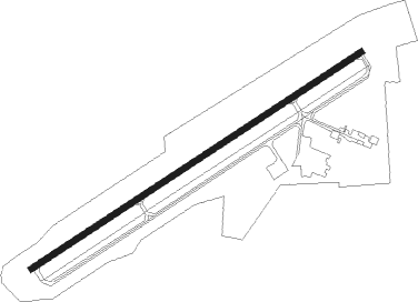
Meadville - Port Meadville
Airport details
| Country | United States of America |
| State | Pennsylvania |
| Region | K6 |
| Airspace | Cleveland Ctr |
| Municipality | Vernon Township |
| Elevation | 1397ft (426m) |
| Timezone | GMT -5 |
| Coordinates | 41.62653, -80.21472 |
| Magnetic var | |
| Type | land |
| Available since | X-Plane v10.40 |
| ICAO code | KGKJ |
| IATA code | MEJ |
| FAA code | GKJ |
Communication
| Port Meadville ASOS | 121.425 |
| Port Meadville CTAF/UNICOM | 123.000 |
| Port Meadville YOUNGSTOWN Approach/Departure | 133.950 |
Approach frequencies
| LOC | RW25 | 108.5 | 18.00mi |
Nearby beacons
| code | identifier | dist | bearing | frequency |
|---|---|---|---|---|
| FKL | FRANKLIN VOR | 19.6 | 118° | 109.60 |
| ERI | ERIE VORTAC | 23.7 | 349° | 109.40 |
| JFN | JEFFERSON VOR/DME | 25.2 | 284° | 115.20 |
| YNG | YOUNGSTOWN VORTAC | 27.2 | 237° | 109 |
| YN | FETCH (YOUNGSTOWN/WARREN) NDB | 30.8 | 222° | 338 |
| TDT | DME | 36.1 | 84° | 117.60 |
| UCP | CASTLE (NEW CASTLE) NDB | 37.3 | 198° | 272 |
| CXR | CHARDON VOR/DME | 43.1 | 263° | 112.70 |
| CIP | DME | 44.6 | 122° | 112.90 |
| EWC | ELLWOOD CITY VOR/DME | 48.1 | 180° | 115.80 |
| ACO | AKRON VOR/DME | 54.2 | 242° | 114.40 |
| DKK | DME | 66.7 | 47° | 116.20 |
Instrument approach procedures
| runway | airway (heading) | route (dist, bearing) |
|---|---|---|
| RW07 | DUCAT (68°) | DUCAT 3000ft |
| RW07 | FKL (298°) | FKL BIBYA (25mi, 258°) 3500ft DUCAT (12mi, 324°) 3000ft |
| RW07 | JIGIP (91°) | JIGIP DUCAT (9mi, 144°) 3000ft |
| RNAV | DUCAT 3000ft CASSA (10mi, 67°) 3000ft KGKJ (5mi, 68°) 1450ft (4967mi, 117°) 1900ft DUCAT (4979mi, 297°) 3100ft DUCAT (turn) | |
| RW25 | ALLCO (230°) | ALLCO CELER (6mi, 92°) 3500ft CELER (turn) 3500ft |
| RW25 | FKL (298°) | FKL CELER (18mi, 342°) 3500ft CELER (turn) 3500ft |
| RNAV | CELER 3500ft SASOC (7mi, 248°) 3300ft KGKJ (6mi, 248°) 1438ft (4967mi, 117°) 1799ft DUCAT (4979mi, 297°) 3000ft DUCAT (turn) |
Disclaimer
The information on this website is not for real aviation. Use this data with the X-Plane flight simulator only! Data taken with kind consent from X-Plane 12 source code and data files. Content is subject to change without notice.
