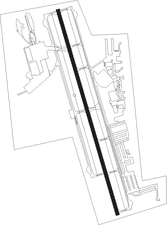
Arlington - Arlington Muni
Airport details
| Country | United States of America |
| State | Texas |
| Region | K4 |
| Airspace | Ft Worth Ctr |
| Municipality | Arlington |
| Elevation | 625ft (190m) |
| Timezone | GMT -6 |
| Coordinates | 32.66386, -97.09428 |
| Magnetic var | |
| Type | land |
| Available since | X-Plane v10.30 |
| ICAO code | KGKY |
| IATA code | GKY |
| FAA code | GKY |
Communication
| Arlington Muni ASOS | 127.375 |
| Arlington Muni CTAF/UNICOM | 123.075 |
| Arlington Muni RGNL Clearance DEL | 118.850 |
| Arlington Muni Ground | 121.875 |
| Arlington Muni Tower | 128.625 |
| Arlington Muni RGNL Approach/Departure | 135.975 |
Approach frequencies
| ILS-cat-I | RW34 | 111.55 | 18.00mi |
| 3° GS | RW34 | 111.55 | 18.00mi |
Nearby Points of Interest:
Marrow Bone Spring Archeological Site
-Ruth Paine Home
-Our Mother of Mercy Catholic Church and Parsonage
-U.S. Post Office
-Gulf, Colorado and Santa Fe Railroad Passenger Station
-South Side Masonic Lodge No. 1114
-M. A. Benton House
-Flatiron Building
-Bryce Building
-W. T. Waggoner Building
-Butler Place Historic District
-Cotton Belt Railroad Industrial Historic District
-William J. Bryce House
-Stephen F. Austin Elementary School
-Leuda-May Historic District
-Elizabeth Boulevard Historic District
-Grand Avenue Historic District
-Ridglea Theatre
-Burk Burnett Building
-Eighth Avenue Historic District
-Central Handley Historic District
-Thomas Shiels House
-American Airways Hangar and Administration Building
-Fort Worth Public Market
-Markeen Apartments
Nearby beacons
| code | identifier | dist | bearing | frequency |
|---|---|---|---|---|
| TTT | MAVERICK VOR/DME | 12.6 | 15° | 113.10 |
| FUZ | RANGER (DALLAS-FORT WORTH VORTAC | 14.2 | 339° | 115.70 |
| CVE | COWBOY (DALLAS) VOR/DME | 16.6 | 40° | 116.20 |
| NFW | NAS JRB FORT WORTH (FT WO TACAN | 18.5 | 287° | 108.70 |
| FT | MUFIN (FORT WORTH) NDB | 19.6 | 309° | 365 |
| PQF | MESQUITE NDB | 29.8 | 76° | 248 |
| DT | PINCK (DENTON) NDB | 37.5 | 351° | 257 |
| MQP | MILLSAP (MINERAL WELLS) VORTAC | 45.8 | 274° | 117.70 |
| CGQ | POWELL (CORSICANA) NDB | 49.4 | 132° | 344 |
| JEN | GLEN ROSE TACAN | 49.9 | 237° | 115 |
| CRS | CORSICANA NDB | 52.1 | 132° | 396 |
| CQY | CEDAR CREEK VORTAC | 52.8 | 119° | 114.80 |
| UKW | BOWIE VORTAC | 63.8 | 320° | 117.15 |
| BYP | BONHAM VORTAC | 68 | 45° | 114.60 |
Departure and arrival routes
| Transition altitude | 18000ft |
| Transition level | 18000ft |
| SID end points | distance | outbound heading | |
|---|---|---|---|
| ALL | |||
| TEX1 | 103mi | 3° | |
| DALL8 | 160mi | 74° | |
| KUSSO8 | 185mi | 97° | |
| GARL1 | 88mi | 100° | |
| JPOOL3 | 68mi | 179° | |
| SWABR8 | 113mi | 267° | |
| STAR starting points | distance | inbound heading | |
|---|---|---|---|
| ALL | |||
| SWVAY4 | 30.4 | 46° | |
| WESAT2, MOTZA1 | 48.4 | 133° | |
| SASIE6, TRUUK2 | 53.4 | 212° | |
| DODJE6, REEKO3 | 34.5 | 307° | |
Instrument approach procedures
| runway | airway (heading) | route (dist, bearing) |
|---|---|---|
| RW34 | WIKEB (346°) | WIKEB ESIKE (5mi, 346°) 2300ft |
| RW34 | YISSU (310°) | YISSU WIKEB (10mi, 260°) 2400ft ESIKE (5mi, 346°) 2300ft |
| RW34 | ZEXON (25°) | ZEXON WIKEB (10mi, 80°) 2400ft ESIKE (5mi, 346°) 2300ft |
| RNAV | ESIKE 2300ft MYKES (6mi, 346°) 2000ft KGKY (5mi, 346°) 657ft (5764mi, 109°) 1100ft JEGIN (5770mi, 288°) 2800ft JEGIN (turn) |
Holding patterns
| STAR name | hold at | type | turn | heading* | altitude | leg | speed limit |
|---|---|---|---|---|---|---|---|
| DODJE6 | CAPTI | VHF | left | 73 (253)° | 1.0min timed | ICAO rules | |
| DODJE6 | CQY | NDB | left | 95 (275)° | < 60000ft | 1.0min timed | ICAO rules |
| DODJE6 | GGG | NDB | right | 114 (294)° | < 17999ft | 1.0min timed | ICAO rules |
| DODJE6 | HERRI | VHF | left | 101 (281)° | 1.0min timed | ICAO rules | |
| DODJE6 | WEIRS | VHF | left | 128 (308)° | < 17999ft | 1.0min timed | ICAO rules |
| MOTZA1 | ACKME | VHF | right | 15 (195)° | 1.0min timed | ICAO rules | |
| MOTZA1 | HEATR | VHF | left | 299 (119)° | 1.5min timed | ICAO rules | |
| MOTZA1 | KAJAY | VHF | right | 283 (103)° | 1.5min timed | ICAO rules | |
| MOTZA1 | MOOSE | VHF | left | 15 (195)° | 1.0min timed | ICAO rules | |
| MOTZA1 | PLEBS | VHF | left | 283 (103)° | 1.0min timed | ICAO rules | |
| MOTZA1 | SPS | NDB | left | 348 (168)° | 1.0min timed | ICAO rules | |
| MOTZA1 | TURKI | VHF | right | 266 (86)° | 1.5min timed | ICAO rules | |
| MOTZA1 | UKW | NDB | left | 283 (103)° | 1.0min timed | ICAO rules | |
| MOTZA1 | ZANTO | VHF | left | 283 (103)° | 1.5min timed | ICAO rules | |
| REEKO3 | PURRS | VHF | left | 136 (316)° | DME 10.0mi | ICAO rules | |
| REEKO3 | VDUBB | VHF | left | 83 (263)° | DME 10.0mi | ICAO rules | |
| SASIE6 | BIRLE | VHF | right | 35 (215)° | 1.5min timed | ICAO rules | |
| SASIE6 | BYP | NDB | right | 45 (225)° | < 60000ft | 1.0min timed | ICAO rules |
| SASIE6 | GAATZ | VHF | right | 35 (215)° | 1.0min timed | ICAO rules | |
| SASIE6 | GLOVE | VHF | right | 64 (244)° | 18000ft - 45000ft | 1.5min timed | ICAO rules |
| SASIE6 | ROBEY | VHF | left | 64 (244)° | 1.0min timed | ICAO rules | |
| SWVAY4 | AGAIN | VHF | right | 195 (15)° | DME 10.0mi | ICAO rules | |
| SWVAY4 | FRSTI | VHF | right | 207 (27)° | DME 10.0mi | ICAO rules | |
| SWVAY4 | PUNKY | VHF | right | 259 (79)° | DME 10.0mi | ICAO rules | |
| SWVAY4 | SHLLY | VHF | right | 268 (88)° | DME 10.0mi | ICAO rules | |
| TRUUK2 | PRIZZ | VHF | left | 38 (218)° | DME 10.0mi | ICAO rules | |
| WESAT2 | FAWNT | VHF | right | 360 (180)° | DME 10.0mi | ICAO rules | |
| WESAT2 | FLOWN | VHF | left | 285 (105)° | DME 10.0mi | ICAO rules | |
| WESAT2 | GREKE | VHF | left | 287 (107)° | DME 10.0mi | ICAO rules | |
| WESAT2 | ROTTR | VHF | left | 355 (175)° | DME 10.0mi | ICAO rules | |
| WESAT2 | TURKI | VHF | right | 266 (86)° | 1.5min timed | ICAO rules | |
| *) magnetic outbound (inbound) holding course | |||||||
Disclaimer
The information on this website is not for real aviation. Use this data with the X-Plane flight simulator only! Data taken with kind consent from X-Plane 12 source code and data files. Content is subject to change without notice.