Goodland - Renner Fld
Airport details
| Country | United States of America |
| State | Kansas |
| Region | K3 |
| Airspace | Denver Ctr |
| Municipality | Goodland |
| Elevation | 3653ft (1113m) |
| Timezone | GMT -7 |
| Coordinates | 39.37064, -101.69900 |
| Magnetic var | |
| Type | land |
| Available since | X-Plane v10.40 |
| ICAO code | KGLD |
| IATA code | GLD |
| FAA code | GLD |
Communication
| Renner Fld ASOS | 121.025 |
| Renner Fld CTAF/UNICOM | 122.950 |
Approach frequencies
| ILS-cat-I | RW30 | 108.9 | 18.00mi |
| 3° GS | RW30 | 108.9 | 18.00mi |
Nearby Points of Interest:
Goodland City Library
-Mary Seaman Ennis House
-Ruleton School
-Minor Sod House
-Henry Hickert Building
-Cheyenne County Courthouse
-Howard T. Sawhill City Park
-Burlington Gymnasium
-Burlington State Armory
-Clark–Robidoux House
-Pond Creek Station
-Thomas County Courthouse
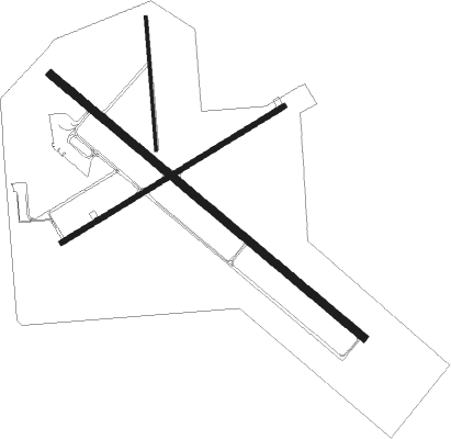
Runway info
Runway 12 / 30  | ||
| length | 1678m (5505ft) | |
| bearing | 127° / 307° | |
| width | 30m (100ft) | |
| surface | concrete | |
| Runway 5 / 23 | ||
| length | 1068m (3504ft) | |
| bearing | 68° / 248° | |
| width | 23m (75ft) | |
| surface | asphalt | |
| Runway 17 / 35 | ||
| length | 547m (1795ft) | |
| bearing | 180° / 360° | |
| width | 12m (40ft) | |
| surface | grass | |
Nearby beacons
| code | identifier | dist | bearing | frequency |
|---|---|---|---|---|
| GLD | GOODLAND VORTAC | 1 | 21° | 115.10 |
| GL | SHUGR (GOODLAND) NDB | 6.5 | 128° | 414 |
| SYF | SAINT FRANCIS NDB | 21.6 | 349° | 386 |
| ITR | KIT CARSON (BURLINGTON) NDB | 28.1 | 258° | 209 |
| JDM | WHEATFIELD (COLBY) NDB | 31.3 | 78° | 408 |
| OEL | OAKLEY NDB | 43.9 | 106° | 380 |
Instrument approach procedures
| runway | airway (heading) | route (dist, bearing) |
|---|---|---|
| RW12 | GLD (201°) | GLD DAKKA (13mi, 303°) 5600ft DAKKA (turn) 5600ft |
| RW12 | KURIQ (75°) | KURIQ FAULD (21mi, 38°) 5700ft DAKKA (6mi, 87°) 5600ft |
| RW12 | MCJEF (157°) | MCJEF DAKKA (34mi, 170°) 5600ft |
| RNAV | DAKKA 5600ft TETOY (8mi, 127°) 5300ft JEMOX (3mi, 127°) 4320ft KGLD (2mi, 127°) 3686ft (5947mi, 111°) 3897ft FEGIT (5938mi, 291°) 5700ft FEGIT (turn) | |
| RW23 | DEPAY (272°) | DEPAY HEGOR (8mi, 319°) 5600ft |
| RW23 | GLD (201°) | GLD HEGOR (12mi, 72°) 5600ft HEGOR (turn) 5600ft |
| RW23 | MCJEF (157°) | MCJEF GEREY (39mi, 136°) 5600ft HEGOR (7mi, 147°) 5600ft |
| RNAV | HEGOR 5600ft PUMKE (8mi, 249°) 5300ft KGLD (5mi, 248°) 3676ft (5947mi, 111°) 4056ft HEGOR (5934mi, 291°) 5600ft HEGOR (turn) | |
| RW30 | GLD (201°) | GLD FEGIT (14mi, 131°) 5700ft FEGIT (turn) 5700ft |
| RW30 | ORION (288°) | ORION FEGIT (37mi, 282°) 5700ft |
| RW30 | WILVA (325°) | WILVA FEGIT (26mi, 335°) 5700ft |
| RNAV | FEGIT 5700ft GENEC (7mi, 307°) 5700ft OLGOE (4mi, 307°) 4280ft KGLD (2mi, 308°) 3708ft (5947mi, 111°) 3903ft DAKKA (5955mi, 291°) 5600ft DAKKA (turn) |
Disclaimer
The information on this website is not for real aviation. Use this data with the X-Plane flight simulator only! Data taken with kind consent from X-Plane 12 source code and data files. Content is subject to change without notice.