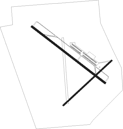
Grenada - Grenada Muni
Airport details
| Country | United States of America |
| State | Mississippi |
| Region | K7 |
| Airspace | Memphis Ctr |
| Municipality | Grenada |
| Elevation | 208ft (63m) |
| Timezone | GMT -6 |
| Coordinates | 33.83244, -89.79816 |
| Magnetic var | |
| Type | land |
| Available since | X-Plane v10.40 |
| ICAO code | KGNF |
| IATA code | n/a |
| FAA code | GNF |
Communication
| Grenada Muni AWOS 3 | 118.025 |
| Grenada Muni CTAF/UNICOM | 122.800 |
Nearby Points of Interest:
Grenada Masonic Temple
-Odd Fellows and Confederate Cemetery
-Cotesworth
-Immanuel Episcopal Church
-Sand Spring Presbyterian Church
-Wesley Memorial Methodist Episcopal
-Southworth House
-Tallahatchie County Courthouse
-Lee House
Nearby beacons
| code | identifier | dist | bearing | frequency |
|---|---|---|---|---|
| GW | TEOCK NDB | 20.3 | 230° | 349 |
| SQS | SIDON VORTAC | 32.6 | 232° | 114.70 |
| UV | TUNNG (OXFORD) NDB | 34.2 | 17° | 426 |
| HLI | HOLLY SPRINGS VORTAC | 58.2 | 18° | 112.40 |
| UJM | MARVELL (HELENA) VOR/DME | 62.3 | 310° | 109.60 |
Instrument approach procedures
| runway | airway (heading) | route (dist, bearing) |
|---|---|---|
| RW04 | YIDGE (56°) | YIDGE 6000ft YIDGE (turn) 3000ft |
| RNAV | YIDGE 3000ft AZMAY (6mi, 57°) 1900ft OWHIN (3mi, 57°) 1020ft KGNF (3mi, 52°) 243ft (5395mi, 111°) 608ft EPGAF (5386mi, 291°) 3000ft EPGAF (turn) | |
| RW13 | WUKNA (127°) | WUKNA 6000ft WUKNA (turn) 3000ft |
| RNAV | WUKNA 3000ft ODNOW (6mi, 127°) 1900ft CUVID (3mi, 127°) 1040ft KGNF (3mi, 128°) 263ft (5395mi, 111°) 453ft ODPOF (5384mi, 291°) 3000ft ODPOF (turn) | |
| RW22 | EPGAF (238°) | EPGAF 6000ft EPGAF (turn) 3000ft |
| RNAV | EPGAF 3000ft RELOF (6mi, 237°) 1900ft KGNF (6mi, 239°) 251ft (5395mi, 111°) 608ft YIDGE (5404mi, 291°) 3000ft YIDGE (turn) | |
| RW31 | ODPOF (307°) | ODPOF 6000ft ODPOF (turn) 3000ft |
| RNAV | ODPOF 3000ft PAKMY (10mi, 307°) 2000ft HUPIR (3mi, 307°) 1080ft KGNF (3mi, 306°) 257ft (5395mi, 111°) 513ft WUKNA (5404mi, 291°) 3000ft WUKNA (turn) |
Disclaimer
The information on this website is not for real aviation. Use this data with the X-Plane flight simulator only! Data taken with kind consent from X-Plane 12 source code and data files. Content is subject to change without notice.

