Gainesville - Gainesville Rgnl
Airport details
| Country | United States of America |
| State | Florida |
| Region | K7 |
| Airspace | Jacksonville Ctr |
| Municipality | Gainesville |
| Elevation | 149ft (45m) |
| Timezone | GMT -5 |
| Coordinates | 29.69006, -82.27177 |
| Magnetic var | |
| Type | land |
| Available since | X-Plane v10.40 |
| ICAO code | KGNV |
| IATA code | GNV |
| FAA code | GNV |
Communication
| Gainesville Rgnl ATIS | 127.150 |
| Gainesville Rgnl CTAF | 119.550 |
| Gainesville Rgnl UNICOM | 122.950 |
| Gainesville Rgnl Ground Control | 121.700 |
| Gainesville Rgnl Tower | 119.550 |
| Gainesville Rgnl JACKSONVILLE Approach | 118.175 |
| Gainesville Rgnl JACKSONVILLE Departure | 118.175 |
Approach frequencies
| ILS-cat-I | RW29 | 111.3 | 18.00mi |
| 3° GS | RW29 | 111.3 | 18.00mi |
Nearby Points of Interest:
Lake Pithlachocco Canoe Site
-Mary Phifer McKenzie House
-Southeast Gainesville Residential District
-Maj. James B. Bailey House
-Masonic Temple
-Pleasant Street Historic District
-Cox Furniture Store
-Old Gainesville Depot
-Cox Furniture Warehouse
-Baird Hardware Company Warehouse
-Epworth Hall
-Yulee Area
-University of Florida Campus Historic District
-Boulware Springs Water Works
-Weil Hall
-Neilson House
-Rochelle School
-Liberty Hill Schoolhouse
-Waldo Historic District
-Haile Homestead
-Micanopy Historic District
-Winecoff House
-Melrose Historic District
-Evinston Community Store and Post Office
-City of Alachua Downtown Historic District
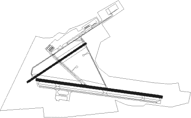
Runway info
Runway 11 / 29  | ||
| length | 2284m (7493ft) | |
| bearing | 101° / 281° | |
| width | 46m (150ft) | |
| surface | asphalt | |
| blast zone | 107m (351ft) / 0m (0ft) | |
| Runway 7 / 25 | ||
| length | 1267m (4157ft) | |
| bearing | 64° / 244° | |
| width | 30m (100ft) | |
| surface | asphalt | |
| blast zone | 131m (430ft) / 137m (449ft) | |
Nearby beacons
| code | identifier | dist | bearing | frequency |
|---|---|---|---|---|
| GNV | GATORS VORTAC | 0.1 | 330° | 116.20 |
| GN | WYNDS (GAINESVILLE) NDB | 5.3 | 101° | 269 |
| OCF | OCALA VORTAC | 30.8 | 175° | 113.70 |
| LCQ | LAKE CITY NDB | 33.7 | 328° | 204 |
| RYD | REYNOLDS (GREEN COVE SPRINGS) NDB | 36 | 66° | 338 |
| NZC | CECIL TACAN | 38 | 37° | 114.10 |
| CTY | CROSS CITY VORTAC | 40.9 | 263° | 112 |
| NIP | JACKSONVILLE TACAN | 45.1 | 48° | 108.20 |
| TAY | TAYLOR VORTAC | 51 | 341° | 112.90 |
| SGJ | SAINT AUGUSTINE VOR/DME | 51.6 | 74° | 109.40 |
| JA | DINNS (JACKSONVILLE) NDB | 52.5 | 31° | 344 |
| CRG | CRAIG (JACKSONVILLE) VORTAC | 55.5 | 50° | 114.50 |
| NRB | MAYPORT TACAN | 60.8 | 51° | 111.40 |
Instrument approach procedures
| runway | airway (heading) | route (dist, bearing) |
|---|---|---|
| RW07 | GRAMR (42°) | GRAMR 2400ft GUZNU (5mi, 328°) 2100ft |
| RW07 | GUZNU (65°) | GUZNU 2100ft |
| RW07 | OVIPY (86°) | OVIPY 2100ft GUZNU (5mi, 148°) 2100ft |
| RNAV | GUZNU 2100ft KACBA (6mi, 64°) 1700ft BOYAP (3mi, 64°) 860ft KGNV (3mi, 70°) 195ft IMCEF (11mi, 63°) 2000ft IMCEF (turn) | |
| RW11 | KOZYA (122°) | KOZYA 2100ft LOLRY (5mi, 194°) 2000ft |
| RW11 | LOLRY (100°) | LOLRY 2000ft |
| RW11 | MANZO (79°) | MANZO 2500ft LOLRY (5mi, 14°) 2000ft |
| RNAV | LOLRY 2000ft KEEZS (6mi, 101°) 1700ft KGNV (5mi, 100°) 192ft (5002mi, 110°) 460ft TUKSE (4991mi, 290°) 2000ft TUKSE (turn) | |
| RW25 | EBAPE (220°) | EBAPE 2000ft IMCEF (5mi, 148°) 2000ft |
| RW25 | IMCEF (243°) | IMCEF 2000ft |
| RW25 | ORTUJ (264°) | ORTUJ 2400ft IMCEF (5mi, 328°) 2000ft |
| RNAV | IMCEF 2000ft AZGOP (7mi, 244°) 1700ft KGNV (5mi, 241°) 172ft GUZNU (11mi, 245°) 2100ft GUZNU (turn) | |
| RW29 | BUSJY (302°) | BUSJY 2500ft TUKSE (5mi, 14°) 2000ft |
| RW29 | OBJOH (261°) | OBJOH 2100ft TUKSE (5mi, 194°) 2000ft |
| RW29 | TUKSE (281°) | TUKSE 2000ft |
| RNAV | TUKSE 2000ft JONTU (6mi, 281°) 1700ft KGNV (6mi, 281°) 155ft (5002mi, 110°) 420ft LOLRY (5013mi, 290°) 2100ft LOLRY (turn) |
Disclaimer
The information on this website is not for real aviation. Use this data with the X-Plane flight simulator only! Data taken with kind consent from X-Plane 12 source code and data files. Content is subject to change without notice.