Guthrie - Guthrie Muni
Airport details
| Country | United States of America |
| State | Oklahoma |
| Region | K4 |
| Airspace | Kansas City Ctr |
| Municipality | Guthrie |
| Elevation | 1066ft (325m) |
| Timezone | GMT -6 |
| Coordinates | 35.85152, -97.41618 |
| Magnetic var | |
| Type | land |
| Available since | X-Plane v10.40 |
| ICAO code | KGOK |
| IATA code | GOK |
| FAA code | GOK |
Communication
| GUTHRIE MUNI ASOS | 133.975 |
| GUTHRIE MUNI CTAF/UNICOM | 122.800 |
| GUTHRIE MUNI OKE CITY Approach/Departure | 124.200 |
Nearby Points of Interest:
Logan County Courthouse
-Co-operative Publishing Company Building
-Carnegie Library
-Guthrie Historic District
-Old North Tower, University of Central Oklahoma
-American Legion Hut
-Threatt Filling Station
-Donald Pollock House
-Founders Tower
-Harding Charter Preparatory High School
-Paseo Arts District
-Milk Bottle Grocery
-Gold Dome
-The Classen
-Oklahoma A & M College Agronomy Barn and Seed House
-First Church of Christ, Scientist
-Magruder Plots
-Seaba's Filling Station
-Cain's Coffee Building
-Pilgrim Congregational Church
-Josephine Reifsnyder Lustron House
-Automobile Alley
-First Christian Church
-St. Paul's Cathedral
-William Frick House
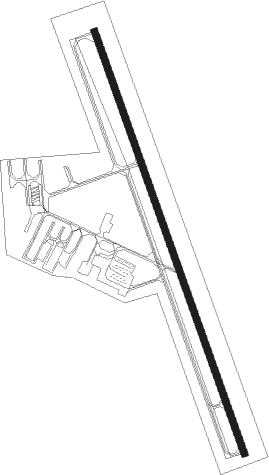
Runway info
| Runway 16 / 34 | ||
| length | 1588m (5210ft) | |
| bearing | 162° / 342° | |
| width | 23m (75ft) | |
| surface | concrete | |
| displ threshold | 0m (0ft) / 62m (203ft) | |
Nearby beacons
| code | identifier | dist | bearing | frequency |
|---|---|---|---|---|
| PWA | WILEY POST (OKLAHOMA CITY VOR/DME | 22.2 | 216° | 113.40 |
| TIK | TINKER (OKLAHOMA CITY) TACAN | 24.9 | 175° | 115.80 |
| SWO | STILLWATER VOR/DME | 27.6 | 42° | 108.40 |
| SW | BLAKI (STILLWATER) NDB | 28 | 41° | 255 |
| IFI | KINGFISHER VORTAC | 28.7 | 266° | 114.70 |
| IRW | WILL ROGERS (OKLAHOMA CIT VORTAC | 31 | 201° | 114.10 |
| EI | GARFY (ENID) NDB | 31.2 | 319° | 341 |
| RG | GALLY (OKLAHOMA CITY) NDB | 34.4 | 197° | 350 |
| ODG | WOODRING (ENID) VOR/DME | 36.1 | 325° | 109 |
| END | VANCE (ENID) VORTAC | 38.3 | 314° | 115.40 |
| SRE | SEMINOLE NDB | 50.2 | 128° | 278 |
| PER | PIONEER (PONCA CITY) VORTAC | 55.1 | 16° | 113.20 |
| PN | PONCA (PONCA CITY) NDB | 60.4 | 18° | 515 |
Departure and arrival routes
| Transition altitude | 18000ft |
| Transition level | 18000ft |
| STAR starting points | distance | inbound heading | |
|---|---|---|---|
| ALL | |||
| GULLI2 | 16.3 | 239° | |
Instrument approach procedures
| runway | airway (heading) | route (dist, bearing) |
|---|---|---|
| RW16 | AVOVE (191°) | AVOVE 3100ft MUMXU (5mi, 258°) 3100ft |
| RW16 | MUMXU (162°) | MUMXU 3100ft |
| RW16 | OYAXO (135°) | OYAXO 3800ft MUMXU (5mi, 78°) 3100ft |
| RNAV | MUMXU 3100ft UDBUW (6mi, 162°) 2700ft KGOK (5mi, 162°) 1095ft HODAM (11mi, 162°) 3100ft HODAM (turn) | |
| RW34 | HODAM (342°) | HODAM 3100ft |
| RW34 | POGUE (11°) | POGUE 3800ft HODAM (5mi, 78°) 3100ft |
| RW34 | ZAMSA (315°) | ZAMSA 3100ft HODAM (5mi, 258°) 3100ft |
| RNAV | HODAM 3100ft JPANL (6mi, 342°) 2700ft JODIN (3mi, 342°) 1760ft KGOK (3mi, 342°) 1111ft MUMXU (11mi, 342°) 3100ft MUMXU (turn) |
Holding patterns
| STAR name | hold at | type | turn | heading* | altitude | leg | speed limit |
|---|---|---|---|---|---|---|---|
| GULLI2 | GULLI | VHF | right | 23 (203)° | 1.0min timed | ICAO rules | |
| *) magnetic outbound (inbound) holding course | |||||||
Disclaimer
The information on this website is not for real aviation. Use this data with the X-Plane flight simulator only! Data taken with kind consent from X-Plane 12 source code and data files. Content is subject to change without notice.