Groton (new London) - Groton New London
Airport details
| Country | United States of America |
| State | Connecticut |
| Region | K6 |
| Airspace | Boston Ctr |
| Municipality | Groton |
| Elevation | 5ft (2m) |
| Timezone | GMT -5 |
| Coordinates | 41.33006, -72.04514 |
| Magnetic var | |
| Type | land |
| Available since | X-Plane v10.30 |
| ICAO code | KGON |
| IATA code | GON |
| FAA code | GON |
Communication
| Groton New London ATIS | 127.000 |
| Groton New London CTAF | 125.600 |
| Groton New London Clearance DEL | 119.850 |
| Groton New London Ground Control | 121.650 |
| Groton New London Tower | 125.600 |
| Groton New London PROVIDENCE Approach/Departure | 125.750 |
Approach frequencies
| ILS-cat-I | RW05 | 111.3 | 18.00mi |
| 3° GS | RW05 | 111.3 | 18.00mi |
Nearby Points of Interest:
Branford House
-Jabez Smith House
-Edward Yeomans House
-Monte Cristo Cottage
-Central Vermont Railroad Pier
-Ohev Sholem Synagogue
-United States Post Office–New London Main
-Acors Barns House
-Whale Oil Row
-Williams Memorial Institute
-Eugene O'Neill Theater Center
-Jonathan Newton Harris House
-Winthrop Mill
-Nathan A. Woodworth House
-Harkness Memorial State Park
-Pequot Fort
-Deshon-Allyn House
-House at 130 Mohegan Avenue
-Thames Shipyard
-Sabino
-The Seaside
-Perkins-Bill House
-Pequotsepos Manor
-Whitehall Mansion
-Mystic Bank
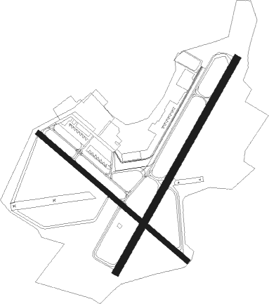
Runway info
Runway 5 / 23  | ||
| length | 1525m (5003ft) | |
| bearing | 42° / 222° | |
| width | 46m (150ft) | |
| surface | asphalt | |
| blast zone | 85m (279ft) / 119m (390ft) | |
| Runway 15 / 33 | ||
| length | 1219m (3999ft) | |
| bearing | 127° / 307° | |
| width | 30m (100ft) | |
| surface | asphalt | |
| displ threshold | 94m (308ft) / 63m (207ft) | |
Nearby beacons
| code | identifier | dist | bearing | frequency |
|---|---|---|---|---|
| GON | GROTON VOR/DME | 0.3 | 273° | 110.85 |
| ORW | NORWICH VOR/DME | 13.7 | 11° | 110 |
| SEY | SANDY POINT (BLOCK ISLAND VOR/DME | 23.3 | 109° | 117.80 |
| HTO | HAMPTON (EAST HAMPTON) VORTAC | 27.5 | 213° | 113.60 |
| MAD | MADISON VOR/DME | 29.2 | 269° | 110.40 |
| HFD | HARTFORD VOR/DME | 29.3 | 302° | 114.90 |
| PVD | PROVIDENCE VOR/DME | 36.4 | 57° | 115.60 |
| HVN | HAVEN DME | 38.1 | 265° | 109.80 |
| PUT | PUTNAM VOR/DME | 38.6 | 18° | 117.40 |
| FOK | SUFFOLK CO (WESTHAMPTON B TACAN | 39.7 | 230° | 111 |
| CCC | CALVERTON VOR/DME | 41.7 | 242° | 117.20 |
| CEF | WESTOVER(SPRINGFIELD/CHIC TACAN | 56.3 | 331° | 114 |
| BAF | BARNES (WESTFIELD/SPRINGF VORTAC | 58.3 | 321° | 113 |
| OW | STOGE (NORWOOD) NDB | 62.7 | 49° | 397 |
| CTR | CHESTER VOR/DME | 70.5 | 317° | 115.10 |
Instrument approach procedures
| runway | airway (heading) | route (dist, bearing) |
|---|---|---|
| RW05 | GON (93°) | GON MONDI (12mi, 220°) 1900ft MONDI (turn) 1900ft |
| RW05 | HTO (33°) | HTO MONDI (15mi, 26°) 1900ft |
| RW05 | MAD (89°) | MAD FLIBB (13mi, 108°) 2000ft MONDI (11mi, 108°) 1900ft |
| RNAV | MONDI 1900ft PINET (7mi, 42°) 1900ft KGON (6mi, 41°) 47ft (4601mi, 120°) 292ft BRRET (4600mi, 300°) BABET (3mi, 61°) 2000ft BABET (turn) | |
| RW23 | GON (93°) | GON JOGIL (13mi, 43°) 2100ft JOGIL (turn) 2100ft |
| RW23 | LAFAY (248°) | LAFAY JOGIL (8mi, 283°) 2100ft |
| RW23 | ORW (191°) | ORW JOGIL (6mi, 116°) 2100ft |
| RW23 | PVD (237°) | PVD JOGIL (25mi, 244°) 2100ft |
| RNAV | JOGIL 2100ft HIRKA (6mi, 222°) 2000ft BRRET (4mi, 222°) 800ft KGON (3mi, 223°) 56ft (4601mi, 120°) 409ft PINET (4604mi, 300°) 2000ft PINET (turn) | |
| RW33 | GON (93°) | GON SUFOK (14mi, 127°) 2000ft SUFOK (turn) 2000ft |
| RW33 | JORDN (335°) | JORDN SUFOK (8mi, 38°) 2000ft |
| RW33 | SEY (289°) | SEY SUFOK (11mi, 269°) 2000ft |
| RNAV | SUFOK 2000ft FISRR (8mi, 307°) 1900ft KGON (6mi, 308°) 55ft (4601mi, 120°) 409ft SUFOK (4590mi, 300°) 2000ft SUFOK (turn) |
Disclaimer
The information on this website is not for real aviation. Use this data with the X-Plane flight simulator only! Data taken with kind consent from X-Plane 12 source code and data files. Content is subject to change without notice.