Kalispell - Glacier Park Intl
Airport details
| Country | United States of America |
| State | Montana |
| Region | K1 |
| Airspace | Salt Lake City Ctr |
| Municipality | Flathead County |
| Elevation | 2977ft (907m) |
| Timezone | GMT -7 |
| Coordinates | 48.31091, -114.25175 |
| Magnetic var | |
| Type | land |
| Available since | X-Plane v10.40 |
| ICAO code | KGPI |
| IATA code | FCA |
| FAA code | GPI |
Communication
| Glacier Park Intl ATIS | 132.625 |
| Glacier Park Intl Ground Control | 121.600 |
| Glacier Park Intl Tower | 124.550 |
| Glacier Park Intl SALT LAKE CTR | 133.400 |
Approach frequencies
| ILS-cat-I | RW02 | 111.5 | 18.00mi |
| 3° GS | RW02 | 111.5 | 18.00mi |
Nearby Points of Interest:
Soldiers' Home Historic District
-Bruyer Granary
-Lockridge Medical Clinic
-A. J. Dean House
-Kalispell Main Street Historic District
-Bader-Jaquette and Westwang Houses and Rental Property
-Fisher House
-Scandinavian Methodist Church
-Courthouse Historic District
-Snyder House
-Woll House
-Headquarters Historic District
-West Entrance Station
-North Fork Road
-Huckleberry Fire Lookout
-Fish Creek Bay Boathouse
-Camas Creek Cutoff Road
-Nyack Ranger Station Historic District
-Logging Creek Ranger Station Historic District
-Kelly's Camp Historic District
-Harrison Lake Patrol Cabin
-Lake McDonald Lodge Historic District
-Lake McDonald Lodge Coffee Shop
-Burton and Lulu Wheeler Cabin
-Wheeler Camp
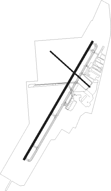
Runway info
Runway 2 / 20  | ||
| length | 2748m (9016ft) | |
| bearing | 46° / 226° | |
| width | 46m (151ft) | |
| surface | asphalt | |
| blast zone | 59m (194ft) / 58m (190ft) | |
| Runway 12 / 30 | ||
| length | 1069m (3507ft) | |
| bearing | 125° / 305° | |
| width | 23m (75ft) | |
| surface | asphalt | |
| blast zone | 31m (102ft) / 31m (102ft) | |
Nearby beacons
| code | identifier | dist | bearing | frequency |
|---|---|---|---|---|
| FCA | KALISPELL VOR/DME | 6.5 | 142° | 113.20 |
| SAK | SMITH LAKE (KALISPELL) NDB | 14.7 | 226° | 515 |
Departure and arrival routes
| Transition altitude | 18000ft |
| Transition level | 18000ft |
| SID end points | distance | outbound heading | |
|---|---|---|---|
| RW02 | |||
| SKOTT2 | 36mi | 169° | |
| KILLY1 | 21mi | 249° | |
| RW12 | |||
| SKOTT2 | 36mi | 169° | |
| RW20 | |||
| GPI1, SKOTT2 | 36mi | 169° | |
| KILLY1 | 21mi | 249° | |
| RW30 | |||
| SKOTT2 | 36mi | 169° | |
Instrument approach procedures
| runway | airway (heading) | route (dist, bearing) |
|---|---|---|
| RW02-Y | ANGIL (345°) | ANGIL ZURLU (4mi, 213°) 9000ft TIYUT (12mi, 257°) 8000ft JUNRU (11mi, 338°) 8000ft |
| RW02-Y | FIKAB (55°) | FIKAB PETIY (18mi, 65°) 9000ft JUNRU (4mi, 54°) 8000ft |
| RW02-Y | OLIBY (73°) | OLIBY NOBTE (15mi, 103°) 9000ft PETIY (7mi, 85°) 8000ft JUNRU (4mi, 54°) 8000ft |
| RW02-Y | SKOTT (349°) | SKOTT TIYUT (15mi, 291°) 8000ft JUNRU (11mi, 338°) 8000ft |
| RNAV | JUNRU 8000ft WULEX (3mi, 41°) 7200ft AVDIH (3mi, 46°) 6200ft BINGQ (7mi, 46°) 5200ft KGPI (8mi, 47°) 3013ft JOGAD (4mi, 1°) ROYOG (8mi, 296°) TONUY (12mi, 213°) WILTO (12mi, 125°) ANGIL (11mi, 133°) 10000ft ANGIL (turn) | |
| RW02-Z | GOGGS (46°) | GOGGS 9000ft |
| RW02-Z | OLIBY (73°) | OLIBY GOGGS (23mi, 93°) 9000ft |
| RNAV | GOGGS 9000ft AVDIH (7mi, 46°) 7300ft JALPA (5mi, 46°) 5800ft KALGE (6mi, 46°) 3840ft KGPI (4mi, 48°) 3013ft (6357mi, 113°) 4200ft GOGGS (6375mi, 293°) 9000ft GOGGS (turn) | |
| RW20 | ANGIL (345°) | ANGIL HUNUR (4mi, 232°) 10000ft BUTSE (14mi, 278°) 9000ft KILLY (12mi, 3°) 9000ft QIGVO (10mi, 31°) 7600ft |
| RW20 | FIKAB (55°) | FIKAB KILLY (26mi, 51°) 9000ft QIGVO (10mi, 31°) 7600ft |
| RW20 | OLIBY (73°) | OLIBY KILLY (24mi, 80°) 9000ft QIGVO (10mi, 31°) 7600ft |
| RW20 | SKOTT (349°) | SKOTT AKABY (10mi, 289°) 9000ft BUTSE (13mi, 308°) 9000ft KILLY (12mi, 3°) 9000ft QIGVO (10mi, 31°) 7600ft |
| RNAV | QIGVO 7600ft RAPOY (6mi, 31°) 6900ft LELKE (6mi, 68°) 6000ft IDAYE (2mi, 102°) 5700ft OYIKA (turn) TAGUY (4mi, 161°) KGPI (4mi, 225°) 3021ft CAUGH (5mi, 227°) DOTRE (4mi, 204°) DEBRE (4mi, 152°) ANGIL (11mi, 131°) 10000ft ANGIL (turn) | |
| RW30 | ANGIL (345°) | ANGIL ONOCO (3mi, 6°) 7200ft UVIFY (5mi, 6°) 6600ft EHTUJ (5mi, 66°) 5800ft |
| RNAV | EHTUJ 5800ft IQGOJ (6mi, 315°) 5400ft KGPI (7mi, 304°) 3016ft CEPUN (10mi, 305°) KILLY (18mi, 205°) 12000ft KILLY (turn) |
Disclaimer
The information on this website is not for real aviation. Use this data with the X-Plane flight simulator only! Data taken with kind consent from X-Plane 12 source code and data files. Content is subject to change without notice.