Gulfport - Gulfport Biloxi Intl
Airport details
| Country | United States of America |
| State | Mississippi |
| Region | K7 |
| Airspace | Houston Oceanic Ctr |
| Municipality | Gulfport |
| Elevation | 24ft (7m) |
| Timezone | GMT -6 |
| Coordinates | 30.40728, -89.07008 |
| Magnetic var | |
| Type | land |
| Available since | X-Plane v10.40 |
| ICAO code | KGPT |
| IATA code | GPT |
| FAA code | GPT |
Communication
| Gulfport Biloxi Intl ATIS | 119.450 |
| Gulfport Biloxi Intl CTAF | 123.700 |
| Gulfport Biloxi Intl UNICOM | 122.950 |
| Gulfport Biloxi Intl Ground Control | 120.400 |
| Gulfport Biloxi Intl Tower | 123.700 |
| Gulfport Biloxi Intl Approach/Departure | 127.500 |
| Gulfport Biloxi Intl Approach/Departure | 124.600 |
Approach frequencies
| ILS-cat-I | RW14 | 110.9 | 18.00mi |
| ILS-cat-I | RW32 | 108.3 | 18.00mi |
| 3° GS | RW14 | 110.9 | 18.00mi |
| 3° GS | RW32 | 108.3 | 18.00mi |
Nearby Points of Interest:
Gulfport Army Air Field Hangar
-Turkey Creek Community Historic District
-Grass Lawn
-Gulfport Veterans Administration Medical Center Historic District
-United States Post Office and Customhouse
-Beauvoir
-W.J. Quarles House and Cottage
-Redding House
-United States Post Office, Courthouse, and Customhouse
-Old Brick House
-Tullis-Toledano Manor
-Saint John's Episcopal Church
-George Austin McHenry House
-Chandeleur Island Light
-Griffin House
-Pascagoula station
-Old Spanish Fort
-Pascagoula Central Fire Station No. 1
-Old Pascagoula High School
-St. Mary's By the River
-Bellevue
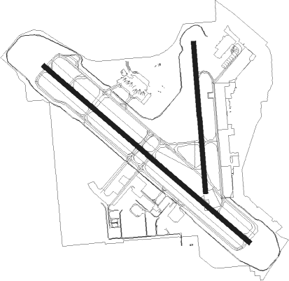
Runway info
Runway 14 / 32  | ||
| length | 2745m (9006ft) | |
| bearing | 131° / 311° | |
| width | 46m (150ft) | |
| surface | asphalt | |
| blast zone | 255m (837ft) / 255m (837ft) | |
| Runway 18 / 36 | ||
| length | 1510m (4954ft) | |
| bearing | 180° / 360° | |
| width | 46m (150ft) | |
| surface | asphalt | |
| blast zone | 0m (0ft) / 91m (299ft) | |
Nearby beacons
| code | identifier | dist | bearing | frequency |
|---|---|---|---|---|
| GPT | GULFPORT VORTAC | 0.3 | 266° | 109 |
| GP | BAYOU NDB | 6.7 | 310° | 360 |
| BIX | KEESLER (BILOXI) TACAN | 7.2 | 90° | 111.80 |
| HS | HANCO (BAY ST LOUIS) NDB | 20.1 | 277° | 221 |
| PCU | PICAYUNE VOR/DME | 35.4 | 283° | 113.95 |
| SJI | SEMMES (MOBILE) VORTAC | 41.4 | 66° | 115.30 |
| MOB | WISLE (MOBILE) NDB | 44.9 | 65° | 248 |
| GVB | BOGALUSA NDB | 49.8 | 301° | 353 |
| GCV | GREENE CO. (LEAKESVILLE) VORTAC | 51.2 | 40° | 115.70 |
| HRV | HARVEY (NEW ORLEANS) VORTAC | 58.8 | 239° | 114.10 |
Instrument approach procedures
| runway | airway (heading) | route (dist, bearing) |
|---|---|---|
| RW14 | BROWA (130°) | BROWA 2800ft |
| RNAV | BROWA 2800ft AVYUM (6mi, 131°) 2000ft KGPT (7mi, 130°) 69ft (5357mi, 109°) 227ft IVOLE (5348mi, 289°) 2800ft IVOLE (turn) | |
| RW18 | BOSWU (181°) | BOSWU 2800ft |
| RNAV | BOSWU 2800ft AHELU (6mi, 180°) 2000ft HUBDA (4mi, 180°) 780ft KGPT (3mi, 185°) 74ft (5357mi, 109°) 227ft RUDAW (5357mi, 289°) 2000ft RUDAW (turn) | |
| RW32 | IVOLE (311°) | IVOLE 2800ft |
| RNAV | IVOLE 2800ft VICKR (6mi, 311°) 2000ft KGPT (7mi, 312°) 77ft (5357mi, 109°) 277ft BROWA (5366mi, 289°) 2000ft BROWA (turn) | |
| RW36 | RUDAW (359°) | RUDAW 2600ft |
| RNAV | RUDAW 2600ft LEYHO (6mi, 360°) 2000ft KGPT (6mi, 358°) 76ft (5357mi, 109°) 277ft BOSWU (5357mi, 289°) 2800ft BOSWU (turn) |
Disclaimer
The information on this website is not for real aviation. Use this data with the X-Plane flight simulator only! Data taken with kind consent from X-Plane 12 source code and data files. Content is subject to change without notice.