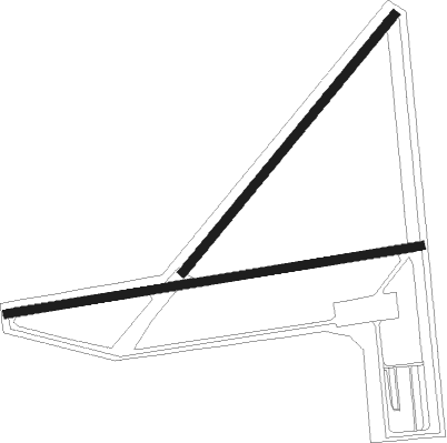
Greenwood - Greenwood County Airport
Airport details
| Country | United States of America |
| State | South Carolina |
| Region | K7 |
| Airspace | Atlanta Ctr |
| Municipality | Greenwood County |
| Elevation | 628ft (191m) |
| Timezone | GMT -5 |
| Coordinates | 34.25039, -82.15781 |
| Magnetic var | |
| Type | land |
| Available since | X-Plane v10.40 |
| ICAO code | KGRD |
| IATA code | GRD |
| FAA code | GRD |
Communication
| Greenwood County Airport ASOS | 121.125 |
| Greenwood County Airport CTAF/UNICOM | 122.800 |
| Greenwood County Airport GREER Approach/Departure | 120.600 |
Nearby beacons
| code | identifier | dist | bearing | frequency |
|---|---|---|---|---|
| GRD | GREENWOOD VORTAC | 0.1 | 72° | 115.50 |
| GIW | CORONACA (GREENWOOD) NDB | 3.5 | 87° | 239 |
| EOE | ENOREE (NEWBERRY) NDB | 26.1 | 83° | 278 |
| GY | DYANA (GREENVILLE) NDB | 30 | 327° | 338 |
| ELW | ELECTRIC CITY (ANDERSON) VORTAC | 32.6 | 285° | 108.60 |
| IRQ | COLLIERS VORTAC | 32.6 | 180° | 113.90 |
| GM | JUDKY (GREENVILLE) NDB | 33.2 | 340° | 521 |
| UOT | UNION COUNTY NDB | 36.4 | 50° | 326 |
| AIK | AIKEN NDB | 43.1 | 141° | 347 |
| EMR | EMORY (AUGUSTA) NDB | 47.9 | 168° | 385 |
| CA | MURRY (COLUMBIA) NDB | 48.4 | 107° | 362 |
| SPA | SPARTANBURG VORTAC | 48.4 | 16° | 115.70 |
| AA | CEDAR (THOMSON) NDB | 48.7 | 212° | 341 |
| VV | JUNNE (GREENSBORO) NDB | 56.2 | 235° | 353 |
| DCM | CHESTER NDB | 57.2 | 61° | 220 |
| AG | BUSHE (AUGUSTA) NDB | 58.8 | 168° | 233 |
Instrument approach procedures
| runway | airway (heading) | route (dist, bearing) |
|---|---|---|
| RW09 | MACER (86°) | MACER 2500ft |
| RNAV | MACER 2500ft HILEM (5mi, 86°) 2000ft KGRD (5mi, 85°) 684ft (5016mi, 113°) 938ft COBOT (5007mi, 293°) 2500ft COBOT (turn) | |
| RW27 | COBOT (267°) | COBOT 2500ft |
| RNAV | COBOT 2500ft HURTO (5mi, 266°) 2000ft KGRD (5mi, 267°) 673ft (5016mi, 113°) 879ft MACER (5026mi, 293°) 2500ft MACER (turn) |
Disclaimer
The information on this website is not for real aviation. Use this data with the X-Plane flight simulator only! Data taken with kind consent from X-Plane 12 source code and data files. Content is subject to change without notice.

