Grand Island - Central Nebraska Regional
Airport details
| Country | United States of America |
| State | Nebraska |
| Region | K3 |
| Airspace | Minneapolis Ctr |
| Municipality | Grand Island |
| Elevation | 1847ft (563m) |
| Timezone | GMT -6 |
| Coordinates | 40.96754, -98.30964 |
| Magnetic var | |
| Type | land |
| Available since | X-Plane v10.40 |
| ICAO code | KGRI |
| IATA code | GRI |
| FAA code | GRI |
Communication
| Central Nebraska Regional ATIS | 127.400 |
| Central Nebraska Regional CTAF | 118.200 |
| Central Nebraska Regional UNICOM | 122.950 |
| Central Nebraska Regional GROUND | 121.900 |
| Central Nebraska Regional GRAND ISLAND TOWER | 118.200 |
| Central Nebraska Regional MINNEAPOLIS ApproachROACH | 119.400 |
| Central Nebraska Regional MINNEAPOLIS DepartureARTURE | 119.400 |
Approach frequencies
| ILS-cat-I | RW35 | 111.9 | 18.00mi |
| 2.6° GS | RW35 | 111.9 | 18.00mi |
Nearby Points of Interest:
Shady Bend Gas Station, Grocery, and Diner
-Grand Island United States Post Office and Courthouse
-Hall County Courthouse
-Grand Island Carnegie Library
-Liederkranz
-Cathedral of the Nativity of the Blessed Virgin Mary (Grand Island, Nebraska)
-Hamilton-Donald House
-H. J. Bartenbach House
-Oscar Roeser House
-Heinrich Giese House
-Cahow Barber Shop
-Nine Bridges Bridge
-Columbia Hall
-Streeter-Peterson House
-Gloe Brothers Service Station
-Wright Morris Boyhood House
-Howard County Courthouse
-Merrick County Courthouse
-Patterson Law Office
-St. Johannes Danske Lutherske Kirke
-St. Peder's Dansk Evangelical Lutheran Kirke
-Heber Hord House
-Riverside Park Dance Pavilion
-IOOF Opera House
-George Meisner House
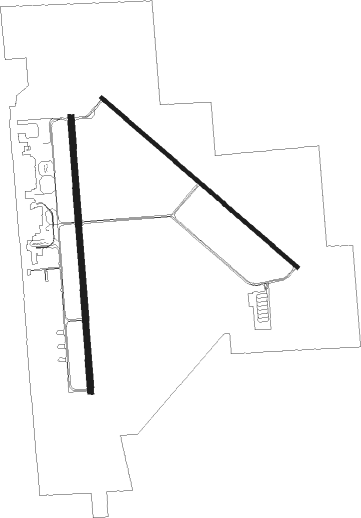
Runway info
Runway 17 / 35  | ||
| length | 2136m (7008ft) | |
| bearing | 180° / 0° | |
| width | 46m (150ft) | |
| surface | concrete | |
| blast zone | 255m (837ft) / 255m (837ft) | |
| Runway 13 / 31 | ||
| length | 2013m (6604ft) | |
| bearing | 127° / 307° | |
| width | 30m (100ft) | |
| surface | concrete | |
Nearby beacons
| code | identifier | dist | bearing | frequency |
|---|---|---|---|---|
| GRI | GRAND ISLAND VOR/DME | 1 | 343° | 112 |
| GR | SANCY NDB | 5.6 | 183° | 380 |
| HSI | HASTINGS VOR/DME | 22.4 | 198° | 108.80 |
| OBH | WOLBACH VORTAC | 24.5 | 354° | 114.80 |
| JYR | YORK NDB | 31.7 | 96° | 257 |
| EAR | KEARNEY VOR | 34.7 | 251° | 111.20 |
| FMZ | BEKLOF (FAIRMONT) NDB | 40.6 | 117° | 392 |
| ODX | ORD NDB | 48.8 | 316° | 356 |
| OLU | COLUMBUS VOR/DME | 52.4 | 64° | 111.80 |
| PLT | PLATTE CENTER (COLUMBUS) NDB | 52.5 | 60° | 407 |
Instrument approach procedures
| runway | airway (heading) | route (dist, bearing) |
|---|---|---|
| RW13 | AZUYI (129°) | AZUYI 4000ft |
| RW13 | DECKY (95°) | DECKY SUKJI (6mi, 63°) 4000ft AZUYI (5mi, 53°) 4000ft |
| RW13 | OBH (174°) | OBH VAMYE (13mi, 194°) 4000ft AZUYI (5mi, 233°) 4000ft |
| RNAV | AZUYI 4000ft BEXEQ (6mi, 127°) 3500ft KGRI (6mi, 131°) 1885ft (5781mi, 113°) 2092ft AGEKY (5774mi, 293°) 4100ft AGEKY (turn) | |
| RW17 | AZAWU (179°) | AZAWU 3500ft |
| RW17 | DECKY (95°) | DECKY SUJWI (15mi, 56°) 4000ft AZAWU (5mi, 90°) 3500ft |
| RW17 | GRASI (263°) | GRASI VECFU (16mi, 296°) 3500ft AZAWU (5mi, 270°) 3500ft |
| RW17 | OBH (174°) | OBH AZAWU (13mi, 169°) 3500ft |
| RNAV | AZAWU 3500ft WICFI (6mi, 180°) 3500ft KGRI (6mi, 177°) 1894ft (5781mi, 113°) 2094ft AXOVY (5783mi, 293°) 3800ft AXOVY (turn) | |
| RW31 | AGEKY (306°) | AGEKY 4100ft |
| RW31 | BRADY (274°) | BRADY AGEKY (9mi, 229°) 4100ft |
| RW31 | HSI (18°) | HSI AGEKY (20mi, 53°) 4100ft |
| RNAV | AGEKY 4100ft BUNPE (6mi, 308°) 3500ft KGRI (6mi, 304°) 1885ft (5781mi, 113°) 2180ft AZUYI (5788mi, 293°) 4000ft AZUYI (turn) | |
| RW35 | AXOVY (2°) | AXOVY 3800ft |
| RW35 | HSI (18°) | HSI AXOVY (11mi, 34°) 3800ft |
| RW35 | MORGS (56°) | MORGS SIWRO (16mi, 73°) 4400ft AXOVY (5mi, 90°) 3800ft |
| RW35 | VAPGE (334°) | VAPGE AXOVY (5mi, 270°) 3800ft |
| RNAV | AXOVY 3800ft WOGGU (6mi, 0°) 3500ft KGRI (6mi, 4°) 1902ft (5781mi, 113°) 2097ft AZAWU (5780mi, 293°) 3500ft AZAWU (turn) |
Disclaimer
The information on this website is not for real aviation. Use this data with the X-Plane flight simulator only! Data taken with kind consent from X-Plane 12 source code and data files. Content is subject to change without notice.