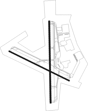
Georgetown - Georgetown Muni
Airport details
| Country | United States of America |
| State | Texas |
| Region | K4 |
| Airspace | Houston Oceanic Ctr |
| Municipality | Georgetown |
| Elevation | 790ft (241m) |
| Timezone | GMT -6 |
| Coordinates | 30.67881, -97.67939 |
| Magnetic var | |
| Type | land |
| Available since | X-Plane v10.40 |
| ICAO code | KGTU |
| IATA code | GTU |
| FAA code | GTU |
Communication
| Georgetown Muni AWOS 3 | 135.425 |
| Georgetown Muni CTAF/UNICOM | 123.000 |
| Georgetown Muni GROUND | 119.125 |
| Georgetown Muni TOWER | 120.225 |
| Georgetown Muni AUSTIN Departure | 119.125 |
Nearby Points of Interest:
Williamson County Courthouse Historic District
-Georgetown Light and Water Works
-Hugh Roy and Lillie Cullen Building
-Harper-Chesser House
-Belford Historic District
-Hutto Commercial Historic District
-Bartlett Commercial Historic District
-Aynesworth-Wright House
-George Washington Baines House
-Barton House
-Camp Mabry
-Barton Springs
-Mayfield-Gutsch Estate
-Austin State Hospital
-Smith-Marcuse-Lowry House
-Frank M. and Annie G. Covert House
-Page-Gilbert House
-Hildreth-Flanagan-Heierman House
-Peter and Clotilde Shipe Mansbendel House
-Col. Monroe M. Shipe House
-Worrell-Ettlinger House
-Cox-Craddock House
-Scottish Rite Dormitory
-J. Frank Dobie House
-Littlefield House

Nearby beacons
| code | identifier | dist | bearing | frequency |
|---|---|---|---|---|
| CWK | CENTEX VORTAC | 19.6 | 154° | 112.80 |
| IL | IRESH (KILLEEN) NDB | 20.7 | 355° | 278 |
| GRK | GRAY (FORT HOOD) VOR/DME | 22.3 | 339° | 111.80 |
| TPL | DME | 34.4 | 26° | 110.40 |
| AGJ | GOOCH SPRINGS VORTAC | 38.6 | 318° | 112.50 |
| RU | GARYS (AUSTIN) NDB | 45.4 | 201° | 272 |
| ROB | ROBINSON (WACO) NDB | 58.6 | 36° | 400 |
| ACT | WACO VORTAC | 62.7 | 23° | 115.30 |
Departure and arrival routes
| Transition altitude | 18000ft |
| Transition level | 18000ft |
| SID end points | distance | outbound heading | |
|---|---|---|---|
| RW11 | |||
| SAYBR3 | 37mi | 65° | |
| ILEXY3 | 87mi | 104° | |
| BNDIA3 | 74mi | 217° | |
| MUCKY3 | 63mi | 258° | |
| AEROZ2 | 149mi | 284° | |
| ELOEL3 | 38mi | 327° | |
| RW18 | |||
| SAYBR3 | 37mi | 65° | |
| ILEXY3 | 87mi | 104° | |
| BNDIA3 | 74mi | 217° | |
| MUCKY3 | 63mi | 258° | |
| AEROZ2 | 149mi | 284° | |
| ELOEL3 | 38mi | 327° | |
| RW29 | |||
| SAYBR3 | 37mi | 65° | |
| ILEXY3 | 87mi | 104° | |
| BNDIA3 | 74mi | 217° | |
| MUCKY3 | 63mi | 258° | |
| AEROZ2 | 149mi | 284° | |
| ELOEL3 | 38mi | 327° | |
| RW36 | |||
| SAYBR3 | 37mi | 65° | |
| ILEXY3 | 87mi | 104° | |
| BNDIA3 | 74mi | 217° | |
| MUCKY3 | 63mi | 258° | |
| AEROZ2 | 149mi | 284° | |
| ELOEL3 | 38mi | 327° | |
| STAR starting points | distance | inbound heading | |
|---|---|---|---|
| ALL | |||
| KALLA4 | 20.7 | 96° | |
| BITER9, POTRR1 | 56.4 | 308° | |
Instrument approach procedures
| runway | airway (heading) | route (dist, bearing) |
|---|---|---|
| RW11 | AGJ (138°) | AGJ URHIN (25mi, 130°) 4000ft LOFJA (8mi, 214°) 3400ft |
| RW11 | BASIS (84°) | BASIS VEGEJ (16mi, 84°) 4000ft LOFJA (8mi, 34°) 3400ft |
| RW11 | CWK (334°) | CWK VEGEJ (27mi, 304°) 4000ft LOFJA (8mi, 34°) 3400ft |
| RW11 | DARTE (249°) | DARTE URHIN (19mi, 290°) 4000ft LOFJA (8mi, 214°) 3400ft |
| RNAV | LOFJA 3400ft LUDFE (6mi, 117°) 2400ft CUBLO (2mi, 117°) 1620ft KGTU (3mi, 116°) 829ft (5802mi, 107°) 1180ft DARTE (5789mi, 288°) 3000ft DARTE (turn) | |
| RW18 | AXWUB (225°) | AXWUB SILIW (9mi, 273°) 3100ft |
| RW18 | DAGHU (143°) | DAGHU SILIW (9mi, 93°) 3100ft |
| RW18 | SILIW (184°) | SILIW 3100ft |
| RNAV | SILIW 3100ft FIHNU (7mi, 184°) 2400ft FORNA (3mi, 184°) 1480ft KGTU (3mi, 185°) 821ft (5802mi, 107°) 1300ft DARTE (5789mi, 288°) 3000ft DARTE (turn) | |
| RW29 | CWK (334°) | CWK FEBYI (7mi, 351°) 3000ft KOJCY (6mi, 34°) 3000ft |
| RW29 | DARTE (249°) | DARTE APCEX (6mi, 168°) 3000ft KOJCY (6mi, 214°) 3000ft |
| RNAV | KOJCY 3000ft IWKOK (6mi, 297°) 2400ft HEGUR (2mi, 297°) 1760ft KGTU (3mi, 298°) 799ft (5802mi, 107°) 1190ft DARTE (5789mi, 288°) 3000ft DARTE (turn) | |
| RW36 | EWETU (323°) | EWETU LUKVE (9mi, 273°) 3100ft |
| RW36 | LUKVE (4°) | LUKVE 3100ft |
| RW36 | ZIGZE (44°) | ZIGZE LUKVE (9mi, 93°) 3100ft |
| RNAV | LUKVE 3100ft ACVEK (7mi, 4°) 2500ft HOPAG (2mi, 4°) 1840ft KGTU (4mi, 3°) 798ft (5802mi, 107°) 1300ft DARTE (5789mi, 288°) 3000ft DARTE (turn) |
Holding patterns
| STAR name | hold at | type | turn | heading* | altitude | leg | speed limit |
|---|---|---|---|---|---|---|---|
| BITER9 | WLEEE | VHF | left | 101 (281)° | 1.0min timed | ICAO rules | |
| *) magnetic outbound (inbound) holding course | |||||||
Disclaimer
The information on this website is not for real aviation. Use this data with the X-Plane flight simulator only! Data taken with kind consent from X-Plane 12 source code and data files. Content is subject to change without notice.