Gunnison - Gunnison Crested Butte Rgnl
Airport details
| Country | United States of America |
| State | Colorado |
| Region | K2 |
| Airspace | Denver Ctr |
| Municipality | Gunnison |
| Elevation | 7678ft (2340m) |
| Timezone | GMT -7 |
| Coordinates | 38.53433, -106.93175 |
| Magnetic var | |
| Type | land |
| Available since | X-Plane v10.40 |
| ICAO code | KGUC |
| IATA code | GUC |
| FAA code | GUC |
Communication
| Gunnison Crested Butte Rgnl AWOS 3 | 135.075 |
| Gunnison Crested Butte Rgnl CTAF/UNICOM | 122.700 |
Approach frequencies
| ILS-cat-I | RW06 | 110.5 | 18.00mi |
| 3.2° GS | RW06 | 110.5 | 18.00mi |
Nearby Points of Interest:
Edgerton House
-Crested Butte
-Alpine Tunnel
-Morley Bridge
-St. Elmo
-Denver & Rio Grande Western Railroad Caboose No. 0577
-Denver & Rio Grande Western Railroad Boxcar No. 3132
-D & RG Narrow Gauge Trestle
-Denver & Rio Grande Western Railroad Locomotive No. 278 and Tender
-Rio Grande Southern Railroad Derrick Car
-Denver & Rio Grande Western Railroad Stock Car No. 5679D
-Denver & Rio Grande Railroad Box Outfit Car No. 04414
-Denver & Rio Grande Western Railroad Stock Car No. 5620
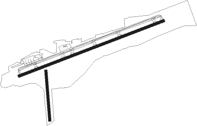
Runway info
Runway 6 / 24  | ||
| length | 2859m (9380ft) | |
| bearing | 77° / 257° | |
| width | 46m (151ft) | |
| surface | asphalt | |
| blast zone | 255m (837ft) / 61m (200ft) | |
| Runway 17 / 35 | ||
| length | 914m (2999ft) | |
| bearing | 180° / 0° | |
| width | 46m (151ft) | |
| surface | gravel | |
| displ threshold | 0m (0ft) / 71m (233ft) | |
Nearby beacons
| code | identifier | dist | bearing | frequency |
|---|---|---|---|---|
| HBU | BLUE MESA (GUNNISON) VOR/DME | 7 | 233° | 114.90 |
| MTJ | MONTROSE VOR/DME | 45.4 | 268° | 117.10 |
| DBL | RED TABLE (EAGLE) VOR/DME | 54.3 | 2° | 113 |
| RIL | RIFLE VOR/DME | 70.1 | 322° | 110.60 |
Instrument approach procedures
| runway | airway (heading) | route (dist, bearing) |
|---|---|---|
| RW06 | HBU (53°) | HBU FESPA (6mi, 208°) 12000ft HIVOT (8mi, 255°) 12000ft KETNE (6mi, 329°) 12000ft KEEZR (5mi, 49°) 11000ft |
| RW06 | MEYRS (84°) | MEYRS CIMUS (6mi, 94°) 12000ft KEEZR (5mi, 94°) 11000ft |
| RW06 | POWES (37°) | POWES NIKTE (7mi, 344°) 13000ft KEEZR (7mi, 344°) 11000ft |
| RW06 | SKIPT (265°) | SKIPT HBU (13mi, 249°) 13000ft FESPA (6mi, 208°) 12000ft HIVOT (8mi, 255°) 12000ft KETNE (6mi, 329°) 12000ft KEEZR (5mi, 49°) 11000ft |
| RNAV | KEEZR 11000ft OSDUE (7mi, 77°) 10300ft KGUC (8mi, 77°) 7707ft POSLY (2mi, 75°) JENRO (3mi, 91°) TIPOC (1mi, 111°) RNGLE (11mi, 227°) HBU (5mi, 312°) 13000ft HBU (turn) | |
| RW24 | COBIX (269°) | COBIX TESKY (9mi, 263°) 14000ft CUVAS (8mi, 263°) 12000ft ROMLY (5mi, 263°) 10600ft |
| RW24 | HBU (53°) | HBU WADDU (7mi, 135°) 13000ft METVY (8mi, 103°) 13000ft HELUP (8mi, 44°) 11600ft ROMLY (4mi, 329°) 10600ft |
| RW24 | POWES (37°) | POWES METVY (19mi, 75°) 13600ft HELUP (8mi, 44°) 11600ft ROMLY (4mi, 329°) 10600ft |
| RW24 | SKOTI (283°) | SKOTI DUFEL (11mi, 273°) 12000ft ROMLY (5mi, 311°) 10600ft |
| RNAV | ROMLY 10600ft FEGUL (3mi, 300°) 10100ft JAMSS (2mi, 287°) 9500ft GADVY (2mi, 287°) CULKI (1mi, 272°) KGUC (2mi, 256°) 7745ft KEEZR (15mi, 257°) NUWZO (12mi, 113°) HBU (5mi, 338°) 14000ft HBU (turn) |
Disclaimer
The information on this website is not for real aviation. Use this data with the X-Plane flight simulator only! Data taken with kind consent from X-Plane 12 source code and data files. Content is subject to change without notice.