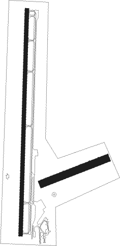
Guymon - Guymon Municipal
Airport details
| Country | United States of America |
| State | Oklahoma |
| Region | K4 |
| Airspace | Kansas City Ctr |
| Municipality | Guymon |
| Elevation | 3123ft (952m) |
| Timezone | GMT -5 |
| Coordinates | 36.68507, -101.50778 |
| Magnetic var | |
| Type | land |
| Available since | X-Plane v10.40 |
| ICAO code | KGUY |
| IATA code | GUY |
| FAA code | GUY |
Communication
| Guymon Municipal ASOS | 119.925 |
| Guymon Municipal CTAF/UNICOM | 122.700 |
Nearby Points of Interest:
Texas County Courthouse
-Hooker Woodframe Grain Elevator
Nearby beacons
| code | identifier | dist | bearing | frequency |
|---|---|---|---|---|
| GUY | GUYMON NDB | 1.2 | 8° | 275 |
| HQG | HUGOTON NDB | 29.4 | 16° | 365 |
| LB | PANCK (LIBERAL) NDB | 31.3 | 63° | 383 |
| LBL | LIBERAL VORTAC | 33.6 | 56° | 112.30 |
| PYX | PERRYTON NDB | 40.1 | 110° | 266 |
| BGD | BORGER VORTAC | 53 | 172° | 108.60 |
| ULS | ULYSSES NDB | 55.1 | 9° | 395 |
Instrument approach procedures
| runway | airway (heading) | route (dist, bearing) |
|---|---|---|
| RW18 | BRAKR (187°) | BRAKR UVCAP (10mi, 8°) 5000ft UVCAP (turn) 5000ft |
| RW18 | RILYO (234°) | RILYO UVCAP (14mi, 266°) 5000ft |
| RNAV | UVCAP 5000ft MELOW (7mi, 188°) 5000ft IQIHY (3mi, 188°) 3940ft KGUY (3mi, 188°) 3148ft (5958mi, 110°) 3353ft BEAKY (5961mi, 290°) 6000ft BEAKY (turn) | |
| RW36 | BEAKY (8°) | BEAKY 5000ft |
| RW36 | BGD (352°) | BGD BEAKY (40mi, 347°) 5000ft |
| RW36 | DHT (60°) | DHT WUVGA (44mi, 70°) 6000ft BEAKY (10mi, 70°) 5000ft |
| RW36 | LBL (236°) | LBL XEYRU (40mi, 211°) 5000ft BEAKY (10mi, 275°) 5000ft |
| RNAV | BEAKY 5000ft HONKS (7mi, 8°) 4800ft GOOGU (3mi, 8°) 3780ft KGUY (2mi, 8°) 3144ft (5958mi, 110°) 3359ft UVCAP (5955mi, 290°) 6000ft UVCAP (turn) |
Disclaimer
The information on this website is not for real aviation. Use this data with the X-Plane flight simulator only! Data taken with kind consent from X-Plane 12 source code and data files. Content is subject to change without notice.

