Greenville - Majors
Airport details
| Country | United States of America |
| State | Texas |
| Region | K4 |
| Airspace | Ft Worth Ctr |
| Municipality | Greenville |
| Elevation | 535ft (163m) |
| Timezone | GMT -6 |
| Coordinates | 33.06783, -96.06533 |
| Magnetic var | |
| Type | land |
| Available since | X-Plane v10.40 |
| ICAO code | KGVT |
| IATA code | GVT |
| FAA code | GVT |
Communication
| Majors AWOS 3 | 133.425 |
| Majors UNICOM | 122.950 |
| Majors CTAF | 118.650 |
| Majors Ground Control | 121.700 |
| Majors Tower | 118.650 |
Approach frequencies
| ILS-cat-I | RW17 | 110.5 | 18.00mi |
| 3° GS | RW17 | 110.5 | 18.00mi |
Nearby Points of Interest:
Post Office Building
-Katy Depot
-Royse City Lodge No. 663 A.F. & A.M.
-Farmersville Masonic Lodge No. 214, A.F. and A.M.
-Porter Farm
-First Methodist Church of Rockwall
-Warren-Crowell House
-Matthew Cartwright House
-Hopkins County Courthouse
-Heard-Craig House
-Allen Water Station
-Sam Rayburn House Museum
-Stephen Decatur Lawrence Farmstead
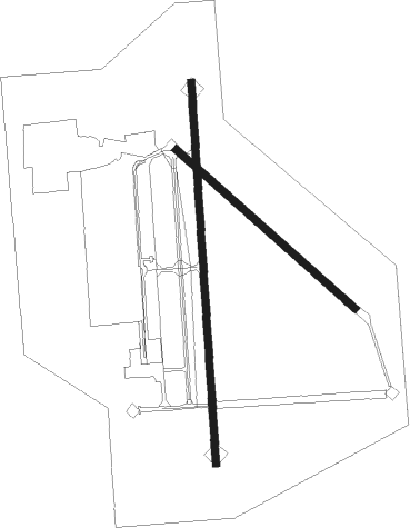
Runway info
Runway 17 / 35  | ||
| length | 2450m (8038ft) | |
| bearing | 181° / 1° | |
| width | 46m (150ft) | |
| surface | asphalt | |
| blast zone | 255m (837ft) / 255m (837ft) | |
| Runway 13 / 31 | ||
| length | 1534m (5033ft) | |
| bearing | 131° / 311° | |
| width | 46m (150ft) | |
| surface | hard surface | |
Nearby beacons
| code | identifier | dist | bearing | frequency |
|---|---|---|---|---|
| MJF | ARVILLA (GREENVILLE) TACAN | 0.2 | 112° | 109.60 |
| GV | MAJOR (GREENVILLE) NDB | 5.3 | 1° | 201 |
| SLR | SULPHUR SPRINGS VOR/DME | 27.4 | 76° | 109 |
| PQF | MESQUITE NDB | 28 | 241° | 248 |
| BYP | BONHAM VORTAC | 29.4 | 340° | 114.60 |
| UIM | DME | 36.9 | 105° | 114 |
| PRX | PARIS VOR/DME | 42 | 52° | 113.60 |
| CVE | COWBOY (DALLAS) VOR/DME | 43.5 | 258° | 116.20 |
| TTT | MAVERICK VOR/DME | 50.5 | 258° | 113.10 |
| CQY | CEDAR CREEK VORTAC | 53.5 | 190° | 114.80 |
| TYR | TYLER VOR/DME | 54.2 | 137° | 114.20 |
| DNI | DENISON (SHERMAN-DENISON) NDB | 54.6 | 321° | 341 |
| URH | (DURANT) DME | 55.1 | 340° | 114.30 |
| ABG | AMBASSADOR (BIG SANDY) NDB | 56.1 | 117° | 404 |
| FZT | FRANKSTON VOR/DME | 65.4 | 152° | 111.40 |
Instrument approach procedures
| runway | airway (heading) | route (dist, bearing) |
|---|---|---|
| RW17 | BYP (160°) | BYP CIPEX (18mi, 146°) 4000ft |
| RW17 | CIPEX (181°) | CIPEX 4000ft |
| RW17 | IKOYA (142°) | IKOYA CIPEX (8mi, 91°) 4000ft |
| RW17 | UCECE (210°) | UCECE CIPEX (6mi, 271°) 4000ft |
| RNAV | CIPEX 4000ft POCNI (7mi, 181°) 2200ft KGVT (6mi, 181°) 577ft (5710mi, 109°) 734ft VECUN (5711mi, 289°) 4000ft VECUN (turn) 4000ft | |
| RW35 | CINOK (37°) | CINOK VECUN (8mi, 91°) 4000ft |
| RW35 | ROCKK (336°) | ROCKK VECUN (13mi, 314°) 4000ft |
| RW35 | SLR (256°) | SLR HAXOS (29mi, 230°) 4000ft VECUN (6mi, 271°) 4000ft |
| RW35 | VECUN (1°) | VECUN 4000ft |
| RNAV | VECUN 4000ft GUYSE (7mi, 1°) 2200ft JUSUB (3mi, 1°) 1140ft KGVT (2mi, 1°) 579ft CIPEX (13mi, 1°) 4000ft CIPEX (turn) |
Disclaimer
The information on this website is not for real aviation. Use this data with the X-Plane flight simulator only! Data taken with kind consent from X-Plane 12 source code and data files. Content is subject to change without notice.