Goldsboro - Wayne Executive Jetport
Airport details
| Country | United States of America |
| State | North Carolina |
| Region | K7 |
| Airspace | Washington Ctr |
| Municipality | Wayne County |
| Elevation | 132ft (40m) |
| Timezone | GMT -5 |
| Coordinates | 35.46056, -77.96492 |
| Magnetic var | |
| Type | land |
| Available since | X-Plane v10.40 |
| ICAO code | KGWW |
| IATA code | n/a |
| FAA code | GWW |
Communication
| Wayne Executive Jetport AWOS 3 | 118.975 |
| Wayne Executive Jetport CTAF/UNICOM | 122.700 |
| Wayne Executive Jetport SEY JOHNSON Approach Departure | 123.700 |
Approach frequencies
| ILS-cat-I | RW23 | 111.9 | 18.00mi |
| 3° GS | RW23 | 111.9 | 18.00mi |
Nearby Points of Interest:
First Presbyterian Church
-Odd Fellows Lodge
-Goldsboro Union Station
-L. D. Giddens and Son Jewelry Store
-Solomon and Henry Weil Houses
-Fort Neoheroka
-La Grange Historic District (North Carolina)
-La Grange Presbyterian Church
-Greene County Courthouse
-Wilson Central Business-Tobacco Warehouse Historic District
-Wilson County Courthouse
-Davis-Whitehead-Harriss House
-Kennedy Memorial Home Historic District
-Cedar Dell
-U.S. Post Office, Former
-Downtown Smithfield Historic District
-Hood-Strickland House
-Hood Brothers Building
-Johnston County Courthouse
-Smithfield Masonic Lodge
-Bentonville Battlefield
-Harper House
-Mitchelltown Historic District
-American Tobacco Company Prizery
-Hill–Grainger Historic District
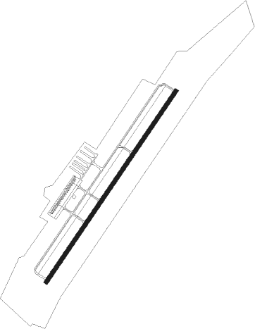
Runway info
| Runway 5 / 23 | ||
| length | 1678m (5505ft) | |
| bearing | 44° / 224° | |
| width | 30m (100ft) | |
| surface | asphalt | |
| blast zone | 152m (499ft) / 0m (0ft) | |
Nearby beacons
| code | identifier | dist | bearing | frequency |
|---|---|---|---|---|
| GSB | SEYMOUR JOHNSON TACAN | 7.5 | 183° | 116.50 |
| IS | STALS (KINSTON) NDB | 18.4 | 129° | 276 |
| ISO | KINSTON VORTAC | 20.6 | 102° | 109.60 |
| JN | JURLY (SMITHFIELD) NDB | 22.5 | 272° | 263 |
| AQE | ALWOOD (GREENVILLE) NDB | 32.5 | 67° | 230 |
| TYI | TAR RIVER (ROCKY MOUNT) VORTAC | 33.5 | 27° | 117.80 |
| HQT | HARNETT (ERWIN) NDB | 34.7 | 268° | 417 |
| CTZ | CLINTON NDB | 35 | 219° | 412 |
| RNW | CHOCOWINITY NDB | 42 | 87° | 388 |
| OA | ELLAS (JACKSONVILLE) NDB | 44.5 | 160° | 261 |
| FGP | FORT BRAGG NDB | 45.8 | 249° | 393 |
| LE | LEEVY (RALEIGH/DURHAM) NDB | 46.3 | 302° | 350 |
| RDU | RALEIGH-DURHAM VORTAC | 46.9 | 297° | 117.20 |
| POB | POPE (FAYETTEVILLE) NDB | 50.4 | 257° | 338 |
| EWN | NEW BERN VOR/DME | 50.7 | 113° | 113.60 |
| EW | KAFTI (NEW BERN) NDB | 50.8 | 116° | 362 |
| NCA | NEW RIVER TACAN | 52 | 145° | 115.40 |
| FAY | FAYETTEVILLE VOR/DME | 52.9 | 242° | 108.80 |
| DIW | DIXON NDB | 59.1 | 150° | 198 |
| HXO | HUNTSBORO (OXFORD) NDB | 59.6 | 322° | 271 |
Instrument approach procedures
| runway | airway (heading) | route (dist, bearing) |
|---|---|---|
| RW05 | BRADE (125°) | BRADE WADAP (20mi, 163°) 2300ft WADAP (turn) 2300ft |
| RW05 | ISO (282°) | ISO WADAP (29mi, 266°) 2300ft WADAP (turn) 2300ft |
| RNAV | WADAP 2300ft FENUD (6mi, 59°) 1700ft KGWW (5mi, 44°) 192ft (4818mi, 114°) 408ft JONVA (4812mi, 295°) 2000ft JONVA (turn) | |
| RW23 | BRADE (125°) | BRADE WOKUL (15mi, 81°) 2000ft JONVA (7mi, 123°) 2000ft |
| RW23 | ISO (282°) | ISO LUDEY (12mi, 322°) 2000ft JONVA (7mi, 303°) 2000ft |
| RW23 | JONVA (225°) | JONVA 2000ft |
| RNAV | JONVA 2000ft HODOR (7mi, 225°) 1700ft YONUV (2mi, 225°) 1100ft KGWW (3mi, 224°) 184ft (4818mi, 114°) 600ft BRADE (4832mi, 294°) 2000ft BRADE (turn) |
Disclaimer
The information on this website is not for real aviation. Use this data with the X-Plane flight simulator only! Data taken with kind consent from X-Plane 12 source code and data files. Content is subject to change without notice.