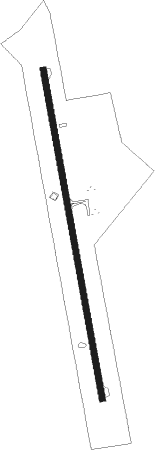
Giddings - Giddings Lee County
Airport details
| Country | United States of America |
| State | Texas |
| Region | K4 |
| Airspace | Houston Oceanic Ctr |
| Municipality | Lee County |
| Elevation | 483ft (147m) |
| Timezone | GMT -6 |
| Coordinates | 30.16928, -96.98003 |
| Magnetic var | |
| Type | land |
| Available since | X-Plane v10.40 |
| ICAO code | KGYB |
| IATA code | n/a |
| FAA code | GYB |
Communication
| Giddings Lee County AWOS 3 | 119.225 |
| Giddings Lee County CTAF/UNICOM | 123.050 |
| Giddings Lee County HOUSTON CNTR | 132.150 |
Nearby beacons
| code | identifier | dist | bearing | frequency |
|---|---|---|---|---|
| IDU | INDUSTRY VORTAC | 25.2 | 117° | 110.20 |
| CWK | CENTEX VORTAC | 31.1 | 291° | 112.80 |
| CL | ROWDY (COLLEGE STATION) NDB | 38.5 | 63° | 260 |
| CLL | COLLEGE STATION VORTAC | 39 | 52° | 113.30 |
| ELA | EAGLE LAKE VOR/DME | 46 | 127° | 116.40 |
| TNV | NAVASOTA VOR/DME | 48.3 | 83° | 115.90 |
| RU | GARYS (AUSTIN) NDB | 51.9 | 258° | 272 |
| IL | IRESH (KILLEEN) NDB | 63.6 | 320° | 278 |
| GRK | GRAY (FORT HOOD) VOR/DME | 67.4 | 316° | 111.80 |
Instrument approach procedures
| runway | airway (heading) | route (dist, bearing) |
|---|---|---|
| RW17 | IDU (297°) | IDU JAYJO (26mi, 326°) 2500ft JOMBU (5mi, 287°) 2300ft PPENS (5mi, 265°) 2300ft |
| RW17 | ILEXY (152°) | ILEXY PPENS (4mi, 88°) 2300ft |
| RW17 | PPENS (173°) | PPENS 2300ft |
| RNAV | PPENS 2300ft HARQE (6mi, 173°) 2100ft KGYB (5mi, 173°) 524ft RAMOS (11mi, 173°) 2500ft RAMOS (turn) | |
| RW35 | CRAYS (61°) | CRAYS POYLU (20mi, 82°) 2600ft RAMOS (5mi, 85°) 2500ft |
| RW35 | IDU (297°) | IDU IWOKU (16mi, 276°) 2500ft RAMOS (5mi, 265°) 2500ft |
| RW35 | JAYJO (225°) | JAYJO IWOKU (21mi, 188°) 2500ft RAMOS (5mi, 265°) 2500ft |
| RW35 | RAMOS (353°) | RAMOS 2500ft |
| RNAV | RAMOS 2500ft IYAHE (6mi, 353°) 2100ft KGYB (5mi, 353°) 482ft PPENS (11mi, 353°) 2500ft PPENS (turn) |
Disclaimer
The information on this website is not for real aviation. Use this data with the X-Plane flight simulator only! Data taken with kind consent from X-Plane 12 source code and data files. Content is subject to change without notice.
