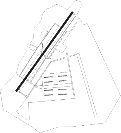
Greenville - Donaldson Field
Airport details
| Country | United States of America |
| State | South Carolina |
| Region | K7 |
| Airspace | Atlanta Ctr |
| Municipality | Greenville County |
| Elevation | 955ft (291m) |
| Timezone | GMT -4 |
| Coordinates | 34.75830, -82.37642 |
| Magnetic var | |
| Type | land |
| Available since | X-Plane v10.40 |
| ICAO code | KGYH |
| IATA code | GDC |
| FAA code | GYH |
Communication
| Donaldson Field AWOS 3 | 127.325 |
| Donaldson Field CTAF/UNICOM | 133.325 |
| Donaldson Field Clearance DEL | 125.950 |
| Donaldson Field Ground Control | 121.400 |
| Donaldson Field Tower | 133.325 |
| Donaldson Field GREER Approach/Departure | 118.800 |
Approach frequencies
| ILS-cat-I | RW05 | 108.3 | 18.00mi |
| 3° GS | RW05 | 108.3 | 18.00mi |
Nearby Points of Interest:
C. Granville Wyche House
-Mills Mill
-T.Q. Donaldson House
-Cureton-Huff House
-West End Commercial Historic District
-Piedmont Number One
-Reedy River Industrial District
-Working Benevolent Temple and Professional Building
-Wyche Pavilion
-Old Greenville City Hall
-Chamber of Commerce Building
-American Cigar Factory
-Greenville County Courthouse
-Carolina Supply Company
-C.F. Haynsworth Federal Building and United States Courthouse
-Gilfillin and Houston Building
-Stradley and Barr Dry Goods Store
-First National Bank
-Fountain Fox Beattie House
-East Park Historic District
-Burdette Building
-Parker High School Auditorium
-Whitehall
-Earle Town House
-Monaghan Mill
Nearby beacons
| code | identifier | dist | bearing | frequency |
|---|---|---|---|---|
| GM | JUDKY (GREENVILLE) NDB | 1.8 | 51° | 521 |
| GY | DYANA (GREENVILLE) NDB | 5.2 | 225° | 338 |
| SPA | SPARTANBURG VORTAC | 27.6 | 59° | 115.70 |
| ELW | ELECTRIC CITY (ANDERSON) VORTAC | 28.6 | 230° | 108.60 |
| BRA | BROAD RIVER (ASHEVILLE) NDB | 31.2 | 350° | 379 |
| GRD | GREENWOOD VORTAC | 32.3 | 156° | 115.50 |
| GIW | CORONACA (GREENWOOD) NDB | 33.4 | 150° | 239 |
| UOT | UNION COUNTY NDB | 36.5 | 96° | 326 |
| SUG | SUGARLOAF MT. (ASHEVILLE) VORTAC | 39.2 | 9° | 112.20 |
| EOE | ENOREE (NEWBERRY) NDB | 45.4 | 121° | 278 |
| ODF | FOOTHILLS (TOCCOA) VOR/DME | 45.6 | 266° | 113.40 |
| IM | KEANS (ASHEVILLE) NDB | 47.6 | 345° | 357 |
| SLP | FIRST RIVER (SHELBY) NDB | 48.4 | 58° | 417 |
| FIQ | FIDDLERS (MORGANTON) NDB | 66.8 | 37° | 391 |
| AHN | ATHENS VOR/DME | 67.6 | 229° | 109.60 |
Departure and arrival routes
| Transition altitude | 18000ft |
| Transition level | 18000ft |
| SID end points | distance | outbound heading | |
|---|---|---|---|
| ALL | |||
| BWALL2 | 49mi | 6° | |
| BIMMR2 | 78mi | 73° | |
| STAR starting points | distance | inbound heading | |
|---|---|---|---|
| ALL | |||
| WORXS2 | 56.1 | 38° | |
| RCTOR2 | 28.0 | 196° | |
| JUNNR3 | 108.5 | 237° | |
| MCHLN2 | 36.9 | 323° | |
Instrument approach procedures
| runway | airway (heading) | route (dist, bearing) |
|---|---|---|
| RW05 | ELLID (90°) | ELLID PAGIY (7mi, 186°) 4000ft NINYI (5mi, 125°) 3000ft |
| RW05 | REEDY (326°) | REEDY ONUCI (15mi, 285°) 4000ft NINYI (5mi, 305°) 3000ft |
| RNAV | NINYI 3000ft LEPBI (7mi, 45°) 2600ft KGYH (6mi, 45°) 1008ft ILEYO (12mi, 46°) 3000ft ILEYO (turn) | |
| RW23 | PEDAL (127°) | PEDAL KOKRE (13mi, 72°) 4000ft ILEYO (5mi, 125°) 3000ft |
| RW23 | PETON (301°) | PETON JIKPA (13mi, 13°) 4000ft ILEYO (5mi, 305°) 3000ft |
| RW23 | SPA (239°) | SPA ILEYO (16mi, 248°) 3000ft |
| RNAV | ILEYO 3000ft HUDUR (6mi, 226°) 2600ft KGYH (6mi, 225°) 971ft (5029mi, 113°) 1355ft NINYI (5037mi, 293°) 3000ft NINYI (turn) |
Disclaimer
The information on this website is not for real aviation. Use this data with the X-Plane flight simulator only! Data taken with kind consent from X-Plane 12 source code and data files. Content is subject to change without notice.