Sherman/denison - North Texas Rgnl
Airport details
| Country | United States of America |
| State | Texas |
| Region | K4 |
| Airspace | Ft Worth Ctr |
| Municipality | Grayson County |
| Elevation | 749ft (228m) |
| Timezone | GMT -6 |
| Coordinates | 33.71411, -96.67367 |
| Magnetic var | |
| Type | land |
| Available since | X-Plane v10.40 |
| ICAO code | KGYI |
| IATA code | PNX |
| FAA code | GYI |
Communication
| North Texas Rgnl ATIS | 118.775 |
| North Texas Rgnl CTAF | 120.575 |
| North Texas Rgnl GROUND | 124.125 |
| North Texas Rgnl TOWER | 120.575 |
| North Texas Rgnl Gainsville RCAG | 124.750 |
Approach frequencies
| ILS-cat-I | RW17L | 111.7 | 18.00mi |
| 3° GS | RW17L | 111.7 | 18.00mi |
Nearby Points of Interest:
Paul Brown Federal Building and United States Courthouse
-Robert E. Lee School
-Oklahoma Presbyterian College
-Bryan County Courthouse
-Durant Downtown Historic District
-Marshall County Courthouse
-State Highway No. 78 Bridge at the Red River
-Sam Rayburn House Museum
-Love County Jail and Sheriff's Residence
-Love County Courthouse
-Heard-Craig House
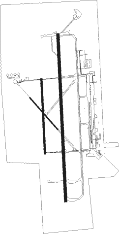
Runway info
Runway 17L / 35R  | ||
| length | 2746m (9009ft) | |
| bearing | 182° / 2° | |
| width | 46m (150ft) | |
| surface | asphalt | |
| blast zone | 255m (837ft) / 255m (837ft) | |
| Runway 17R / 35L | ||
| length | 1223m (4012ft) | |
| bearing | 182° / 2° | |
| width | 30m (100ft) | |
| surface | asphalt | |
| blast zone | 255m (837ft) / 255m (837ft) | |
| Runway 13 / 31 | ||
| length | 695m (2280ft) | |
| bearing | 138° / 318° | |
| width | 18m (60ft) | |
| surface | asphalt | |
| blast zone | 255m (837ft) / 0m (0ft) | |
Nearby beacons
| code | identifier | dist | bearing | frequency |
|---|---|---|---|---|
| DNI | DENISON (SHERMAN-DENISON) NDB | 6.7 | 2° | 341 |
| URH | (DURANT) DME | 19.7 | 51° | 114.30 |
| BYP | BONHAM VORTAC | 24.4 | 112° | 114.60 |
| AI | ADDMO (ARDMORE) NDB | 33.6 | 333° | 400 |
| DT | PINCK (DENTON) NDB | 36.8 | 230° | 257 |
| ADM | ARDMORE VORTAC | 38.7 | 315° | 116.70 |
| GV | MAJOR (GREENVILLE) NDB | 45.3 | 132° | 201 |
| MJF | ARVILLA (GREENVILLE) TACAN | 49.5 | 137° | 109.60 |
| CVE | COWBOY (DALLAS) VOR/DME | 50.8 | 196° | 116.20 |
| TTT | MAVERICK VOR/DME | 53.9 | 203° | 113.10 |
| PQF | MESQUITE NDB | 54.8 | 171° | 248 |
| FUZ | RANGER (DALLAS-FORT WORTH VORTAC | 55.6 | 212° | 115.70 |
| FT | MUFIN (FORT WORTH) NDB | 60.5 | 220° | 365 |
| NFW | NAS JRB FORT WORTH (FT WO TACAN | 68.4 | 219° | 108.70 |
Instrument approach procedures
| runway | airway (heading) | route (dist, bearing) |
|---|---|---|
| RW17L | ADM (135°) | ADM ZUNUV (23mi, 119°) 3600ft GEYEG (7mi, 119°) 3000ft |
| RW17L | BYP (292°) | BYP GEYEG (32mi, 313°) 3000ft GEYEG (turn) 3000ft |
| RNAV | GEYEG 3000ft HIGIR (6mi, 182°) 2800ft CEKOK (5mi, 182°) 1320ft KGYI (2mi, 183°) 784ft (5738mi, 109°) 941ft SERYO (5739mi, 289°) 3000ft SERYO (turn) | |
| RW35R | BYP (292°) | BYP SERYO (22mi, 267°) 3000ft SERYO (turn) 3000ft |
| RNAV | SERYO 3000ft YINCU (6mi, 2°) 2400ft URACU (3mi, 2°) 1400ft KGYI (3mi, 1°) 800ft (5738mi, 109°) 949ft GEYEG (5737mi, 289°) 3000ft GEYEG (turn) |
Disclaimer
The information on this website is not for real aviation. Use this data with the X-Plane flight simulator only! Data taken with kind consent from X-Plane 12 source code and data files. Content is subject to change without notice.