Casper - Harford Field
Airport details
| Country | United States of America |
| State | Wyoming |
| Region | K1 |
| Airspace | Denver Ctr |
| Municipality | Natrona County |
| Elevation | 5370ft (1637m) |
| Timezone | GMT -7 |
| Coordinates | 42.92441, -106.30947 |
| Magnetic var | |
| Type | land |
| Available since | X-Plane v10.40 |
| ICAO code | KHAD |
| IATA code | n/a |
| FAA code | HAD |
Communication
| Harford Field Harford CTAF | 122.900 |
Nearby Points of Interest:
Roosevelt School
-Casper Downtown Historic District
-Fort Caspar
-Casper–Natrona County International Airport
-DUX Bessemer Bend Bridge
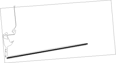
Runway info
| Runway 07 / 25 | ||
| length | 1162m (3812ft) | |
| bearing | 86° / 266° | |
| width | 13m (42ft) | |
| surface | dirt | |
Nearby beacons
| code | identifier | dist | bearing | frequency |
|---|---|---|---|---|
| DDY | MUDDY MOUNTAIN (CASPER) VOR/DME | 10 | 11° | 116.20 |
Disclaimer
The information on this website is not for real aviation. Use this data with the X-Plane flight simulator only! Data taken with kind consent from X-Plane 12 source code and data files. Content is subject to change without notice.