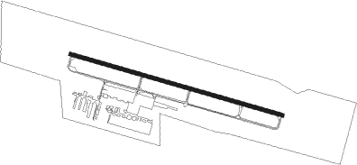
Hamilton - Butler Co Regl
Airport details
| Country | United States of America |
| State | Ohio |
| Region | K5 |
| Airspace | Indianapolis Ctr |
| Municipality | Hamilton |
| Elevation | 629ft (192m) |
| Timezone | GMT -5 |
| Coordinates | 39.36375, -84.52194 |
| Magnetic var | |
| Type | land |
| Available since | X-Plane v10.40 |
| ICAO code | KHAO |
| IATA code | HAO |
| FAA code | HAO |
Communication
| Butler Co Regl ASOS | 121.425 |
| Butler Co Regl CTAF/UNICOM | 123.050 |
| Butler Co Regl CINCINNATI Approach/Departure | 121.000 |
Approach frequencies
| ILS-cat-I | RW29 | 109.75 | 18.00mi |
| 3° GS | RW29 | 109.75 | 18.00mi |
Nearby Points of Interest:
Symmes Mission Chapel
-Rentschler House
-Robinson-Schwenn Building
-High Street Commercial Block
-Butler County Courthouse
-St. Stephen Church and Rectory
-Lane-Hooven House
-Benninghofen House
-Hamilton Historic Civic Center
-Morgan-Hueston House
-Fortified Hill Works
-Anderson-Shaffer House
-Edgeton
-Becker House
-Augspurger Grist Mill
-Augspurger Paper Company Rowhouse 2
-Samuel Augspurger House
-Mill Office and Post Office
-Augspurger Paper Company Rowhouse 1
-Augspurger Schoolhouse
-Hughes School
-Frederick Augspurger Farm
-John Kennel Jr. Farm
-Samuel Augspurger Farm
-Christian Iutzi Farm
Nearby beacons
| code | identifier | dist | bearing | frequency |
|---|---|---|---|---|
| HKF | HOOK FIELD (MIDDLETOWN) NDB | 8.8 | 29° | 239 |
| MW | ONIDA (MIDDLETOWN) NDB | 15.8 | 43° | 223 |
| PWF | SPORTYS (BATAVIA) NDB | 22.3 | 133° | 245 |
| CVG | CINCINNATI VORTAC | 22.5 | 208° | 117.30 |
| RID | RICHMOND VOR/DME | 27.7 | 321° | 110.60 |
| HW | CUBLA (WILMINGTON) NDB | 30 | 91° | 299 |
| AT | BRUNY (DAYTON) NDB | 30.2 | 21° | 315 |
| MXQ | MIDWEST (WILMINGTON) VOR/DME | 33.6 | 85° | 112.90 |
| HLB | BATESVILLE NDB | 34.2 | 269° | 254 |
| FFO | PATTERSON (DAYTON) TACAN | 34.8 | 46° | 115.20 |
| IL | AIRBO (WILMINGTON) NDB | 37.1 | 81° | 407 |
| SQ | PNTHR (CONNERSVILLE) NDB | 37.5 | 304° | 227 |
| DQN | DAYTON VOR/DME | 39.6 | 11° | 114.50 |
| SGH | DME | 42.2 | 55° | 113.20 |
| XSF | SPRINGFIELD TACAN | 42.4 | 55° | 133.80 |
| FLM | FALMOUTH VOR/DME | 44 | 164° | 117 |
| UWL | NEW CASTLE NDB | 48.1 | 303° | 385 |
| AWW | WINCHESTER NDB | 51.7 | 334° | 212 |
| GVR | (MADISON) DME | 57.2 | 237° | 114.65 |
| ROD | ROSEWOOD VORTAC | 59.7 | 27° | 117.50 |
| JN | BALLL (MUNCIE) NDB | 61.3 | 316° | 365 |
| MI | BALLL (MUNCIE) NDB | 61.3 | 316° | 365 |
| AI | VIDEO (ANDERSON) NDB | 62.3 | 306° | 394 |
| MIE | MUNCIE VOR/DME | 66.1 | 315° | 114.40 |
Departure and arrival routes
| Transition altitude | 18000ft |
| Transition level | 18000ft |
| STAR starting points | distance | inbound heading | |
|---|---|---|---|
| ALL | |||
| SHB6 | 45.6 | 99° | |
| HEDEE4 | 37.0 | 249° | |
| CINCE9 | 23.0 | 255° | |
| HARDU5 | 102.9 | 332° | |
Instrument approach procedures
| runway | airway (heading) | route (dist, bearing) |
|---|---|---|
| RW11 | CVG (28°) | CVG MONTR (25mi, 351°) 2700ft MONTR (turn) 2700ft |
| RNAV | MONTR 2700ft CLIFH (7mi, 106°) 2500ft DASBY (2mi, 106°) 1740ft KHAO (3mi, 106°) 672ft (5151mi, 115°) 1020ft BRNIE (5137mi, 295°) 3000ft BRNIE (turn) | |
| RW29 | CINPA (207°) | CINPA BRNIE (23mi, 156°) 3000ft BRNIE (turn) 3000ft |
| RW29 | CVG (28°) | CVG BRNIE (27mi, 61°) 3000ft BRNIE (turn) 3000ft |
| RNAV | BRNIE 3000ft HOLGR (8mi, 286°) 2600ft PUNUE (3mi, 286°) 1700ft KHAO (4mi, 286°) 665ft (5151mi, 115°) 944ft MONTR (5163mi, 295°) 2700ft MONTR (turn) |
Holding patterns
| STAR name | hold at | type | turn | heading* | altitude | leg | speed limit |
|---|---|---|---|---|---|---|---|
| CINCE9 | BOWRR | VHF | left | 68 (248)° | 1.0min timed | ICAO rules | |
| CINCE9 | HEDEE | VHF | left | 68 (248)° | 1.0min timed | ICAO rules | |
| CINCE9 | TIGRR | VHF | left | 51 (231)° | 1.0min timed | 230 | |
| HARDU5 | CHEDA | VHF | left | 191 (11)° | 1.5min timed | ICAO rules | |
| HARDU5 | HARDU | VHF | right | 154 (334)° | DME 10.0mi | ICAO rules | |
| SHB6 | CEGRM | VHF | left | 292 (112)° | < 17999ft | 1.0min timed | 230 |
| SHB6 | VHP | NDB | left | 272 (92)° | 1.0min timed | ICAO rules | |
| *) magnetic outbound (inbound) holding course | |||||||
Disclaimer
The information on this website is not for real aviation. Use this data with the X-Plane flight simulator only! Data taken with kind consent from X-Plane 12 source code and data files. Content is subject to change without notice.
