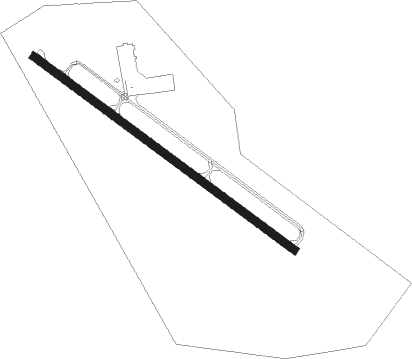
Hattiesburg - Hattiesburg Bobby L Chain Muni
Airport details
| Country | United States of America |
| State | Mississippi |
| Region | K7 |
| Airspace | Houston Oceanic Ctr |
| Municipality | Hattiesburg |
| Elevation | 148ft (45m) |
| Timezone | GMT -6 |
| Coordinates | 31.26494, -89.25289 |
| Magnetic var | |
| Type | land |
| Available since | X-Plane v10.40 |
| ICAO code | KHBG |
| IATA code | HBG |
| FAA code | HBG |
Communication
| Hattiesburg Bobby L Chain Muni ASOS | 135.425 |
| Hattiesburg Bobby L Chain Muni CTAF/UNICOM | 122.800 |
Nearby Points of Interest:
Beverly Drive-In Theater
-Walthall School
-Eaton Elementary School
-Longleaf Trace
-Mahned Bridge
-Old Augusta Historic Site
-Newell Rogers House
-Laurel Central Historic District
-Covington County Courthouse
-John Ford Home
-George Austin McHenry House
Nearby beacons
| code | identifier | dist | bearing | frequency |
|---|---|---|---|---|
| LBY | EATON (HATTIESBURG) VORTAC | 10.2 | 331° | 110.60 |
| GVB | BOGALUSA NDB | 38.8 | 238° | 353 |
| GCV | GREENE CO. (LEAKESVILLE) VORTAC | 40.6 | 102° | 115.70 |
| GP | BAYOU NDB | 47 | 173° | 360 |
| PCU | PICAYUNE VOR/DME | 48.9 | 214° | 113.95 |
| HS | HANCO (BAY ST LOUIS) NDB | 49.9 | 194° | 221 |
| GPT | GULFPORT VORTAC | 52.3 | 168° | 109 |
| BIX | KEESLER (BILOXI) TACAN | 54.1 | 159° | 111.80 |
| SJI | SEMMES (MOBILE) VORTAC | 56.2 | 121° | 115.30 |
| MOB | WISLE (MOBILE) NDB | 57.5 | 118° | 248 |
Departure and arrival routes
| Transition altitude | 18000ft |
| Transition level | 18000ft |
| SID end points | distance | outbound heading | |
|---|---|---|---|
| RW13 | |||
| LBY2 | 10mi | 331° | |
| RW31 | |||
| LBY2 | 10mi | 331° | |
Instrument approach procedures
| runway | airway (heading) | route (dist, bearing) |
|---|---|---|
| RW13-Y | CERNU (93°) | CERNU 2500ft HILGA (10mi, 45°) 2500ft |
| RW13-Y | DIYET (166°) | DIYET 2500ft HILGA (10mi, 225°) 2500ft |
| RW13-Y | HILGA (127°) | HILGA 2500ft |
| RNAV | HILGA 2500ft CUPPA (7mi, 127°) 2000ft NETTI (3mi, 127°) 1080ft ZENBO (2mi, 127°) 412ft (5368mi, 109°) 440ft HILGA (5377mi, 289°) 2500ft HILGA (turn) | |
| RW13-Z | CERNU (93°) | CERNU HILGA (10mi, 45°) 2500ft |
| RW13-Z | DIYET (166°) | DIYET HILGA (10mi, 225°) 2500ft |
| RW13-Z | HILGA (127°) | HILGA 6000ft HILGA (turn) 2500ft |
| RNAV | HILGA 2500ft CUPPA (7mi, 127°) 2000ft NETTI (3mi, 127°) 1080ft KHBG (3mi, 127°) 189ft (5367mi, 109°) 600ft HILGA (5377mi, 289°) 2500ft HILGA (turn) |
Disclaimer
The information on this website is not for real aviation. Use this data with the X-Plane flight simulator only! Data taken with kind consent from X-Plane 12 source code and data files. Content is subject to change without notice.