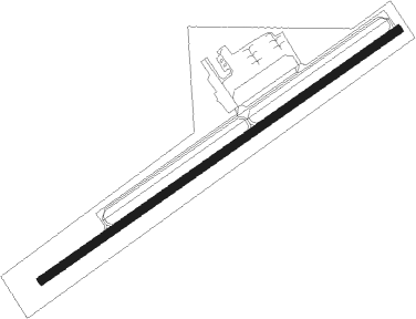
Heber Springs - Heber Springs Muni
Airport details
| Country | United States of America |
| State | Arkansas |
| Region | K4 |
| Airspace | Memphis Ctr |
| Municipality | Heber Springs |
| Elevation | 630ft (192m) |
| Timezone | GMT -6 |
| Coordinates | 35.51170, -92.01301 |
| Magnetic var | |
| Type | land |
| Available since | X-Plane v10.40 |
| ICAO code | KHBZ |
| IATA code | n/a |
| FAA code | HBZ |
Communication
| Heber Springs Muni CTAF/UNICOM | 122.700 |
Nearby Points of Interest:
Woman's Community Club Band Shell
-Clarence Frauenthal House
-Dr. Cyrus F. Crosby House
-Hugh L. King House
-T.E. Olmstead & Son Funeral Home
-Cleburne County Courthouse
-Rector House
-Mike Meyer Disfarmer Gravesite
-Cleburne County Farm Cemetery
-Shaheen-Goodfellow Weekend Cottage
-Dill School
-Woodrow Store
-Walter Marsh House
-Cary House
-Austin Pangburn House
-McAdams House
-John Shutter House
-Churchill-Hilger House
-Avanell Wright House
-James William Boggs House
-Rufus Gray House
-Darden-Gifford House
-Livestock and Equipment Barn, Glenn Homestead
-Martindale Corn Crib
-Brewer School
Nearby beacons
| code | identifier | dist | bearing | frequency |
|---|---|---|---|---|
| BV | ALMND (BATESVILLE) NDB | 15.5 | 48° | 335 |
| DS | CERCY (SEARCY) NDB | 26.4 | 147° | 375 |
| LRF | JACKSONVILLE TACAN | 36.3 | 194° | 109.20 |
| LIT | LITTLE ROCK VORTAC | 50.7 | 191° | 113.90 |
| FLP | DME | 52 | 331° | 116.05 |
| LI | LASKY (LITTLE ROCK) NDB | 52.6 | 199° | 353 |
Instrument approach procedures
| runway | airway (heading) | route (dist, bearing) |
|---|---|---|
| RW06 | RILVE (64°) | RILVE 4000ft |
| RNAV | RILVE 4000ft JEKMU (6mi, 64°) 2600ft KHBZ (6mi, 64°) 656ft (5504mi, 111°) 1032ft POYOG (5493mi, 291°) 4000ft POYOG (turn) 4000ft | |
| RW24 | POYOG (244°) | POYOG 4000ft |
| RNAV | POYOG 4000ft TYPIC (6mi, 244°) 2600ft COGIK (3mi, 244°) 1540ft KHBZ (3mi, 244°) 671ft (5504mi, 111°) 1032ft RILVE (5514mi, 291°) 4000ft RILVE (turn) 4000ft |
Disclaimer
The information on this website is not for real aviation. Use this data with the X-Plane flight simulator only! Data taken with kind consent from X-Plane 12 source code and data files. Content is subject to change without notice.
