Hammond - Hammond Northshore Regl
Airport details
| Country | United States of America |
| State | Louisiana |
| Region | K4 |
| Airspace | Houston Oceanic Ctr |
| Municipality | Hammond |
| Elevation | 43ft (13m) |
| Timezone | GMT -6 |
| Coordinates | 30.52169, -90.41838 |
| Magnetic var | |
| Type | land |
| Available since | X-Plane v10.40 |
| ICAO code | KHDC |
| IATA code | n/a |
| FAA code | HDC |
Communication
| Hammond Northshore Regl ATIS | 118.325 |
| Hammond Northshore Regl CTAF/UNICOM | 122.700 |
| Hammond Northshore Regl TOWER | 120.575 |
| Hammond Northshore Regl NEW ORLEANS Approach/Departure | 119.300 |
| Hammond Northshore Regl NEW ORLEANS Approach/Departure | 125.500 |
Approach frequencies
| ILS-cat-I | RW18 | 111.5 | 18.00mi |
| 3° GS | RW18 | 111.5 | 18.00mi |
Nearby Points of Interest:
Randal House
-McGehee House
-Old Livingston Parish Courthouse
-Hungarian Settlement School
-Carter Plantation
-Macedonia Baptist Church
-Pass Manchac Light
-Madisonville Town Hall
-Arcola Presbyterian Church
-Christ Episcopal Church
-Abita Springs Historic District
-Johnson House
-Griffin's Bakery
-Dew Drop Social and Benevolent Hall
-Green Shutters
-Old St. Helena Parish Jail
-Fontainebleau State Park
-Thomas M. Babington House
-Greenlaw House
-Castleberry Boarding House
-Our Lady of Grace Church (Reserve, Louisiana)
-Francois Cousin House
-Audubon Plantation
-San Francisco Plantation House
-Robert Penn Warren House
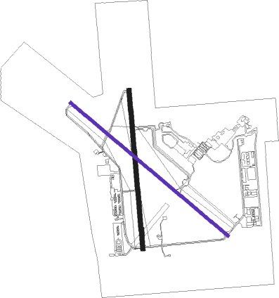
Runway info
Runway 18 / 36  | ||
| length | 1530m (5020ft) | |
| bearing | 179° / 359° | |
| width | 46m (150ft) | |
| surface | concrete | |
| Runway 13 / 31 | ||
| length | 1983m (6506ft) | |
| bearing | 130° / 310° | |
| width | 30m (100ft) | |
| surface | asphalt | |
| displ threshold | 0m (0ft) / 207m (679ft) | |
Nearby beacons
| code | identifier | dist | bearing | frequency |
|---|---|---|---|---|
| HP | ANGER (HAMMOND) NDB | 5 | 358° | 212 |
| RQR | RESERVE VOR/DME | 27.5 | 201° | 110.80 |
| MS | KINTE (NEW ORLEANS) NDB | 29.8 | 178° | 338 |
| PCU | PICAYUNE VOR/DME | 35.6 | 87° | 113.95 |
| GVB | BOGALUSA NDB | 35.9 | 57° | 353 |
| BT | RUNDI (BATON ROUGE) NDB | 41.1 | 274° | 284 |
| MC | FERNI (MCCOMB) NDB | 44.2 | 353° | 413 |
| LSU | FIGHTING TIGER (BATON ROU VORTAC | 45.3 | 268° | 116.50 |
| HRV | HARVEY (NEW ORLEANS) VORTAC | 45.7 | 148° | 114.10 |
| MCB | MC COMB VORTAC | 47.7 | 12° | 116.70 |
| HS | HANCO (BAY ST LOUIS) NDB | 50 | 94° | 221 |
| TBD | TIBBY (THIBODAUX) VOR/DME | 55.7 | 206° | 112 |
Instrument approach procedures
| runway | airway (heading) | route (dist, bearing) |
|---|---|---|
| RW36 | RQR (21°) | RQR IYRON (17mi, 36°) 2200ft |
| RW36 | VEILS (58°) | VEILS IYRON (19mi, 86°) 2200ft |
| RW36 | WAVEZ (312°) | WAVEZ IYRON (12mi, 274°) 2200ft |
| RNAV | IYRON 2200ft BEEHE (6mi, 359°) 1800ft FELLO (3mi, 359°) 660ft KHDC (2mi, 1°) 93ft BARUN (15mi, 359°) 1800ft BARUN (turn) |
Disclaimer
The information on this website is not for real aviation. Use this data with the X-Plane flight simulator only! Data taken with kind consent from X-Plane 12 source code and data files. Content is subject to change without notice.