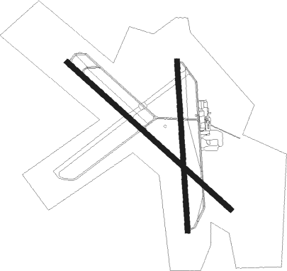
Natchez - Natchez-adams County
Airport details
| Country | United States of America |
| State | Mississippi |
| Region | K7 |
| Airspace | Houston Oceanic Ctr |
| Municipality | Adams County |
| Elevation | 270ft (82m) |
| Timezone | GMT -6 |
| Coordinates | 31.61367, -91.29733 |
| Magnetic var | |
| Type | land |
| Available since | X-Plane v10.40 |
| ICAO code | KHEZ |
| IATA code | HEZ |
| FAA code | HEZ |
Communication
| Natchez-Adams County AWOS 3 | 124.675 |
| Natchez-Adams County CTAF/UNICOM | 122.800 |
Approach frequencies
| ILS-cat-I | RW13 | 111.35 | 18.00mi |
| 3° GS | RW13 | 111.35 | 18.00mi |
Nearby Points of Interest:
Jefferson College
-Selma Plantation
-Assembly Hall
-Washington Methodist Church
-Brandon Hall
-Elizabeth Female Academy
-Edgewood
-Lansdowne
-D'Evereux
-Cemetery Bluff District
-Weymouth Hall
-Oakland
-Airlie
-Cottage Gardens
-Linden
-The Burn
-Monmouth
-Clifton Heights Historic District
-Holy Family Catholic Church Historic District
-Arlington
-Tillman House
-King's Tavern
-Dr. Charles H. Dubs Townhouse
-Neibert-Fisk House
-The Elms
Nearby beacons
| code | identifier | dist | bearing | frequency |
|---|---|---|---|---|
| HEZ | NATCHEZ VOR/DME | 0.2 | 333° | 110 |
| HAH | NATCHEZ-ADAMS COUNTY NDB | 4.6 | 3° | 388 |
| TKH | TALLULAH (VICKSBURG/TALLULAH) NDB | 40.3 | 23° | 344 |
| MC | FERNI (MCCOMB) NDB | 45.7 | 115° | 413 |
| ML | SABAR (MONROE) NDB | 65 | 316° | 392 |
| MLU | MONROE VORTAC | 65.9 | 321° | 117.20 |
Instrument approach procedures
| runway | airway (heading) | route (dist, bearing) |
|---|---|---|
| RW13 | CASDU (132°) | CASDU 2800ft |
| RNAV | CASDU 2800ft ZUTKI (6mi, 132°) 1900ft YISUS (2mi, 132°) 1100ft KHEZ (3mi, 131°) 316ft (5472mi, 109°) 466ft WEGRA (5464mi, 289°) 2800ft WEGRA (turn) | |
| RW18 | WUSOV (182°) | WUSOV 2800ft |
| RNAV | WUSOV 2800ft VOYUB (6mi, 181°) 1800ft OZINU (2mi, 181°) 1060ft KHEZ (3mi, 183°) 319ft (5472mi, 109°) 620ft CAKOP (5472mi, 289°) 2800ft CAKOP (turn) | |
| RW31 | WEGRA (312°) | WEGRA 2800ft |
| RNAV | WEGRA 2800ft EMOPE (6mi, 312°) 1900ft YEYUR (2mi, 312°) 1160ft KHEZ (3mi, 312°) 319ft (5472mi, 109°) 672ft CASDU (5479mi, 289°) 2800ft CASDU (turn) | |
| RW36 | CAKOP (0°) | CAKOP 2800ft |
| RNAV | CAKOP 2800ft BOKPE (6mi, 1°) 1900ft ZUNLA (3mi, 1°) 1000ft KHEZ (3mi, 359°) 310ft (5472mi, 109°) 640ft WUSOV (5471mi, 289°) 2800ft WUSOV (turn) |
Disclaimer
The information on this website is not for real aviation. Use this data with the X-Plane flight simulator only! Data taken with kind consent from X-Plane 12 source code and data files. Content is subject to change without notice.

