Hagerstown - Hagerstown Regl
Airport details
| Country | United States of America |
| State | Maryland |
| Region | K6 |
| Airspace | Washington Ctr |
| Municipality | Washington County |
| Elevation | 704ft (215m) |
| Timezone | GMT -5 |
| Coordinates | 39.70850, -77.72650 |
| Magnetic var | |
| Type | land |
| Available since | X-Plane v10.40 |
| ICAO code | KHGR |
| IATA code | HGR |
| FAA code | HGR |
Communication
| Hagerstown Regl HGR ASOS | 126.375 |
| Hagerstown Regl HGR Ground Control | 120.800 |
| Hagerstown Regl HGR Tower | 120.300 |
| Hagerstown Regl POTOMAC Approach | 126.825 |
| Hagerstown Regl POTOMAC Departure | 126.825 |
Approach frequencies
| ILS-cat-I | RW27 | 111.9 | 18.00mi |
| ILS-cat-I | RW09 | 111.9 | 18.00mi |
| 3° GS | RW27 | 111.9 | 18.00mi |
| 3° GS | RW09 | 111.9 | 18.00mi |
Nearby Points of Interest:
Paradise Manor
-Brightwood
-Dorsey-Palmer House
-Spring Grove Farm and Distillery
-Rockland Farm
-Hagerstown Armory
-Western Maryland Railway Station
-Price-Miller House
-Hagerstown Commercial Core Historic District
-Washington County Courthouse
-Old Washington County Library
-Hagerstown Charity School
-Hagerstown Historic District
-Stover-Winger Farm
-Lantz-Zeigler House
-Mitchell-Shook House
-Houses At 16-22 East Lee Street
-Rohrer House
-Old Forge Farm
-Western Maryland 202
-Antietam Hall
-Greencastle Historic District
-Good-Hartle Farm
-Leitersburg Historic District
-Plumb Grove
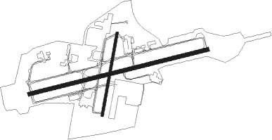
Runway info
Runway 9 / 27  | ||
| length | 2136m (7008ft) | |
| bearing | 83° / 263° | |
| width | 46m (151ft) | |
| surface | asphalt | |
| blast zone | 109m (358ft) / 0m (0ft) | |
| Runway 2 / 20 | ||
| length | 966m (3169ft) | |
| bearing | 19° / 199° | |
| width | 30m (98ft) | |
| surface | asphalt | |
Nearby beacons
| code | identifier | dist | bearing | frequency |
|---|---|---|---|---|
| HGR | HAGERSTOWN VOR | 6 | 265° | 109.80 |
| THS | SAINT THOMAS VORTAC | 17 | 315° | 115 |
| MRB | MARTINSBURG VORTAC | 20.1 | 201° | 112.10 |
| FDK | FREDERICK VOR | 24.1 | 130° | 109 |
| EMI | WESTMINSTER VORTAC | 36.9 | 106° | 117.90 |
| CX | LATLE (HARRISBURG) NDB | 43.5 | 57° | 219 |
| HAR | HARRISBURG VORTAC | 46.7 | 48° | 112.50 |
| AML | ARMEL (WASH.,D.C.) VOR/DME | 48 | 161° | 113.50 |
| MD | ENOLA (HARRISBURG) NDB | 49.8 | 57° | 204 |
| FND | ELLICOTT (BALTIMORE) NDB | 50.7 | 114° | 371 |
| GTN | GEORGETOWN (WASH., D.C.) NDB | 54.4 | 142° | 323 |
| LDN | LINDEN VORTAC | 55.9 | 209° | 114.30 |
| BUH | ANNE ARUNDEL (FT MEADE) NDB | 58.4 | 123° | 260 |
| DCA | WASHINGTON, D.C. VOR/DME | 60.2 | 141° | 111 |
| DCA | OXONN (WASHINGTON) NDB | 65.2 | 143° | 332 |
| ADW | ANDREWS (CAMP SPRINGS) VORTAC | 67.3 | 136° | 113.10 |
Departure and arrival routes
| Transition altitude | 18000ft |
| Transition level | 18000ft |
| STAR starting points | distance | inbound heading | |
|---|---|---|---|
| ALL | |||
| TRSTN3 | 97.4 | 2° | |
Instrument approach procedures
| runway | airway (heading) | route (dist, bearing) |
|---|---|---|
| RW09 | ASUTE (113°) | ASUTE TOMAC (17mi, 152°) 4000ft COVUK (7mi, 94°) 3600ft |
| RW09 | COVUK (83°) | COVUK 3600ft |
| RW09 | MUMSY (55°) | MUMSY KUTSE (11mi, 4°) 4000ft COVUK (8mi, 62°) 3600ft |
| RNAV | COVUK 3600ft FODEV (3mi, 83°) 3100ft HESGI (3mi, 83°) 2500ft KHGR (6mi, 83°) 719ft (4840mi, 117°) 864ft HAIGS (4823mi, 297°) 4000ft HAIGS (turn) | |
| RW27 | THS (135°) | THS ZUPUX (27mi, 108°) 4200ft ZUPUX (turn) 4000ft |
| RNAV | ZUPUX 4000ft NOLIN (7mi, 259°) 2900ft WORUL (5mi, 263°) 1340ft KHGR (2mi, 263°) 741ft (4840mi, 117°) 886ft COVUK (4852mi, 297°) 3600ft COVUK (turn) |
Holding patterns
| STAR name | hold at | type | turn | heading* | altitude | leg | speed limit |
|---|---|---|---|---|---|---|---|
| TRSTN3 | JOHOF | VHF | right | 214 (34)° | DME 10.0mi | ICAO rules | |
| *) magnetic outbound (inbound) holding course | |||||||
Disclaimer
The information on this website is not for real aviation. Use this data with the X-Plane flight simulator only! Data taken with kind consent from X-Plane 12 source code and data files. Content is subject to change without notice.