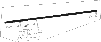
Whitefield - Mount Washington Rgnl
Airport details
| Country | United States of America |
| State | New Hampshire |
| Region | K6 |
| Airspace | Boston Ctr |
| Municipality | Whitefield |
| Elevation | 1074ft (327m) |
| Timezone | GMT -5 |
| Coordinates | 44.36755, -71.54581 |
| Magnetic var | |
| Type | land |
| Available since | X-Plane v10.40 |
| ICAO code | KHIE |
| IATA code | HIE |
| FAA code | HIE |
Communication
| MOUNT WASHINGTON RGNL ASOS | 118.525 |
| MOUNT WASHINGTON RGNL CTAF/UNICOM | 122.800 |
Nearby Points of Interest:
Waumbek Cottages Historic District
-Weeks Estate
-Garland Mill
-United States Post Office–Lancaster Main
-William Dennis Weeks Memorial Library
-Wilder-Holton House
-Felsengarten
-Rocks Estate
-Burt-Cheney Farm
-Edward H. Lane House
-Littleton Town Building
-United States Post Office and Courthouse–Littleton Main
-Crawford House Artist's Studio
-Tip-Top House
-Abbie Greenleaf Library
-Dow Academy
-Lovett's by Lafayette Brook
-The Frost Place
-Franconia Notch
-Judge David Hibbard Homestead
-George Washington Noyes House
-Mount Jasper Lithic Source
-Maidstone State Park
-Congregational Church
-Lee Farm
Nearby beacons
| code | identifier | dist | bearing | frequency |
|---|---|---|---|---|
| GMA | MAHN (WHITEFIELD) NDB | 6 | 268° | 386 |
| BML | DME | 22.1 | 54° | 116.55 |
| MPV | MONTPELIER VOR/DME | 42.4 | 253° | 116.90 |
| RQM | RANGELEY NDB | 48 | 54° | 221 |
| LAH | HANOVER (LEBANON) NDB | 48.3 | 224° | 276 |
| LC | BLNAP (LACONIA) NDB | 49.9 | 179° | 328 |
| LEB | DME | 50.4 | 224° | 113.70 |
| YSC | DME | 57.9 | 346° | 113.20 |
| ENE | KENNEBUNK VOR/DME | 69.4 | 135° | 117.10 |
| CNH | CLAREMONT NDB | 69.8 | 220° | 233 |
Instrument approach procedures
| runway | airway (heading) | route (dist, bearing) |
|---|---|---|
| RW10-Y | JOBBY (265°) | JOBBY AYZOO (26mi, 271°) 7100ft LIDOW (9mi, 250°) 4800ft LIDOW (turn) 4800ft |
| RW10-Y | LAROE (337°) | LAROE ZAMIM (40mi, 298°) 7100ft LIDOW (14mi, 38°) 4800ft |
| RW10-Y | MPV (73°) | MPV IREYU (21mi, 64°) 6000ft LIDOW (9mi, 68°) 4800ft |
| RNAV | LIDOW 4800ft ELJUM (6mi, 88°) 3400ft PAYIK (2mi, 88°) 2600ft KHIE (5mi, 88°) 1093ft (4620mi, 122°) 1480ft LIDOW (4633mi, 302°) 4800ft LIDOW (turn) | |
| RW10-Z | JOBBY (265°) | JOBBY AYZOO (26mi, 271°) 7100ft LIDOW (9mi, 250°) 4800ft LIDOW (turn) 4800ft |
| RW10-Z | LAROE (337°) | LAROE ZAMIM (40mi, 298°) 7100ft LIDOW (14mi, 38°) 4800ft |
| RW10-Z | MPV (73°) | MPV IREYU (21mi, 64°) 6000ft LIDOW (9mi, 68°) 4800ft |
| RNAV | LIDOW 4800ft ELJUM (6mi, 88°) 3400ft KHIE (7mi, 88°) 1093ft (4620mi, 122°) 1474ft CRESY (4616mi, 302°) JOBBY (17mi, 84°) 7100ft JOBBY (turn) |
Disclaimer
The information on this website is not for real aviation. Use this data with the X-Plane flight simulator only! Data taken with kind consent from X-Plane 12 source code and data files. Content is subject to change without notice.